Curated OER
Mapping the changes in Canada's population
High schoolers find and analyze data found in the census. They compare the population from 1996 to 2001. They explore the type of data they can find in the Census of Population.
Curated OER
Watersheds, Watersheds Everywhere
Students identify the watershed in which their school is located. They use maps to locate their homes and school. They define and use the correct vocabulary.
Curated OER
Backseat Travelers
Fourth graders investigate the geography of the Southeast regions of the United States. They conduct Internet research, listen to the book "No Star Nights," and plan and write a trip through this regions.
Curated OER
Opening Doors to Social Studies with Children's Literature: The Desert Alphabet Book
Pupils explore the geography of the United States. In this social studies lesson, students identify the major deserts on a map of the United States.
Curated OER
The Desert Alphabet Book
Students use a book to discover an interesting fact from the desert using each letter of the alphabet. Using a United States map, they identify the meanings of symbols and locate deserts within the U.S. In groups, they participate in...
Curated OER
Treaty Trail: Crossing the Bitterroot Mountains
Students examine art and primary documents that depicts the Native Americans' crossing of Washington's Bitterroot Mountains to arrive at the Spokane Council. Students investigate and compare maps and other historical materials determine...
Curated OER
State Nicknames Quiz
In this online interactive geography quiz worksheet, students examine the chart that includes the names of 49 states. Students identify the nicknames of the states in 6 minutes.
Curated OER
Country Flags Quiz
In this online interactive country flag quiz worksheet, students examine the 20 pictured country flags and try to name all of the countries represented in 4 minutes.
Curated OER
Second Biggest Cities Quiz
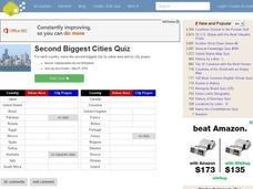
For this online interactive geography quiz worksheet, students examine the chart that includes details about 20 major cities in the world. Students identify the names of the cities in 4 minutes.
Curated OER
Countries w/ Biggest Armies Quiz
In this online interactive military quiz worksheet, students examine the chart that includes details about the number of troops in 20 countries. Students identify the names of the countries in 4 minutes.
Curated OER
Famous Streets Quiz
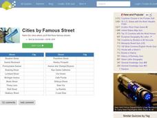
For this online interactive geography quiz worksheet, learners examine the chart that includes the names of 18 famous streets in the world. Students have 4 minutes to identify the names of the cities where the streets are found.
Curated OER
Biggest Cities in Canada Quiz
In this online interactive geography quiz worksheet, students examine the chart that includes the population of 20 Candian cities. Students identify the names of the largest cities in Canada in 4 minutes.
Curated OER
Highest Mountain Countries Quiz
In this online interactive geography quiz worksheet, students examine the chart that includes the elevations of 20 world mountains. Students identify the names of the mountains in 4 minutes.
Curated OER
Biggest Cities in Each State Quiz
In this online interactive geography quiz activity, students examine the chart that includes the names of 50 U.S. states. Students identify the names of the two largest cities in each state in 8 minutes.
Curated OER
Landlocked Countries Quiz
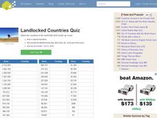
In this online interactive geography quiz worksheet, students examine the chart that includes details about the population in 44 landlocked countries. Students identify the names of the countries in 5 minutes.
Curated OER
Famous Lakes Quiz
In this online interactive geography quiz worksheet, students examine the chart that includes details about 15 famous world lakes. Students identify the names of the lakes in 3 minutes.
Curated OER
Regions of Countries Quiz
In this online interactive geography quiz worksheet, students examine the chart that includes details about 20 world regions. Students identify the names of the countries where the regions are located in 4 minutes.
Curated OER
World's Biggest Lakes Quiz
In this online interactive geography quiz worksheet, students examine the chart that includes the area of 20 of the world's largest lakes. Students identify the names of the lakes in 4 minutes.
Curated OER
Biggest Cities in India Quiz
For this online interactive geography quiz worksheet, students examine the chart that includes the population of 20 Indian cities. Students identify the names of the largest cities in India in 4 minutes.
Curated OER
Cities Named for Saints Quiz
In this online interactive geography quiz worksheet, students examine the chart that includes the populations of 16 world cities named for saints. Students identify the names of the cities in 4 minutes.
Curated OER
Winter Holidays Around the World
How much do you know about the holidays around the world? Second graders put their knowledge to the test with a 14-day activity about global celebrations. They read informational text, employ KWL charts, and compare and contrast the many...
Curated OER
Cultural Anthropology Study Using the Fundamentals of Geography and GPS
Students, in groups, operate the GPS unit, plotting each head stone with accompanying description. Two other students to log in data that corresponds to the given points. One student to note general observations
Curated OER
The 50 States
Fifth graders use maps and music to learn the 50 states. In this US Geography lesson, 5th graders map out a region of the United States and practice singing the song, The 50 States that Rhyme.
Curated OER
What is the Population Distribution of Cartoon Characters Living On the Pages of Your Newspaper?
Students read various cartoons in their local newspaper and calculate the population demographics, spatial distribution and grouping of the characters. Using this information, they create a population distribution map and share them with...


