Curated OER
World Map and Globe - Lesson 15 Mountains of the World
Students locate major world mountain ranges. In this geography lesson plan, students identify major mountain ranges on 6 on of the 7 continents on a large world physical map.
AGSSS
World Regions
Help your learners to visualize where historical events have taken place around the globe with a map that details the major regions of the seven continents.
DePaul University
Egypt
The country of Egypt is more than just big pyramids and ancient pharaohs. After reading a brief overview of this African nation, young learners will demonstrate their understanding of the text by identifying the main idea and supporting...
Curated OER
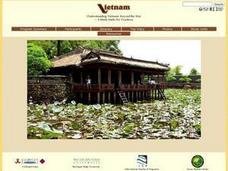
Understanding Modern Vietnam Through the Five Themes of Geography
Students explore Vietnam and prepare a studenT book about Vietnam using the five themes of Geography. These books be used to teach a younger classroom about Vietnam, as part of a service-learning project in our school.
Curated OER
How Cultures Differ - Two Different Perspectives on the Same Even
Students explore the effects of culture through the story Running by Peter Hessler. In this geography and cultural lesson, students act as newspaper reporters covering the story of the race. Students write newspaper articles as reporters...
Curated OER
World Map and Globe - Lesson 15 (K-3)
Students discover mountain ranges and their locations in the world. For this physical map lesson, students locate and identify major mountain ranges of the world on a large physical map.
Foreign Policy Research Institute
Asian Islam and Arab Islam
Focus on the impact and practice of Islam throughout Asia and the Middle East. Learners review the seven major religions, the spread of Islam, and Islamic tenets commonly practiced. They then research one country that practices Islamic...
Curated OER
The Cultural Geography of Egypt
Students describe Egypt's historical, cultural and recreational sites and activities. They explain Egyptian customs and conduct; and apply what they have learned to create a travel brochure about Egypt.
Curated OER
Out On A Limb In The Pacific Rim?
Students act as cultural attachés to investigate and present briefings on the post-1945 histories and United States diplomatic relationships with East Asian countries. They articulate their foreign policy findings.
Curated OER
Internet Fact Hunt at the "Fact Monster" Web Site- Hunt #33
In this Internet fact hunt worksheet, students access the "Fact Monster" web site to locate the answers to 5 multiple choice questions. They answer questions about US history, geography, literature, and science.
Smithsonian Institution
Dia de los Muertos: Celebrating and Remembering
Help scholars understand the history, geography, traditions, and art of Dia de los Muertos, the Day of the Dead. Find background information for your reference as well as a detailed cross-curricular lesson plan. Learners compare...
Curated OER
Geography of the Silk Road And the Tokaido Road
Students examine the geographical features of the Silk Road and the Tokaido Road in this introductory lesson on Chinese geography. Small group learning is emphasized and encouraged.
Curated OER
China - the Geography of European Imperialism - Spheres of Influence in China
Ninth graders create a map of China. They identify the various spheres of influence carved out by the Imperialist powers of Europe as well as locating geographical features of china and major cities. They explain the global impact of...
Curated OER
Wildlife
The centerpiece of this lesson plan is a predator-prey simulation in which colored paperclips represent different species of animals camouflaged against a colored background. Relevant follow-up questions are provided. The activity is...
Curated OER
Beijing: An Important City in China
Students investigate Beijing by reading an essay. In this Chinese Geography lesson, students read an essay written about Beijing and answer questions on a comprehension worksheet. Students may research Beijing further by...
Curated OER
Taming the Wild Aurochs
Fourth graders assess the development of animal husbandry, outline it in detail as well as arrange the steps in sequential order. In addition, they discuss how certain animals came to be domesticated, concentrate to research on one of...
Curated OER
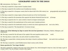
GEOGRAPHY GOES TO THE DOGS
Students use countries and dogs from around the world to answer the questions.
Curated OER
The Silk Road
Students research the geography of Asia from Xian to Istanbul. They explore the intricacies of ancient trade, including trade goods and policies. They study minorities within and outside of various Chinese and other Asian empires.
Curated OER
Corals and Coral Reefs
Students label the continents, oceans, and seas on a provided world map and use it to determine where they would expect most of the world's coral reefs to be found based on provided information the teacher has read to them.
Curated OER
The Carter Center’s Work in Sub-Saharan Africa
Students explore the state of Sub-Saharan Africa. In this geography skills lesson, students examine the work of the Carter Center in Africa as they investigate the strengths and weaknesses of linguistic, tribal, and religious...
Curated OER
Which Foods Come From Rainforests?
A very interesting and colorful presentation on the original sources of food is here for you. Learners discover where foods such as bananas, asparagus, potatoes, and oranges come from. They come from rainforests located all over the world!
Curated OER
Put the Mountains on the Map
Students discuss what they know about the regions where snow leopards live. They observe the worksheets to see if they can identify any of the mountain ranges and then use atlases to check and complete the country identification worksheet.
Curated OER
Maps that Teach
Students study maps to locate the states and capital on the US map. Students locate continents, major world physical features and historical monuments. Students locate the provinces and territories of Canada.
National Endowment for the Humanities
Lesson 3: On the Road with Marco Polo: From Hormuz to Kashgar
Young explorers examine the route that Marco Polo and his father traveled to reach China. They examine online maps of the Silk Road and harsh terrain of Afghanistan to determine challenges that may have been encountered during travel.


