National Museum of the American Indian
The A:Shiwi (Zuni) People: A Study in Environment, Adaptation, and Agricultural Practices
Discover the connection of native peoples to their natural world, including cultural and agricultural practices, by studying the Zuni people of the American Southwest. This instructional activity includes examining a poster's...
Teacher.org
Christmas Around the World Part 1
A creative lesson shines a spotlight on Christmas celebrations throughout six different countries. Scholars read an informative text and share their new-found knowledge with their peers. After hearing about each country, pupils choose...
National Endowment for the Humanities
La Familia
Young scholars identify at least one country where the Spanish language is spoken, describe similarities and differences between Spanish, Mexican, and Puerto Rican families, and practice speaking the Spanish words for several family...
Scholastic
Perfect Postcards: California
It's time to hear about some adventures in travel! The Transcontinental Railroad changed life and travel in the United States during the 1800s. Practicing online research skills, pupils discover the features they would like to visit on...
Curated OER
LESSON PLANS
Second graders encounter how the native and Spanish cultures influenced art on Colonial New Mexico. They experience some of the games, art and tools of colonial New Mexico. Students strive to increase new vocabulary. They also access how...
Curated OER
A Tough Nut to Crack
Children, based on a set of criteria, evaluate the quality of pecans. They research recorded history of pecan trees as well as how their seeds moved across western Missouri into southeastern Kansas, Oklahoma, Texas and Mexico. In...
Curated OER
State of Alabama
In this reading passages about the state of Alabama worksheet, students read about the state's geography, history, exploration, industry, and people and use the information to answer multiple choice and true and false questions. Students...
Curated OER
Understanding Mayan Culture
Students study an ancient culture in Mexico whose people were called the Mayans. They compare certain aspects of Mayan culture with Ancient Egypt. They discuss why some other ancient cultures (Egypt and China) were able to survive for...
Curated OER
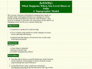
What Happens When Sea Level Rises or Falls
Students examine the impact of sea level on land formations. In this geography and map lesson, students construct a contour map model illustrating how much of the clay "coastline" is covered as water is added. Metric measurement is...
Curated OER
How to Clean Up An Oil Spill
Students practice cleaning up an oil spill. In this good citizenship lesson, students experiment with different cleaning agents to see which ones clean oil off a soft toy. They compare this experiment with the volunteers helping with the...
Curated OER
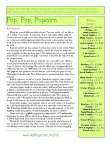
Pop Around the World
Students study the origin of popcorn. They locate countries where it is grown on a world map. They color the world map and glue kernels of popcorn onto the countries from which popcorn originated. They write the names of common items...
Curated OER
Tornado Alley-- Night of the Twisters
In this science and geography worksheet, learners read 2 pages of background information about Tornado Alley which may help them understand Night of the Twisters by Ivy Ruckman.
Curated OER
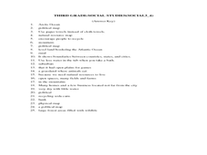
Third Grade Social Studies-Multiple Choice Activity
In this grade 3 social studies activity, 3rd graders complete a set of 25 questions about a variety of topics including geography, types of communities, map and questions about the environment.
Curated OER
Murals: Historic Walls
Young scholars examine Mexican history in murals. In this visual arts lesson, students research the artistic style of Mexican murals and the artists that create them. Young scholars then present their research findings to their...
Curated OER
Immigration: Creating Change
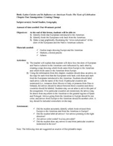
Students explore how immigration has changed the culture of America. After identifying the foods and diets of Europeans and Native cultures, students create a map indicating where foods came from. Students design a restaurant menu,...
Agriculture in the Classroom
Wad-a-Watershed
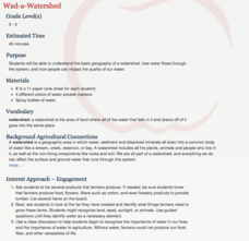
What kind of impact do humans have on watersheds? Find out in a instructional activity that defines, explores, and promotes ways to protect our watersheds. The ultimate goal of the instructional activity is for learners to discover how a...
Concord Consortium
Look High and Low
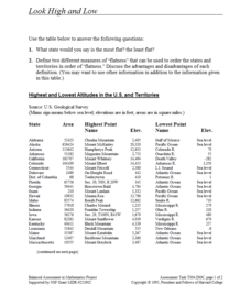
From the highest high to the lowest low here's a resource that won't fall flat. Given data on the area and the highest and lowest elevations of each of the 50 states, learners decide which states are the least flat and the most flat. Of...
Curated OER
Exploration and Settlement of the American Southwest
Students scrutinize the Zuni Pueblo Revolt in this seven lessons unit on early Spanish explorers in the American southwest. The discovery of the Spanish missions, the search for the seven cities of gold, and particular geological...
Curated OER
California Cities Map Quiz
In this online interactive geography quiz worksheet, students examine the map that includes 12 California cities. Students identify the names of the cities in 3 minutes.
Curated OER
Countries and Languages Quiz
For this online interactive geography quiz worksheet, students examine the chart that includes 20 languages. Students identify the names of the countries with the greatest number of native speakers in 4 minutes.
Curated OER
City to Country Quiz
In this online interactive geography quiz worksheet, students examine the chart that includes 20 world cities. Students identify the names of the countries where the cities are located in 4 minutes.
Curated OER
East to West: Africa's Influence on Mexico
Your historians and social anthropologists study the relationship between peoples of ancient Africa and ancient Mesoamerica. They relate in written or verbal form the African presence in the ancient Americas. They create their own...
Curated OER
GEOGRAPHY GOES TO THE DOGS
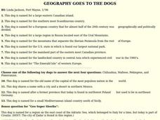
Students use countries and dogs from around the world to answer the questions.
Curated OER
Meet the Mayas, Aztecs and Incas
Students study the geography of the Mayas, Aztecs and Incas and create a map book. They share in stories and legends about these people. Handouts and worksheets are included.
Other popular searches
- Mexico Geography
- New Mexico Geography
- Mexico Geography Map
- Cultural Geography of Mexico
- Mexico Culture Geography
- The Geography of Mexico
- Physical Geography of Mexico
- Teaching Geography of Mexico
- Making Physical Maps Mexico


