Curated OER
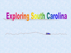
Exploring South Carolina
If you are having your students conduct a State study this presentation could be a nice example to show them. This resource provides general information about the geography, animals, and city life one may find in South Carolina. Web...
Curated OER
Geographic Regions and Backyard Geology with the USGS Tapestry Map
A beautiful tapestry map of North America is examined by geology masters. The map incorporates the topography and geology of different regions. You can purchase printed copies or a large poster of the map, or if you have a computer lab...
Curated OER
Americas: Physical Map
In this Americas physical map instructional activity, students make note of the major landforms and bodies of water located on the North American and South American continents.
Theodore Roosevelt Association
Roosevelt's Legacy: Conservation
The legacy of Theodore Roosevelt carries through modern American politics, economics, foreign policy, and society. But his proudest and most profound efforts were in the world of conservation, and in preserving the natural beauty of...
Curated OER
Exploring the World's Geography
Students discuss the seven continents of Earth and the diverse geography. After discussion, they create their own paper-mache globes which properly display all seven continents, the equator, and the prime meridian. They conduct research...
AGSSS
World Regions
Help your learners to visualize where historical events have taken place around the globe with a map that details the major regions of the seven continents.
Curated OER
Motivating Activities for Geography Week
Here is a great way to pique your students' interest in geography, and help them learn about their world.
Curated OER
History/Geography
Students review North America, Africa, Europe and Asia. They identify Australia as the smallest continent. They identify Australia as an island continent nicknamed "the land down under." They color a map of Australia.
Curated OER
Number The Stars Geography
In this social studies worksheet, learners look for the location of Denmark and then color the continents of Europe and North America.
Curated OER
The First North Americans
Students identify and interpret the different North American Indian groups, by region, and the type and impact of their interaction with Europeans.
Then they complete an overview of one main Native American group during the age of...
Curated OER
People of the Plains:Music and Dance
Fourth graders are given a worksheet stating the goal of the day, different sections to visit, and time spent on each section. They are given the CDs, 4th graders are told to insert the CDs into the computer. Students go to The Plains...
Curated OER
Jamestown Celebrates 400th Anniversary
Students view a world map and identify the locations of England and Virginia and discuss what kinds of things they would take with them on this kind of trip. They read the words in the news box on the student page and fill in the blanks...
PBS
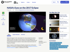
NASA's Eyes on the 2017 Eclipse
How did the 2017 eclipse look in Los Angeles—or Chicago? Experience both views, plus many more, using a lesson from PBS's Space series for middle schoolers. Scholars follow the movements of the sun, moon, and Earth during the most recent...
Curated OER
U.S. and Canada: How are We the Same? How are We Different?
Get high school geographers to compare and contrast Canada and the United States. They begin by drawing a freehand map of North America, then complete readings to gain insight into Canada. The text is not provided; however, another text...
Curated OER
On the Road Again
Students trace the migration route of a gray whale. They color and label a map of North America, and using photocopy pictures of a gray whale, they move the whale along the migration route over a ten week period.
Curated OER
People of the Plains: Roles of Men And Women
Fourth graders study the geography of North America and the indigenous people who lived there. They read about rules, games, toys and dolls, and education. They fill out Venn Diagrams comparing the roles of men and women during the videos.
Curated OER
World Map and Globe
Pupils locate and identify continents and countries. For this world map lesson, students locate and identify one country on each continent.
Curated OER
Coming to America
Fifth graders listen to the song America by Neil Diamond, view pictures of Ellis Island, and role play as processing officers who evaluate, classify and recommend which immigrants can stay in America.
Institute for Geophysics
Understanding Maps of Earth
Here is your go-to student resource on primary geography concepts, including facts about the surface of the earth and its hemispheres, latitude and longitude, globes, types of maps, and identifying continents and oceans.
NASA
Outline Maps
Don't miss this gold mine of blank maps for your next geography lesson! Regions include traditional continents such as Asia, Europe, and Africa, as well as other major world areas such as the Pacific Rim and the Middle East.
Curated OER
Our States, My State
Here is a very nice instructional activity on the shape of the United States, and the shapes of the individual states for your young geographers. They utilize worksheets embedded in the plan to color in a variety of states and to become...
New York State Education Department
US History and Government Examination: August 2010
Geography has played a complex role in America history. The Atlantic Ocean has served as a buffer to protect the United States from European Wars, but its proximity to Cuba, however, left it vulnerable to nuclear war during the Cuban...
Curated OER
World Map and Globe
Students practice using a globe. In this geography lesson, students review globes and practice locating the earth's oceans. Students use the globe to locate and identify the seven continents.
Curated OER
Endangered Species
In this geography instructional activity, high schoolers identify how to manipulate data on a range of endangered species. They create a bar graph of endangered animals from Africa, Asia, Australia, North America, or South America....
Other popular searches
- North America Geography
- North American Geography
- North America World Geography
- Geography North America Maps


