Curated OER
Arkansas Geography/History Relief Map
Sixth graders research a number of sources including the Internet to find information about the regions of Arkansas while locating sites of national historic interest. They located sites on maps while working at assigned websites. They...
Curated OER
Landforms By Hand: Geography, Map Skills
Students experiment with landform vocabulary by using their own hands and a bar of soap as media.
Curated OER
Peru Geography and the Environment
Fourth graders draw maps of Peru and examine how Peru is a geographically diverse country.
Curated OER
Geography of the Harbor
Learners study estuaries and their boundaries. In this investigative instructional activity students locate an estuary on a map and use nautical and topographical maps.
Curated OER
Postcards from California: A Unit on Geography, Social Studies, History and California's Resources
Fourth graders examine patterns that influence population density in the various regions of California. The unit's three lessons utilize graphic organizers for the interpretation and presentation of data.
Curated OER
Geography of China
Young scholars research Chinese dynasties and write papers on them. They conclude by making comparisons between eastern and western cultures.
Space Awareness
Let's Map the Earth
Before maps went mobile, people actually had to learn how to read maps. Pupils look at map elements in order to understand how to read them and locate specific locations. Finally, young cartographers discover how to make aerial maps.
National Museum of the American Indian
The A:Shiwi (Zuni) People: A Study in Environment, Adaptation, and Agricultural Practices
Discover the connection of native peoples to their natural world, including cultural and agricultural practices, by studying the Zuni people of the American Southwest. This lesson includes examining a poster's photographs, reading...
K12 Reader
Location, Location, Location
Why do some places in the world have more people living there than other places? Learn about the ways the countries have formed around natural resources with a reading comprehension activity. After kids read a short...
Curated OER
Goop to Geoforms
Students illustrate geographical terms in three-dimensional form. They use magic modeling goop and paint to create features of the geographic landscape. Students explain the meaning of geographical terms.
Curated OER
Chesapeake and Ohio Canal
Students use maps, readings, drawings, plans and photos to research and the importance of canals in the early industrial economy of America. They consider the development of the Potomac River Canal and research early transportation methods.
Curated OER
Exploring China
Second graders explore the geography, holidays, important teachers, and inventions from China in the nine lessons of this unit. The results of their inquiries are expressed through a variety of products, writings, and presentations.
Curated OER
Mapping West Virginia
Fourth graders explore West Virginia. In this Unites States geography instructional activity, 4th graders discuss the type of land and the cities in West Virginia. Students create two overlays, with transparencies, that show the natural...
Curated OER
Mining Riches
Students research and map how various mining ventures have changed local geographies and populations. First they read the article provided--Examining the Environmental and Social Impact of the Mining Industry.
Curated OER
What in the World Is a Watershed?
Learners discover the role of a watershed. In this geography lesson, students are shown a diagram of a watershed and discuss the definition of a watershed. Learners demonstrate the role of a watershed by using an umbrella and spraying it...
Curated OER
Water in Alabama History
Students examine the role of water in Alabama's history. They discover the geographical regions of the state and how dams change Alabama's rivers.
Curated OER
State of Alabama
In this reading passages about the state of Alabama activity, students read about the state's geography, history, exploration, industry, and people and use the information to answer multiple choice and true and false questions. Students...
Curated OER
Mapping Landforms of South Carolina
Third graders analyze South Carolina maps. In this geography lesson, 3rd graders locate the five land regions in the state are and discuss how the regions are different. Students identify the major bodies of water and analyze how...
Curated OER
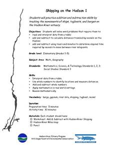
Shipping on the Hudson
Students track movements of ships, tugboats, and barges on the Hudson River estuary in order to practice addition and subtraction skills. They solve word problems by reading and interpreting data from a table. They calculate distances...
Curated OER
Where Is Rome?
Third graders discover Ancient Rome through maps and worksheets. In this world history lesson, 3rd graders locate Rome on a world map and identify the scope of the Roman Empire. Students label an entire map of Italy after...
Curated OER
Twain: Steamboat's a-Comin'
Young scholars discover how rivers inspire creative expression. In this Mark Twain lesson, students list songs about rivers and discuss common characteristics. They locate the Mississippi River on a map and write a script in which...
Curated OER
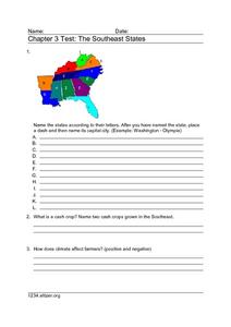
Chapter 3 Test: The Southeast States
For this geography worksheet, students complete a test about the southeastern United States. They name the states, tell about the climate and crops, complete a matching activity about the landforms. and another about the industry.
Curated OER
Around the World in 5 Days
Learners explore continents, draw map, discuss cultures, use research to learn geography, and investigate cultures.
Curated OER
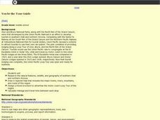
You be the Tour Guide
Students research the natural features and wildlife of Arizona and Utah. They draw a map of the region that includes rivers, towns, mountains and roads. They work together to create a travel brochure of the area.
Other popular searches
- Ireland Geography Rivers
- Rivers and Lakes Geography
- Geography Rivers Year 3
- Geography Rivers Fieldwork
- Geography Rivers and Floods
- Geography Rivers Poems
- Geography Rivers of Canada
- Geography Rivers Thames
- Geography Rivers in Texas
- U. S. Geography Rivers
- U S Geography Rivers


