Curated OER
Geography Words
This worksheet uses maps of South America and Canada to combine basic geography vocabulary and using prepositions. Students use the maps to answer questions about the locations of various countries on the two maps. This would be a good...
Curated OER
Travel by Train: South American DVD Assignment
In this geography skills instructional activity, students watch the National Geographic video "Travel by Train." Students then respond to 18 short answer questions about content in the video about South America.
Curated OER
South America
In this South America word search worksheet, students locate the names of 35 South American countries. The word search is in the shape of the South American continent.
National Geographic
Mapping the Americas
Celebrate the geography of the Americas and develop map skills through a series of activities focused on the Western Hemisphere. Learners study everything from earthquakes and volcanoes of the Americas and the relationship...
Curated OER
Geography A to Z: Letter O
The world is full of places that start with the letter O. It's true! Your class can use what they know about geography to answer seven curious questions related to world locations that all begin with letter O. Like Ohio, Ottowa, and...
Curated OER
South Asian Architecture
Seventh graders review and discuss architecture from South Asia. They then study images of various buildings from North Africa/Southwest Asia, and make comparisons
Curated OER
South America: Physical Map
In this South American physical map activity, students make note of the major landforms and bodies of water located on the continent.
Curated OER
Exploring South Carolina
If you are having your students conduct a State study this presentation could be a nice example to show them. This resource provides general information about the geography, animals, and city life one may find in South Carolina. Web...
PBS
Make a Balloon Globe
"We've got the whole world in our hands," is what your students will be singing after completing this fun geography activity. Using the included templates for the seven continents and a balloon, they create their very own globes.
Richmond Community Schools
Map Skills
Young geographers will need to use a variety of map skills to complete the tasks required on this worksheet. Examples of activities include using references to label a map of Mexico, identify Canadian territories and European...
Curated OER
Bank Loans Money to Start Businesses
After locating Latin American countries on a world map, children read about how microbanks are loaning money to help start small businesses. Involving both current events and economics, the teacher introduces the article with a map...
Curated OER
Geothermal Energy in Latin America
Here is a wonderful series of lessons designed to introduce learners to the variety of renewable, clean energy sources used by people all over the world. Geothermal energy is the resource focused on. This particular sources of energy...
World Maps Online
Introduction to the World Map
Students identify the differences between maps and globes. In this map skills instructional activity, students are shown a globe and a map and recognize the differences. Students use post-it notes to locate several locations on the world...
Curated OER
South America
For this social studies worksheet, students search for 36 words relating to South America. Words include names of countries, major geographical features, and some words relating to the culture of South America.
Curated OER
South America
In this map of South America worksheet, students study the map of South America and then write the names of the 15 countries and territories on the provided lines.
Curated OER
People in the World-Brazil
Second graders explore information about South America and choose a country to study. They explore culture, food, geography, clothing, language, and recreation of their country. Students visualize their learning by developing a slide...
Curated OER
Fascinating Geography Facts
In this geography worksheet, students will read 4 interesting United States geography facts and 19 fascinating world geography facts.
New York City Department of Education
Geography and Early Peoples of the Western Hemisphere
Young historians discover the early people of the western hemisphere. The unit explores how the land changed, how it was used and homes of early Americans such as Incas, Mayans, Inuits, Aztecs, and Pueblos. Individuals also examine these...
Curated OER
European Explorers of North and South America
Sixth graders explore the connection between the geography of America and the migration of the Native Americans to the American continents to the future conquering of the continents by the Europeans. They discuss the causes and effects...
Curated OER
World Map Labels
In this geography skills worksheet, students identify the countries and bodies of water labelled on the maps of the world, Africa, Asia, Canada, Europe, the Caribbean, the Middle East, North America, Australia, and South America.
Curated OER
Itaipu Dam and Power Plant (Brazil and Paraguay)
Learners study South America's Itaipu Dam and Power Plant in order to gain an understanding that hydroelectric power is a major means of generating electricity throughout the world. They also look into the environmental impacts that...
Curated OER
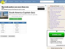
South American Capitals Quiz
In this online interactive geography quiz worksheet, students respond to 12 identification questions about the capital cities of South America. Students have 4 minutes to complete the quiz.
Curated OER
Flags Of Latin America
Middle schoolers determine the symbolism of Latin American flags. In this Latin America lesson, students research the cultures and histories of countries as well as the history behind their flags. Middle schoolers recreate the flags and...
Curated OER
Americas: Physical Map
In this Americas physical map instructional activity, students make note of the major landforms and bodies of water located on the North American and South American continents.


