Richmond Community Schools
Map Skills
Young geographers will need to use a variety of map skills to complete the tasks required on this worksheet. Examples of activities include using references to label a map of Mexico, identify Canadian territories and European countries,...
Arcademics
Penguin Hop
It's a race to learn the state capitals. Using a multi-player video game, participants hop from iceberg to iceberg as penguins in response to questions about state capitals. The real-time practice lets both teacher and learner assess...
Curated OER
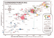
Gapminder World 2012
Here is a very interesting infographic that compares the average life expectancies, per capita incomes, and population sizes of every country in the world in 2012.
Scholastic
Volleyball Road Trip
Review coordinate mapping with your young geographers by matching cities on a volleyball team's road trip itinerary to their appropriate coordinate locations.
University of Kansas
Newspaper in the Classroom
Newspapers aren't only for reading—they're for learning skills, too! A journalism unit provides three lessons each for primary, intermediate, and secondary grades. Lessons include objectives, materials, vocabulary, and procedure, and...
Core Knowledge Foundation
Maya, Aztec, and Inca Civilizations
Here are a series of lessons on the Mayan, Aztec, and Incan civilizations. This incredible, 15-lesson unit would be perfect for any fifth grade study on these important civilizations. Learners focus on the complex nature of the cultures,...
Curated OER
Body and Mind "Scapes"
Robert Harris' artwork is the focus of this interesting series. Each lesson examines his images of the land and the sea and leads into activities that center around geography and the environment. Pupils create pieces of music, and a...
Curated OER
Social Studies: Geographic Regions
Third graders create Powerpoint presentations about the five themes of geography in regions of the United States. They focus on the Northeast, Southeast, and Midwest regions. Students use both pictures and words in their shows.
Curated OER
The Geography of China
In this online interactive social studies worksheet, students respond to 9 multiple choice questions regarding the geography of China. Students may check their answers immediately.
Curated OER
Geography in the News
Ninth graders are introduced to an article in which falls into one of the five themes of geography. They pick their own article and summarize it to the class.
Curated OER
Year 3 Geography
In this social studies worksheet, students find the words that are related to the concepts found in Geography and the answers are found at the bottom of the page.
Curated OER
Latitude on World Maps - World Map Activity 2
Pupils explore the concept of latitude. In this geography lesson, students discover the global grid system and complete a map activity which require them to record the latitude of various cities in the world.
Curated OER
The Physical Geography of South Asia
Students describe the physical forces that formed and shaped the Himalaya, then discuss the physical geography of Mount Everest and how it influences the routes climbers take to the summit.
Curated OER
The Geography of South Asia
In this online interactive geography worksheet, students answer 9 multiple choice questions regarding the geography of South Asia. Students may submit their answers to be scored.
Curated OER
The Global Grid System-World Map Activity
Students demonstrate how to use the global grid system. In this map skills lesson, students use a world map to locate various locations. Students identify locations based on the global grid system. Students complete a worksheet as an...
Curated OER
Geography of the United States
Students examine the population growth of the United States. In this Geography lesson, students construct a map of the fifty states. Students create a graph of the population of the USA.
Curated OER
Geography Game - Educated Guess
Young scholars participate in a geography game that involves teams creating clues about a secret location. They select a location, develop the clues, and take turns solving the clues written by the other teams.
Curated OER
How to Teach Geography with KidPix II
Students use the computer program KidPix II to color a map of the world. In this world map lesson plan, students fill in different colors for different continents that are told to them on the program KidPix II.
Curated OER
How to Teach Geography with KidPix 1
Students create a compass rose. In this geography lesson, students create a compass rose using the computer program KidPix 1.
Curated OER
Archaeological Study
Students analyze the difference between archaeology and anthropology while studying the evolution of different products. In this archaeology and anthropology instructional activity, students trace the progression of a certain tool or...
Curated OER
The Influence of Physical Geography
Students explore the limits and demands of their physical world and how it relates to the survival and well-being of people.
Curated OER
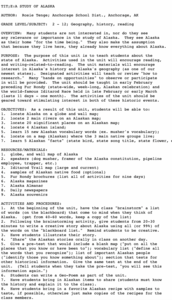
A Study of Alaska
Students explore Alaska. This lesson is gearing mostly for students who live in Alaska.
Curated OER
Geography and our Family Favorites
Students talk with older family members about favorite family foods and where they have originated. They learn the process that went into the preparation and cooking of these foods and contrast how technology has affected food...
Curated OER
Your Neighborhood Geography
Tenth graders observe geographical characteristics of their own neighborhoods. They take digital pictures and write a summary of the geographical features they find which they present to the class.
Other popular searches
- World Geography Studies
- Geography Studies the Sea
- Geography Studies Rocks
- Elementary Geography Studies
- Geography Studies Cd Rom
- Social Studies Geography
- Social Studies Us Geography
- Social Studies and Geography
- Social Studies Maps Geography


