Oregon State
World Map of Plate Boundaries
Young geologists piece together the puzzle of plate tectonics in an earth science lesson. Given a physical map of the world, they search for land formations that indicate the location of different types of plate boundaries.
Science 4 Inquiry
Edible Plate Tectonics
Many people think they can't observe plate tectonics, but thanks to GPS, we know that Australia moves at a rate of 2.7 inches per year, North America at 1 inches per year, and the Pacific plate at more than 3 inches per year! Scholars...
Curated OER
Plate Tectonics - Evolution of the Earth
Tons of photographs, diagrams, animations, and satellite images fill the slides of an education earth science presentation. It begins with volcanic activity and earthquakes, and then moves into plate tectonics, boundaries, and driving...
It's About Time
Plate Boundaries and Plate Interactions
How does the Earth continually repair itself? Explore the answer to this question, and others, with a unit on plate boundaries and interaction. Pupils classify the types of movement at plate boundaries and identify the distribution of...
Curated OER
Earth Materials - Geology and Plate Tectonics
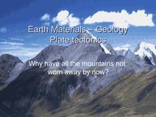
Not going into depth on any one topic, this Earth science presentation skims the crust. It touches on the materials that construct the crust and then moves into plate tectonics. This is a useful and colorful note-taking guide for your...
Curated OER
Tectonic Plates, Earthquakes, and Volcanoes
Challenge geography classes to locate the major volcanoes and earthquake faults on a world map. In groups, they identify the pattern made and examine the relationship between the locations of the faults and volcanoes and tectonic plates....
Environment Agency - Abu Dhabi
Plate Tectonics
Young scholars observe a presentation on plate tectonics, layers of the earth, and plate boundaries. They then use the Internet to research major plates and label them on a world map.
Curated OER
When Plates Collide
Students investigate tectonic plates. In this geology and geography lesson, students construct convergent, divergent, and transform boundaries using oobleck, foam, and tile. A large amount of background information and relevant website...
Curated OER
The Earth Moves Under My Feet
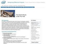
Students study earthquakes, monitor seismic activity using the Web, and plot real-time activity. They examine movement of the Earth's tectonic plates. They create an earthquake preparedness project.
Curated OER
Plate Tectonics: Fifth Grade Lesson Plans and Activities
Fifth graders continue their investigation of the plate tectonics cycle with an exploration of the movement of Earth's crust. During the lab, young geologists conduct an experiment to discover the result of different types of stress...
Curated OER
Volcanoes and Plate Tectonics
In this earth science worksheet, students read and study about divergent and convergent boundaries, tectonic plates and volcanoes to complete 1 data chart 7 short answer questions.
Curated OER
Plate Tectonics: Movin' and Shakin'
Students are introduced to the causes of plate movements and the hazards they present. They plot the location of 50 earthquakes and 50 volcanic eruptions on a map and explore the relationships between plate tectonics, earthquakes, and...
Curated OER
Mapping Plate Boundaries
Students discover plate boundaries based on the uneven geographic occurrence of geologic hazards. After discussing geologic hazards, students plot different sets of earthquakes and volcanic eruptions on maps.
Curated OER
Shaky New Zealand
Students explore Earth science by building a model in class. In this tectonic plate lesson, students identify the impact tectonic shifts have on humans and animals and where the plates and faults lie under New Zealand. Students examine...
Curated OER
Devastation of Indian Quake
Learners read an online article at CNNfyi.com to determine what happened in India after an earthquake. They determine the magnitude of this earthquake and address the issue of relief efforts from other countries.
Curated OER
New Zealand Subduction Zone Model
Students explore world geography by creating a model in class. In this tectonic plate lesson, students identify diagrams which discuss the tectonic plates in New Zealand and how they affect everyday life. Students utilize cardboard,...
Curated OER
Earthquakes And Fault Lines
Students discuss major causes of earthquakes and identify famous fault lines, access and map information about ten largest earthquakes in world from 1989 to 1998, and theorize about location of these earthquakes as they relate to Earth's...
Curated OER
Wegener and Plate Tectonics: A Hands-On Lesson
Students are introduced to and experiment with the basic concepts of plate tectonic theory as well as assess the history of the theory of plate tectonics. They explain and illustrate the basic concepts through diagrams and models of...
Curated OER
Physical and Human Geography Review Worksheet and Study Guide
In this geography skills activity, students respond to 30 short answer questions pertaining to physical and human geography.
Curated OER
Plate Tectonics
In this geology worksheet, learners will cut a map of California along the San Andreas fault line to see how California might change in the future. Then students will compare a world map from 50 million years in the future with a present...
Curated OER
ESRI Live Earthquake Site
Students examine a World map and find earthquakes near plate boundaries. They locate and describe earthquakes in the United States and California.
It's About Time
The Changing Geography of Your Community
Lead your class in exploring their local communities as well as the general environment. As they determine continental distributions by investigating minerals, rocks, and fossils located in their local region, pupils construct a...
Curated OER
Striking Earthquake!
Students simulate strike slip faults using CEENBoTs. In this earth science lesson, students identify the fault lines and tectonic plates on a world map. They label the different parts of a fault line.
Curated OER
Normal (dip-slip) Earthquake!
Students label the fault lines and tectonic plate boundaries on the world map. For this earth science lesson, students simulate ocean floor formation using CEENboTs. They explain the causes of earthquakes.


