Curated OER
Using Google Squared to Compare and Contrast Canada and the US
Sixth graders compare and contrast Canada and the United States. In this geography skills instructional activity, 6th graders use Google Squared to research information so that they may compare the geography of Canada and the United States.
Curated OER
Geological Forces and Topography
Young scholars discuss and research the Earth's geological processes. In this geology lesson, students study maps of Utah and the United States to learn about geological features. Young scholars then complete the research cards for each...
Curated OER
Using Literature to Introduce the Five Themes of Geography
Students listen to a read aloud of "If You Grew Up With Abraham Lincoln". Using the text, they identify examples of the five themes of geography and write them down. Using a map, they plot the places mentioned in the book and sort facts...
Curated OER
The Physical Geography of Australia, Oceania, and Antarctica
Students access information from the United States Geological Survey's Web site This Dynamic Earth to research the Ring of Fire. They answer four questions and then apply what they have learned to create a bulletin board display.
Curated OER
Welcome to New York State
Students choose one region of New York state, and create a travel brochure that includes information such as geographical features, tourist attractions, accesibility, economic features, and historical events that occured in that region.
Curated OER
Mapping Electricity
Students complete Internet research and use their map reading skills to learn about how the United States creates and uses electricity in different states. In this energy sources lesson, students study the mini map of energy usage in the...
Curated OER
Exploring Our Country: An United States Scavenger Hunt
Young scholars visit a selected web site and search answers to given questions. They investigate census data for a several states. They explore data such as business, geography, and people. Students demonstrate ways to navigate...
Curated OER
Geography of Puerto Rico - Review Questions
In this geography of Puerto Rico worksheet, students answer short answer questions about facts of geography in Puerto Rico. Students complete 10 questions.
Curated OER
The Silly States: Where Is Your State and City?
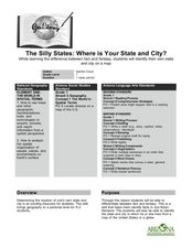
First graders read The Scrambled States of America and discuss whether it is real or fantasy as compared to the United States. In this geography lesson, 1st graders identify their city or state on a map and work in groups to color the...
Curated OER
U.S. Possessions
Ninth graders research the United States acquisition of the Philippines and their fight for independence. They locate the Philippines on a map and brainstorm how its geography has benefits. They access the Internet and complete a student...
Curated OER
To War or Not To War!
Ninth graders examine the various types of propaganda used during World War II. In groups, they make notes on each example and determine why they believe the opinion of the United States involvement in the war changed. They share their...
Curated OER
Train Of States
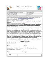
Fourth graders create a class book with information about each of the United States. After students draw a state name out of a hat, they use various resources to fill in a facts chart about their state. Students draw the state flag and...
Curated OER
Day-to-Day Life in a Small African Village
Students experience just a bit of what it's like living in a village in Tanzania-from language to geography to health and hygiene issues. They compare aspects of school and home life in the United States with those in Tanzania and...
US Mint
Absolutely and Relatively: The Puerto Rico Quarter Reverse
How much does your class know about Puerto RIco? How much can they learn from the back of a 2009 quarter? Use the coin, part of a series of quarters that depict US territories, to teach learners about the geography, culture, and history...
Curated OER
Exile: Cuba and the United States
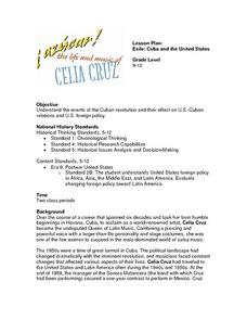
High schoolers gain an understanding of U.S./Cuban Relations. In this world history lesson plan, students examine the events of the Cuban revolution and their effect on U.S.-Cuban relations and U.S. foreign policy.
Curated OER
Lesson 1: Map Data and the Census
Students learn about the history of the census. In this U. S. Census lesson plan, students develop an understanding about how the United States Constitution grants and distributes power and discover how the spatial organization of...
Curated OER
United States Map- Land Elevation
Students explore a physical map. In this map skills lesson, students discuss examples of elevation and investigate the symbols used to identify elevation on a map. Students use the map to identify various land elevations.
Curated OER
Colonial Maps
Students discover the history of America by identifying the traditional colonies. In this U.S. history lesson plan, students examine a world map and identify where the voyagers left from Europe to arrive at the United States. Students...
T. Smith Publishing
48 Contiguous States
What do your pupils know about the United States? This resource asks learners to respond to 10 questions about certain states and landmarks. Useful for a geography lesson and to help familiarize your learners with the continent. An...
Curated OER
The United States Enters the Korean Conflict
Students locate the Korean Peninsula on a world map. They, in groups, study different sources, which explain why the U.S. entered the Korean conflict. One group uses textbooks, the other uses a government document.
Curated OER
Name That Place: Cultural Place Names in the United States
Students examine the origin of the people that settled in the United States. In this United States History instructional activity, students work in small groups to complete several activities that explore early settlement, such as a...
Curated OER
Making a Travel Folder
Students explore the United States. For this U.S. geography and expository writing lesson, students select a place in the United States to research. Students take notes and create a travel "folder," or brochure, using the information...
Curated OER
The Expansion of The United States, 1846-1848
Young scholars interpret historical maps,identify territories acquired by the United States in the 1840s. Also they identify states later formed from these territories. The primary sources for the lesson are the maps found in the...
Curated OER
State Research
Learners apply previous knowledge of the United States to label a classroom map and then work independently to complete an online scavenger hunt. This lesson is intended for an upper-elementary classroom studying American History and/or...
Other popular searches
- United States Geography
- United States Geography Unit
- Physical Maps United States
- United States Geography Maps
- United States Geography 4 6
- United States + Geography
- Physical Maps of United States


