Curated OER
United States Quiz 3
In this United States worksheet, students answer short answer questions about the geography and holidays of the United States. Students complete 10 short answer questions.
Core Knowledge Foundation
Volume 2 - A History of the United States: Modern Times—Late 1800s to the 2000s
The second volume of the Core Knowledge History of the United States ebook begins by asking young scholars to consider the impact immigration, industrialization, and urbanization had on the United States in the late 1800s. The text ends...
Curated OER
Learn the States and Postal Abbreviations
If you are preparing to cover the 50 states with your class, you don't want to miss this resource. It includes an excellent set of worksheets through which learners practice identifying states from their abbreviations and placing those...
Curated OER
United States Geography: Crossword Puzzle
In this geography worksheet, students use the 14 clues in order to fill in the crossword puzzle with the appropriate United States geography answers.
Curated OER
The Great State!
The creation of state home pages is the focus of this lesson. Learners research one of15 states for which special State Quarters have been released, and create a home page for that state. They also perform Internet research and utilize...
Curated OER
The United States and Canada Review Worksheet and Study Guide
In this geography skills activity, students respond to 34 short answer questions about the geographic features and climates found in the United States and Canada.
Curated OER
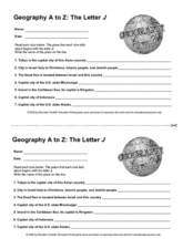
Geography A to Z: The Letter J
How many states, capitals, countries, and locations do your kids know that begin with the letter J? Hopefully they know seven of them, because that's the number of questions on the fun and fast worksheet.
Curated OER
States & Capitals 1-25
Young pupils test their geography skills by matching the 50 states to their correct state capitals. The states are listed in alphabetical order on the left, and a list of state capitals are presented in random order in a right-hand...
Curated OER
The Fifty States
Students become familiar with the states. They study capitols, mottos, nicknames, and other various details. They create group projects that be presented to the class.
Curated OER
Geography A to Z: The Letter S
The letter S is the clue learners need to answer each of the seven geography questions on the worksheet. They answer questions about African, Canadian, Middle Eastern, and US geography using locations that begin with the letter S.
Curated OER
50 States: New England States
Students discover where certain states are located and what the look like. They look for their information on a web site. Each student is assigned a state which they must research then present to the entire class.
Curated OER
Discovering American Symbols
Help youngsters get to know their states and capitals, explore their own country, and study American symbolism. They take a "trip" across America collecting symbols, images, and information about each state as they go (through text and...
Curated OER
American States and Their Capitals
In this United States capitals worksheet, students match the 15 states on the left side of the sheet to their respective capitals on the right side of the sheet.
Curated OER
The 50 States and its Holidays
Though the format of this ELL lesson plan is confusing (the standards listed are for plate tectonics, yet the objectives are for American geography and holidays), a teacher could glean some ideas from the main idea. Here, pupils complete...
Curated OER
Geography A to Z: The Letter G
Using clues to answer questions is a way to increase deductive reasoning skills. Kids answer seven geography clues with answers all starting with the letter G. A great way to test world geography or warm up the class.
Curated OER
Geography A to Z: The Letter F
The geography letter of the day is F! The class needs to determine the answer to each of the seven clues with a world location that starts with letter F. Wonderful for a daily warm up or as an exit-card activity.
Curated OER
The United States in 1790
In this geography skills worksheet, students study the provided map of the United States in 1790 and then complete the provided quiz over the 17 states and territories.
Curated OER
Latin America and United States Policy Today
Young scholars compare the situation of Latin American immigrants with the situation of immigrants from other areas of the world. They use media to obtain information on topics of academic interest, personal interest, and intellectual...
Curated OER
Food on the Map
Learners work together to examine the tastiest towns in the United States. After discovering the names of the equipment, they identify the seven continents. They take a survey and locate the cities and states of the foods mentioned.
Curated OER
N is for Natural State
For any pupils who live in the state of Arkansas, this would be a fabulous educational experience to help them get to know their state better. Through the use of activities in literature, art, mathematics, science, social studies, and...
Curated OER
Symbols of Our State: Arkansas
Here are a series of lessons designed to assist early elementary learners to discover the symbols of Arkansas. They learn about the state flag, insect, state seal, state bird, flower, tree, and gem. A booklet (emedded in the plan), is...
Curated OER
Geography A to Z : Letter H
What starts with the letter H? A lot of things do! Including the names of seven different geographic locations around the globe. Learners use the clues to determine the answers, all beginning with the letter H.
Curated OER
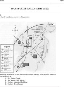
Fourth Grade Social Studies
In this social studies worksheet, 4th graders answer multiple choice questions on state maps, city maps, road maps, political maps, and more. Students complete 25 multiple choice questions.
Tennessee State Museum
An Emancipation Proclamation Map Lesson
Did the Emancipation Proclamation free all slaves during the Civil War? Why was it written, and what were its immediate and long-term effects? After reading primary source materials, constructing political maps representing information...


