Curated OER
Oregon State Word Jumble
In this word jumble worksheet, students unscramble the letters to spell words associated with the state of Oregon. Students spell 20 words.
Curated OER
States and Territories
In this United states worksheet, 5th graders read a short script pertaining to the states and territories. Students complete 10 fill in the blank questions and self check this online interactive worksheet.
Curated OER
United Nations General Assembly
Students study China and the Chinese occupation of Tibet. They read position summaries/notes of China, Tibet and various foreign nations. Then they roleplay members of United Nations General Assembly and discuss and debate the topic.
Curated OER
Geography Puzzles
Students study the continents of the world. In this Internet geography lesson, students connect to online mapping games. Students collaborate in order to develop their understanding of world geography, including countries and capital...
Curated OER
California Geography
Fourth graders explore geography of four distinct regions of California: mountains, coast, central valley, and desert. They locate California on map, identify state's boundaries and borders, and explore agriculture, a major economic...
Curated OER
Geography Lesson 1
Students examine relationship between population centers and sports teams, explore influence of weather on attendance, and research influence of geography, traffic flow and disposable income on site selection for sports stadiums.
Curated OER
Popcorn Geography
Students use kernels to create a "Top Corn-Producing States" map or graph. They read and round off numbers. Students identify on a U.S. outline map the location of corn-growing states. They create a visual (map or graph) illustration...
Curated OER
Geography, Climate, and Community in the Dominican Republic
Students familiarize themselves with the geography and culture of the Dominican Republic. They use primary source materials on the Dominican Republic to explore the question: How does where you live influence how you live? They describe...
Curated OER
Mapping the News
Students explore cartography. In this map skills and map making lesson, Students work in groups to create wall size world maps including legends, compass roses, latitude and longitude, and physical features. Students collect...
Curated OER
51st State
Students, in small groups, design a new state and create a brochure to present to an agency representative outlining the given information in the lesson plan. Students use templates in the compute lab to write sentences they have...
Curated OER
Maps
Maps, globes, and computer software aid young explorers as they locate state capitols, major cities, geographic features, and attractions for states they are researching. They then use desktop publishing software to create a map to share...
Curated OER
NATO Geography & Language
The class receives background information on NATO, an atlas, and a blank world map. They color the original 1949 countries in red, the 1952 additions in green, and the 1990 additions in blue. This exercise would be a good starting point...
Curated OER
Regions of the United States
Students research maps in order to propose geographic reasons for geographic patterns such as state boundaries, interstates and elevations.
Curated OER
Plotting Slave Population Density in Connecticut in the 1700's
Tenth graders explore slavery in the U.S. by researching the web. In this U.S. history lesson, 10th graders identify the geography of Connecticut and the overall involvement the state had in the slavery process. Students view data of the...
Curated OER
Agriculture Cares for the World
Students explore world geography by analyzing agriculture. In this dietary habits lesson, students discuss the role parents play in their children's diet and where the food comes from. Students write agricultural research paragraphs and...
US Mint
Desert Dwellers
What can a quarter possibly teach young learners about desert ecosystems? More than you might think. After displaying and discussing the included picture of the Arizona state quarter, the class participates in a series of...
Sharp School
Travel Brochure Project
Designing a travel brochure is a classic project that will help your class members develop a variety of skills, such as researching informational texts, designing creative visual products, and communicating what you have learned.
Teach Engineering
What's Wrong with the Coordinates at the North Pole?
Here is an activity that merges technology with life skills as individuals use Google Earth to explore the differences between coordinate systems and map projections. The self-guided instructional activity is the fourth segment in a...
Lerner Publishing
Teaching Community Helpers
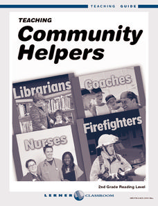
Youngsters discover who the leaders in their community are and what it means to build a community in this four-lesson unit.
Curated OER
Ancient Greece: Athens as a City State
Sixth graders find Greece on the map and recognize how the geography of Greece was important in its development. In this ancient Greece lesson, 6th graders research Greece and compare to the civilization of ancient Egypt. Students answer...
Curated OER
The Rise of the City States in Greece
Sixth graders examine Ancient Greece and its development of democracy. In this Greek History activity, 6th graders explore the rise of city-states in Greece and its overall effect on the development of democracy. The class continues with...
Curated OER
Wales: An Interdisciplinary Unit
Students practice basic map and geographic skills as they compare Oregon to Wales. Students color map of Wales and Oregon using color codes to distinguish between land, water, and bordering nations or states, listen to stories and...
Curated OER
Regions and Habitats
Fourth graders identify the different habitats found in the seven regions of the United States. In this ecology lesson, 4th graders write an essay about how humans affect the ecosystem and vice versa. They discuss how changes on one...
Curated OER
Geography, Ecology, and Folklife
Students identify how do geography and ecology influence a region's folklife. Then they investigate this question and consider how an outsider might view their own region in this instructional activity. Students also identify how the...
Other popular searches
- United States Geography
- United States Geography Unit
- Physical Maps United States
- United States Geography Maps
- United States Geography 4 6
- United States + Geography
- Physical Maps of United States


