Curated OER
Create your own Parfleche!
What is a parfleche? It is a box used by the Plains Indians to carry goods as they traveled. First, the class will discuss the uses of these highly ornate boxes and the nature of the Plains Indians' nomadic lifestyle. Then, the class...
Curated OER
Pack your Parfleche!
Imagine you are a Plains Indian, a nomad getting ready to follow a herd of buffalo. Now imagine what you would have to pack for your trip. Little ones examine images of a traditional parfleche (packing box), and then create packing lists...
Council for Economic Education
China - Where Will They Fit in the World Economy?
Teach scholars why China is so crucial to global economics through an informative resource. Activities include using databases to search for information, watching a video or listening to a podcast, and reading about China's economy as a...
Curated OER
An Exploration of Cradle-to-Cradle Design Thinking
Introduce cradle-to-cradle design thinking. Scholars first discuss the importance of natural laws and rights. They then use a variety of online and print resources to research eco-efficiency and cradle-to-cradle design.
Thoughtful Education Press
Compare and Contrast
Encourage readers to compare and contrast the information that they find in informational text with a variety of reading passages and worksheets. Learners read all about subjects in science, social studies, and literature...
Teach Engineering
Where Are the Plastics Near Me? (Mapping the Data)
The last activity in a nine-part series has teams create a Google Earth map using the data they collected during a field trip. Using the map, groups analyze the results and make adjustments to the map to reflect their analysis. A short...
Concord Consortium
Center of Population
Let the resource take center stage in a lesson on population density. Scholars use provided historical data on the center of the US population to see how it shifted over time. They plot the data on a spreadsheet to look the speed of its...
Planet e-Book
Dubliners
The Dubliners contains 15 short stories all bound in one book. The stories begin with narration by young children, and as they progress, so do the ages of the narrators. The author, James Joyce, focuses most stories on characters that...
Curated OER
A Sense of West Virginia
Students consider their perceptions of the world through their 5 senses while visiting the West Virginia State Museum. In this West Virginia history instructional activity, students discover how knowing about the past helps with their...
Curated OER
Geography: Alaska Geography Treasure Hunt
Students locate features listed on the Treasure Hunt sheet.
Curated OER
Symbols of Our Land
Students explore the symbols and figures significant to the American culture in the five lessons of this unit. The U.S. flag in various versions, the Statue of Liberty, and the Lincoln Momorial are all covered in short segments in this...
Curated OER
Propane Incident in Clayton, North Carolina
Students assume the role of members of the state fire marshal's office and develop a plan for the Fire Chief of Clayton on how the derailment of tank cars of propane in downtown Clayton should be handled. Students investigate any...
Curated OER
Creating the Modern Middle East
Students examine the creation of the Middle East and how the Ottoman Turks attempted to unite the peoples of the Middle East. They discuss why European powers took control of the nations in southwest Asia and how the creation of Israel...
Curated OER
Virginia In the World: The Geography of Commerce
Students examine how Virginia connects with the world through export trade. Using a map, they use symbols to depict the value of trade and the direction of the flow of goods. They complete a scavenger hunt using electronic almanacs and...
Curated OER
the Potential Consequences of Climate Variability And Change
Students analyze the consequences of changing variables on a system. Changes in a model are measured and recorded and conclusions drawn based on the data provided in this six lessons unit.
Curated OER
Food vis Ships
Students take a short quiz before embarking on their journey. They explore all different types of food around the world as well as labeling all those places on a world map. Observance is given to all the different types of vehicles used...
Curated OER
Mesopotamia
Young scholars map Mesopotamia. In this Geography lesson, students are introduced to Ancient Mesopotamia. Young scholars use an atlas to label the defining features and areas of Mesopotamia on a map.
Curated OER
Water in Alabama History
Learners examine the role of water in Alabama's history. They discover the geographical regions of the state and how dams change Alabama's rivers.
Curated OER
Canada Eh? Pre/Post Tests on Canada Using GPS
Middle schoolers participate in a GPS activity and answer questions about Canada. In this Canada instructional activity, students identify location by using a GPS Unit and latitude and longitude. Middle schoolers find an Inuksuk...
Curated OER
Story Stretching: Tall Tales in North America
Students are introduced to tall tales. In this introductory tall tales unit, students explore the tall tales of Casey Jones and Johnny Appleseed. This unit includes many interdisciplinary lessons including graphing skills and geography.
Curated OER
Africa Capitals Map Quiz
In this online interactive geography quiz learning exercise, students examine the map that includes 53 African countries. Students match the names of the countries to the appropriate locations.
Curated OER
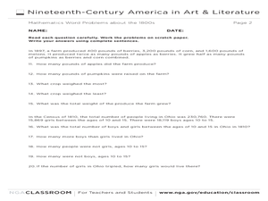
Mathematics Word Problems About the 1800s
In this history and math worksheet, learners solve 20 problems pertaining to life in America in the 1800s. Students read four paragraphs and solve the five problems using that information. Basic math operations are used.
Curated OER
Oh Canada!!
Fifth graders become familiar with the people, culture, government and geography of Canada. In this Canadian people and places lesson, 5th graders research and create a map of Canada reflecting their gathered...
Curated OER
Straberry Girl: Florida's Location and Shape
Students explore geography by reading a story about Florida. In this Florida vegetation lesson, students read the book Strawberry Girl and identify the locations in Florida that are mentioned in the book. Students identify the type of...
Other popular searches
- United States Geography
- United States Geography Unit
- Physical Maps United States
- United States Geography Maps
- United States Geography 4 6
- United States + Geography
- Physical Maps of United States


