Core Knowledge Foundation
Isn’t It Exciting? (The American Industrial Revolution and Urbanization)
America was built on the ingenuity, work ethic, and foresight of our ancestors. Sixth graders learn about the complex Gilded Age in American history, including the prominent inventors and captains of industry, and how they all connect...
National Park Service
Living & Non-Living Interactions
What better way to learn about ecosystems than by getting outside and observing them first hand? Accompanying a field trip to a local park or outdoor space, this series of collaborative activities engages children in learning about the...
Science Matters
Seismic Activity and California Landforms
By the 19th instructional activity in the 20-part series, scholars realize volcanoes and earthquakes are related to plate boundaries. The instructional activity extends and applies the knowledge by having individuals create a bumper...
Curated OER
Getting to Know My World
Students participate in hands-on activities using maps and globes to identify geographical features. Students use map legends to identify direction. Students locate oceans, continents, countries, states and cities. Handouts and...
Curated OER
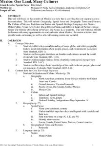
Mexico: One Land, Many Cultures
Students research and study the country of Mexico and complete a project about it. In this Mexico lesson plan, students research Mexico's geography, traditions, art, songs, stories, and legends that are native to Mexico.
Curated OER
The Basis for Our Moral Code (Judaism and Christianity)
Students consider the history and significance of the Judao-Christian culture through this nine lesson unit. Scenes from the Old and New Testaments are reenacted as students unearth some of the foundations of our Western Culture.
Curated OER
Colony Crops
Fifth graders determine which crops were grown in the 13 colonies depending on their climate and geography. They explore what crops are grown in the states created from the original colonies.
Curated OER
Journey on the Underground Railroad
Young scholars use Indiana and Michigan state road maps to trace a route to Canada from Madison, IN. with the many possible stops along the way. They make a picture book that depicts a runaway slave's journey on UCR.
Curated OER
America's Heartland
Students complete geography and trade activities about global trade. In this geography and trade lesson, students read information to learn about absolute advantage, comparative advantage, trade factors, U.S. trade partners, and...
Curated OER
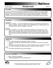
Kansas Land
Fourth graders discover the geographic regions of Kansas. In this geography lesson, 4th graders explore the different regions of Kansas and determine how the different geography affects daily life in Kansas.
Curated OER
If These Walls Could Talk: Seeing a Culture Through Human Features
Students read Talking Walls and discuss the walls presented and their importance to the culture. For this geography lesson, students locate and label each country/continent discussed in the book on a world map. Students take a walk and...
Curated OER
Grades 6-8 Lesson Plan - Cities as Transportation Centers
Middle schoolers examine maps of the 1800's and 1900's. In this geography skills lesson, students collaborate to read core maps and identify transportation centers and travel networks.
Curated OER
Trading Faces
Students use addition to determine values of coin combinations. They play a game where they come up with possible trades: two nickels for a dime and complete a tally worksheet. There are other lessons in this unit.
Curated OER
Louisiana Purchase
Students use maps to locate and describe the area purchased by the Louisiana Purchase. In groups, they write a letter to Thomas Jefferson in which they evaluate the topography, climate and geography of the land. They determine the land's...
Curated OER
Postcards from the Edge: Endangered Species
Students use the internet to identify the endangered species in their state. Using this information, they create a postcard with a picture of the animal along with facts. They discuss the main reasons to protect the endangered species...
Curated OER
American Indian Art
Students complete a unit of study about Native American visual art. In this visual art lesson, students complete five lessons to study Native American art.
Curated OER
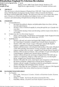
Elizabethan England To Glorious Revolution
Students explore the development of England from 1500 to 1689 in this eight lessons unit. The various parts of history affected by both political and religious factors are synthesized in this unit.
Curated OER
Diary of a Worm Secret Agents
Second graders explore the geography of Washington D.C. and President Bush's hometown of Crawford, Texas. They read the book, Diary of a Worm, determine the best route to go to Texas from Washington D.C., and throw a birthday party for...
Curated OER
Traveling on the Sea of Gold: An Adventure in Japan Through Literature
Pupils explore the geography and culture of Japan through the story "Sea of Gold" by Yoshiko Uchida. They draw a travel poster of Japan, label a map of Japan, use chopsticks to eat Cheerios, read and discuss various books about Japan,...
Curated OER
Adventures on the Eastern Half of Planet Earth
Seventh graders explore a country in the Eastern hemisphere. They develop a packet that could be used by someone visiting that country during the month of December. Students explore the climate, foods, geography, customs and culture of...
Curated OER
Legends of the Fifth
Students explore the the legends and myths of the Orient, Africa, Europe, Asia, and the Americas in this six lessons unit. Different cultures and belief systems of the inhabitants of these areas are examined through storytelling techniques.
Curated OER
Canada, Our Neighbor to the North
Students obtain knowledge of Canadian geography and history. Students work in groups gathering information to create a brochure on Canada. Students discover how French and British history helped shape Canada as a nation.
Curated OER
Virginia: The Land and its First Inhabitants
Students review the five geographical regions of the state of Virginia. Using a map, they locate and label Virginia, surrounding states and the crops grown in the area. They present their map to the class and complete a worksheet to end...
Curated OER
Water Features - Lesson 2 - U.S. Political Map Grade 4-5
Learners locate water features on maps. In this geography lesson, students complete worksheets that require them to identify water features on a U. S. political map.
Other popular searches
- United States Geography
- United States Geography Unit
- Physical Maps United States
- United States Geography Maps
- United States Geography 4 6
- United States + Geography
- Physical Maps of United States


