Curated OER
Our 50 States
Students identify the location of the 50 states using an interactive map. They practice geography skills by playing a fun game. Pupils become familiar with the state abbreviations for the US states. Students become familiar with the...
Curated OER
United States Map- State Capitals
Students explore the state capitals. In this geography lesson, students use a political map to identify the state capitals and place post-it notes on various capitals.
Curated OER
Geography A to Z: The Letter G
Using clues to answer questions is a way to increase deductive reasoning skills. Kids answer seven geography clues with answers all starting with the letter G. A great way to test world geography or warm up the class.
Curated OER
Geography A to Z: The Letter F
The geography letter of the day is F! The class needs to determine the answer to each of the seven clues with a world location that starts with letter F. Wonderful for a daily warm up or as an exit-card activity.
New York State Education Department
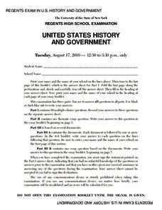
US History and Government Examination: August 2010
Geography has played a complex role in America history. The Atlantic Ocean has served as a buffer to protect the United States from European Wars, but its proximity to Cuba, however, left it vulnerable to nuclear war during the Cuban...
Curated OER
Geography and Culture of China
Take out a map, a paper, a ruler, and those coveted colored pencils for a lesson on Chinese culture and geography. This is a multifaceted approach to basic geography skills that incorporate story telling, class discussion, primary source...
Curated OER
N is for Natural State
For any pupils who live in the state of Arkansas, this would be a fabulous educational experience to help them get to know their state better. Through the use of activities in literature, art, mathematics, science, social studies, and...
Curated OER
States in the USA Quiz
In this online interactive geography quiz worksheet, students respond to 50 identification questions about the states in the United States of America. Students have 4 minutes to complete the quiz.
Curated OER
American States and Their Capitals
In this United States capitals worksheet, students match the 15 states on the left side of the sheet to their respective capitals on the right side of the sheet.
Curated OER
Capitals of the United States Word Search
In this Capitals of the United States word search, students identify and circle the names of capitals located in America. A list of 50 towns is provided. An answer key is available.
New York State Education Department
US History and Government Examination: August 2011
Using primary source documents, pupils consider how the United States' democratic story has evolved over time. A second essay question examines the role of geography in history, and multiple-choice questions sharpen test-taking skills.
Student Handouts
Geography of Dr. Martin Luther King, Jr.
Young geographers follow Dr. Martin Luther King's journey during the civil rights movement by identifying major events on a map of the eastern United States, such as his birth in Atlanta, Georgia and his famous...
Scholastic
Perfect Postcards: California
It's time to hear about some adventures in travel! The Transcontinental Railroad changed life and travel in the United States during the 1800s. Practicing online research skills, pupils discover the features they would like to visit on...
Curated OER
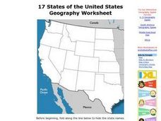
17 states
In this states instructional activity, students label states in the United States that are on the west side of the country. Students label 17 states.
Curated OER
State to State Scavenger Hunt
In this states worksheet, students utilize the Internet to access one specific website to locate the answers to five fill in the blank statements about the states found on a United States map.
Curated OER
Fascinating Geography Facts
In this geography worksheet, students will read 4 interesting United States geography facts and 19 fascinating world geography facts.
Curated OER
Spanish Influence in the U.S.
Eighth graders research the role of the first Spanish conquistadors who explored the now United States. Using the internet, they gather information on different explorers and write a paper about why he is important in American history. ...
Curated OER
What State Am I?
In this state activity, students read clues that describe one state in the United States. They answer the riddle and then check their work by marking out every third letter in an answer box. There are seven problems in this one-page,...
Curated OER
Midwestern States
In this United States geography worksheet, students study the image of the Midwestern states. Student then label the states with the following choices: Missouri, Iowa, South Dakota, Minnesota, Nebraska, Illinois, North Dakota, Kansas,...
Curated OER
What State Are You In?
Young scholars identify the major U.S. cities. In this U.S. geography lesson, students work in pairs and use game cards to name various cities in the United States.
Curated OER
States and Capitals
This map skills PowerPoint features an interactive states and capitals game. The object of the game is to identify the capital cities of each of the 50 states. The excellent presentation includes United States maps, game directions, and...
Curated OER
What's In a Name?
Students examine the origins of the names of U.S. states, focusing on names that were derived from Native American words. They are provided with lists of the names of the 50 states, and then research online or in library resources the...
Curated OER
Max Knows Mexicao, United States and Canada
Students utilize their map skills to explore the regions of North America. They explore the physical characteristics and climates of the regions. Students label their map and prepare a presentation of their findings.
Curated OER
Biomes and Regions of the United States
Students examine and identify the characteristics of the biomes of the world. Using the Internet, they compare and contrast the similarities and differences and discover how living things are supported in the biomes. They discuss how the...
Other popular searches
- United States Geography
- United States Geography Unit
- Physical Maps United States
- United States Geography Maps
- United States Geography 4 6
- United States + Geography
- Physical Maps of United States


