Alabama Department of Archives and History
Military Conscription in World War I: Alabamians Express Their Opinions
If called, would you go? Should the US government have the power to impose a draft during any war? The Selective Service Act of 1917 (aka the Conscription Act of 1917) authorized the drafting of men into the military for only the second...
Curated OER
Ozark Karst: A Fragile Landform
Young geologists become familiar with the Karst Topography in the Ozark Mountains. They study how human activity has affected the cave ecosystem. They conduct a simulation in which a large development is proposed in the area, and they...
Curated OER
Massive Migrations
Here is an exciting exploration of a fascinating topic for your emerging ecologists: bird migration! They begin by visiting the US Fish & Wildlife Service website to discover which Arctic birds come to their areas. They are assigned...
Curated OER
Physical Education Unit Plan: Soccer - Lesson 3
Lesson three of this unit focuses on multiculturalism in soccer. Begin class by showing video clips of soccer in other countries. This lesson includes a link to Rwandan youth playing soccer in an open space. Playing soccer in third...
The New York Times
Decision Point: Understanding the U.S.’s Dilemma Over North Korea
Simulate the Situation Room and analyze the US's relationship with North Korea. The plan starts off with a quick review and an examination of a online timeline that updates as the situation continues. Next, the class reads an article and...
Museum of Tolerance
Disenfranchised People of the New Nation
Why are some immigrant groups in the United States embraced while others become disenfranchised? To answer this question, teams investigate why groups emigrated to the US, why some of these these peoples were disenfranchised, and their...
Curated OER
Maps that Teach
Students study maps to locate the states and capital on the US map. Students locate continents, major world physical features and historical monuments. Students locate the provinces and territories of Canada.
Curated OER
The Eerie Canal
Students discover bodies of water in the United States by investigating the Eerie Canal. In this U.S. Geography instructional activity, students discuss Lake Eerie and the canal that was built in order to transport goods. Students...
Curated OER
United States & Canada: How Are We The Same? How Are We Different?
Pupils compare and contrast similarities and differences between Canada and the US. In this geography lesson, students read various articles and identify similarities and differences in economies, cultures, geography, climate, and...
Curated OER
Mexico: Introduction to History and Literature
Students study the geography of Mexico (i.e. major cities, surrounding countries and bodies of water, mountain ranges, rivers, volcanoes), They take turns reading aloud information provided (xerox copies) about Mexico. After each...
Curated OER
Island Animals
Students explore the concepts of endangered animals and conservation. In this animal conservation lesson, students complete activities to investigate the endangered animals of the US Virgin Islands. Students complete multiple worksheets...
Curated OER
Presidents North and South Timeline
Fourth graders conduct online research to create a timeline of ten US Presidents. In this historical events instructional activity, 4th graders find online information about the birth dates and birth states of ten US Presidents. This...
Curated OER
Hip Hop and Geography
Students study the various geographic regions of the U.S. and discuss how popular music is influenced by cultural/regional factors. Groups choose East Coast, West Coast, Midwest, or South in rap/hip hop music and create a PowerPoint or...
Curated OER
US Geography, The Blues
This lesson enables teachers to use blues styles and performers to think about various geographical regions of the United States. By studying different blues styles from the Mississippi Delta, Texas, and the Piedmont region of the...
Curated OER
Geography of the Study of the Spanish-speaking People of Texas
Students identify the physical features, demographic characteristics, and history of the four Texas towns featured in Russell Lee's photo essay, "The Spanish-Speaking People of Texas." They conduct Internet research, and create a travel...
Curated OER
Geography and Culture in South Carolina
Students explore South Carolina. In this cultural heritage lesson, students investigate the topography of South Carolina using maps. Students are engaged in identifying the different regions of the state and examine the cultural heritage...
Curated OER
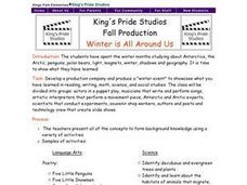
Winter is All Around Us
Students present what they have learned on Antartica. Students identify deciduous and evergreen trees and plants; identify and study about the habitats of animals that migrate, hibernate, and adapt; study the Aurora and Aurora Borealis...
Curated OER
Going...going...gone? Tropical Rainforests-How They Work, What They Do for Us, What's Being Done to Them...
Sixth graders explore the Tropical Rainforest and come to understand what it is and how it affects the ecosystem. In this rainforests instructional activity, 6th graders write about the Tropical Rainforest, imagine they are in the...
Curated OER
Regions of Virginia
In this geography worksheet, 5th graders identify the regions of the state of Virginia and sort them according to location. Then 10 questions focus upon the specifics of different regions.
Curated OER
New England Jeopardy
Jeopardy style games are fun ways to help learners review for tests or solidify concepts recently covered in class. This Jeopardy game focuses on the industrial economy of New England. Students will need to know general information on...
Curated OER
Five Themes of Geography
Learners conduct research to determine why geography is important and how it provides information regarding many aspects of the world. They investigate the hemispheres, longitude, latitude and absolute location.
Curated OER
State Poster Fair: US Geography, Social Science, Art
Students research a US state, design and construct a state 'poster' to display important facts about that particular state. They present their work to the class.
Curated OER
Regions of the US: Gulf Stream, States and Their Capitals
Fifth graders identify one way of dividing the US into geographical regions and then consider alternate ways of doing the same. They locate each of the fifty states and their capitals on a map. They research the Gulf Stream region.
Curated OER
GEOGRAPHY OF FOOD & FIBER
Students will explain the ways geography determines the crops grown in the United States and other countries, and the resulting trade relationships.1. Discuss trade routes, both ancient and current. Discuss why the most direct route from...
Other popular searches
- Us Geography
- Canada Geography Land Use
- Us and Canada Geography
- Us Geography Climate
- Us Geography Skills
- Usa Geography Map Skills
- Us Geography Pdf
- Us Geography Scavenger Hunt
- Us Geography Northeast
- Us Geography Activity
- Us Geography Slavery
- Us Cultural Geography


