Curated OER
Global Wind Patterns Notes
In this global wind patterns worksheet, students take notes on the wind patters in the southern and northern hemispheres. They indicate the latitude the winds occur at, the pressure, the characteristics and the direction the wind moves....
NASA
Earth's Global Energy Budget
Introduce your earth science enthusiasts to the earth's energy budget. Teach them using an informative set of slides that include illuminating lecturer's notes, relevant vocabulary, embedded animations, colorful satellite maps, and a...
Curated OER
El Nino
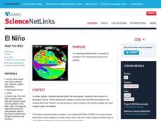
Explore the properties of water and the affects of El Nino. Middle schoolers will learn about the devastation an El Nino can cause as well as the definition of El Nino. Additionally, they will discover the cause of El Nino along with the...
Curated OER
Hurricane Winds: A Spatial Hierarchy of Processes at Different Scales
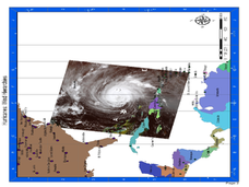
In this earth science lesson, students study a satellite image of hurricane Isabel and write answers to 5 questions that follow. They match predictions to the map locations.
Curated OER
Design Your Own Imaginary Continent
In this continent activity, students design their own continent and include latitudes, mountain ranged, river, wind patterns, and temperature highs and lows. They also include a variety of cities in specified locations.
Curated OER
What Is El Niño?
Students access information at remote sites using telecommunications, identify impacts by reviewing past El Ni??o events, make and use scale drawings, maps, and maps symbols to find locations and describe relationships.
Curated OER
Wind Circulation, Surface Currents and Climate
Students describe connections between wind patterns, surface currents, and ocean climate zones. In small groups, they color the ocean climate zones in four different shades of blue. Students then answer questions like what four...
Port Jefferson School District
Climate Patterns
Young climatologists explore the factors that contribute to a region's climate in this two-part earth science activity. To begin, learners are provided with a map of an imaginary planet and are asked to label global wind and ocean...
Curated OER
Follow Your Dreams: Career Goals
It is so important for impending high school graduates to start thinking about their potential careers. Here, they discuss the persistence of Blondie Hasler and his impressive transatlantic trip. They follow various routes on a map and...
Curated OER
A Comparison of Cloud Coverage over Africa
Young scholars identify different climate regions and local weather patterns. For this cloud coverage lesson students use NASA satellite data and import it into Excel.
NOAA
Currents
Learn how ocean currents are vital to humans and marine life. The eighth installment of a 23-part NOAA Enrichment in Marine sciences and Oceanography (NEMO) program, focuses on ocean currents and how they affect global climate. The...
Curated OER
Is Portland, Oregon Experiencing Global Warming?
Students use data to determine if the climate in Portland has changed over the years. In this weather lesson students complete line graphs and study long wave radiation.
Curated OER
once and future MOON
Beyond the phases of the moon, this comprehensive lesson plan covers geologic history and geology. Amateur astronauts examine photos of the lunar landscape, experiment with the creation of craters, and delve into information about the...
Curated OER
Arkansas: A Changing Climate, a Changing Land
Here is a lesson on the climate zones and geography of Arkansas. In it, learners look at maps (embedded) of different climate zones found throughout Arkansas. They engage in discussions regarding how global warming and climate change is...
Curated OER
Comparing the Effects of El Nino and La Nina
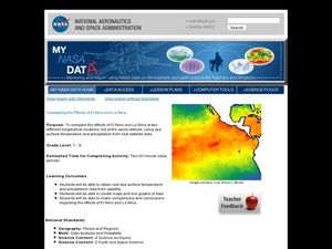
Students examine the differences between an El Nino and La Nina year. For this investigative lesson students create maps and graphs of the data they obtained.
Curated OER
Weather's Outer Limits
Students make educated guesses and explain their reasoning and compile, graph, and map weather data. They then study environmental weather extremes on earth and discover that many variables determine climate.
Curated OER
Mapping a Refuge
Students record observations gathered while at a national wildlife refuge. In this lesson on wildlife refuges, students choose an observation spot and record seasonal changes throughout the year.
Curated OER
Fallout!
Students plot the locations of fallout from two disasters that polluted much of the world's air. They plot the ash fallout from the 1980 Mt. St. Helen's eruption to see what the wind patterns in the United States look like overall. Next...
Curated OER
Finding the Way
Young scholars identify and research navigational tools used in deep sea explorations. They are introduced to a compass, the Global Positioning System and sonar technology and then describe their uses in underwater exploration.
Curated OER
Ocean Currents and Sea Surface Temperature
Students use satellite data to explore sea surface temperature. They explore the relationship between the rotation of the Earth, the path of ocean current and air pressure centers. After studying maps of sea surface temperature and ocean...
Curated OER
You Can Die Here
Students examine Death Valley including the amount of precipitation and winds that it gets. In this climate based lesson students explain the reasons for the amount of precipitation and windward patterns in Death Valley.
Curated OER
Storm That Drowned a City
Students use a map to locate New Orleans and watch a video on the destruction of Hurricane Katrina. As a class, they watch a demonstration on how a wetland can reduce the impact of a hurricane. In groups, they perform their own...
Curated OER
Cultural Exchange (Salem)
Students view the photo of the The Tea Trade Painting and discuss what they see. They will then discuss what went into the beginning of a major sea voyage. Next they explore routes traveled by the New England traders. They study sailing...
Weather Bug
WeatherBug
Exploring the weather has never been more intriguing! Whether you are looking for a quick glance at the 10-day forecast, trying to figure out if lightning is heading your way, or wondering what the pollen count is, you will find out...


