Curated OER
The Flat Earth
Young scholars differentiate between different planes. In this geometry lesson, students differentiate between a plane and a sphere. They discuss the Great Circle, Geodesic and Lune as it relates to the earth.
Curated OER
Plate Tectonics: An "Eggs"periment
Students investigate plate tectonics by observing a cracked egg shell. In this Earth science lesson, students draw borders of continents on an egg shell, only to watch it crack in a glass. Students record the breakup of the...
Global Oneness Project
A Collapsing City Skyline
Have your high schoolers learn about the modern history of Myanmar by close-reading an article about the city and people of the city Yangon. As they'll learn, the country is going through some dramatic transitions. After...
Curated OER
The American Revolution
Students study the American Revolution using Google Earth and United Streaming online resources. In this American Revolution lesson, students complete a KWL chart with information they know about the American Revolution. Students then...
Curated OER
Eratosthenes And Radius of the Earth
Students calculate the radius of the earth. They use the method and data suggested by Eratosthenes. They investigate the interrelationships among mass, distance, force, and time through experimental processes.
Chicago Botanic Garden
Recent Weather Patterns
Decide whether weather is changing! A two-part activity first challenges classes to review the differences between weather and climate. Once finished, individuals then analyze historical data to determine if climate change is happening...
Curated OER
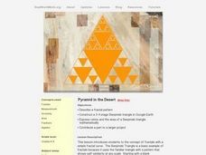
Pyramid in The Desert
Students investigate the Sierpinski triangle and calculate the ratio and area of the triangle. In this fractals instructional activity, students calculate parts of a Sierpincki triangle. They use Google Earth to help them construct the...
Curated OER
An Introduction to the Night Sky and Movement Astronomy
Basically, this is an interactive exploration of educational astronomy software and an app. Young astronomers discover how the apparent motion of the sky relates to Earth's movements and the position of the observer. It is out of this...
Curated OER
Convergence with The Cay: Exploring Geographic Concepts Wrapped in a Story
Here's an awesome unit that uses The Cay as the anchor text. The 16-page packet is loaded with teaching ideas, activities, and suggested adjustments.
Curated OER
The Grand Canyon
In this geological processes worksheet, students use Google Earth to access pictures of the Grand Canyon. Students look at the layering of rock over time. Students complete 2 short answer questions.
Curated OER
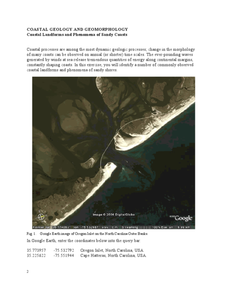
Coastal Geology and Geomorphology
In this coastal geology worksheet, students use Google Earth to locate and identify different types of landforms and phenomena that occur along a coast. This worksheet has 2 short answer questions.
Curated OER
Coastal Geology and Geomorphology
For this coastal geology worksheet, students use Google Earth to locate the Oregon coastline. Students then complete 6 short answer questions based on coastal geology.
Curated OER
Fostering Geospatial Thinking: Space to Earth: Earth to Space (SEES)
High schoolers locate and access data to help them with their science inquiry. In this geographical positioning lesson students evaluate and compare data sets.
Curated OER
Where on Earth Are You From?
Students create family trees and discuss cultural differences. In this cultural diversity lesson, students discuss the places their families came from and develop questions for each other.Students show their families path of...
National Wildlife Federation
Go with the Flow
The quality of a watershed has a direct impact on the community it services. Learners study their own watershed using a topographical map. They recreate the watershed components using colored pencils to track the upstream and downstream...
Curated OER
The Finer Things in Life
Momoyama and Edo are periods in Japanese history that can be defined culturally and artistically. Learners explore and discuss how the samurai used sword guards and grip enhancers. Pupils read the story "The Inch-High Samurai," examine...
EngageNY
Why Move Things Around?
Explore rigid motion transformations using transparency paper. Learners examine a series of figures and describe the transformations used to create the series. They then use transparency paper to verify their conclusions.
Curated OER
Water
Students complete activities to examine the properties of water. In this water science lesson, students read a book about water's forms and study a map or globe of the Earth to investigate water. Students discuss living things that need...
Curated OER
Converging Earthquake!
Students identify the fault lines and tectonic plates on the map. In this earth science lesson, students simulate landscape formation using robots. They take a quiz at the end of the lesson to demonstrate mastery.
Curated OER
Trade in the Silk Road Cities
Students use Google Earth to map cities along the Silk Road trade route. In this Silk Road trading lesson, students complete a worksheet examining production, transportation, and value of goods and research trade items. Students create a...
Google
Plate Tectonics Questions
Investigating plate tectonics, boundaries, and the earth's physical attributes is the focus of this short answer, tectonic plates learning exercise.
Curated OER
Great Explorers
Students research an explorer and present a multimedia presentation on the explorer. In this United States explorers lesson, students watch a video about Lewis and Clark. Students use Google Earth to study their journey and keep a KWL...
Curated OER
Where in the World? The Basics of Latitude and Longitude
Students are introduced to the concepts of latitude and longitude. In groups, they identify the Earth's magnetic field and the disadvantages of using compasses for navigation. They identify the major lines of latitude and longitude on a...
California Mathematics Project
Meteorology
See how estimation is essential to making temperature weather maps. Scholars use ratios and rates of change to estimate temperatures at locations where temperature readings have not been made. They connect this idea to linear functions.
Other popular searches
- Google Earth Landforms
- Google Earth Scavenger Hunt
- Google Earth North Pole
- Google Earth Game
- Social Studies Google Earth
- Geography Google Earth
- Google Earth Lesson Plans
- Google Earth and Regions
- Google Earth Geology
- Google Earth Journalism
- Google Earth Glaciation
- Google Earth Ratings=3


