Curated OER
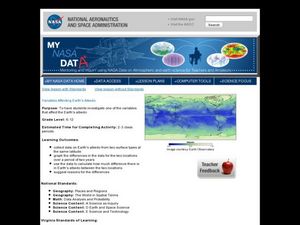
Variables Affecting Earth's Albedo
Learners study the variables that affect the Earth's albedo. In this environmental data analysis lesson students interpret and graph information and calculate changes.
Curated OER
Hershey and the World: The 5 Themes of Geography and Google Earth
Students invsestigate cocoa producing regions in the world. In this geography skills lesson plan, students examine how the 5 themes of geography affect the Hershey Chocolate Company as they compare and contrast cocoa production in...
Teachers' Curriculum Instituted
The Roman Record
Using Google Earth, Google Docs, and other Google Tools, collaborative groups of seventh graders research and then create and share online newspapers reporting on the early development, geographical features, political issues, and...
Curated OER
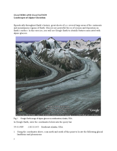
Landscapes of Alpine Glaciation
In this glaciers activity, students use Google Earth to look for examples of different glacial landforms and phenomena. Students complete 2 short answer questions.
NY Learns
Geography of the Fertile Crescent by ECSDM
Using Google Earth, a vocabulary assignment, and map handout, your class members will outline the Fertile Crescent in Mesopotamia and identify the source of the Tigris and Euphrates rivers. They will then complete graphic organizers...
Curated OER
My Summer Vacation
Students study the United States geography using Google Earth. For this U.S. geography lesson, students create travel journals about five U.S. geographical locations. Students research the human and physical characteristics for each region.
Curated OER
Time Zone Problems
In this time zones worksheet, students use a formula along with information found on Google Earth to calculate time zones around the world. Students complete 12 word problems.
Curated OER
Google Earth Virtual Vacation
Students explore different areas of America by using the internet and the "Google Earth" website in this interactive, social studies lesson for late elementary students. This lesson includes a resource link to download a free program to...
Montana State University
Meet Mount Everest
Learning about one landform might seem boring to some, but using the resource provided practically guarantees scholar interest. The second in a sequential series of eight covering the topic of Mount Everest includes activities such as a...
Curated OER
Estuary and Watershed
Students investigate the San Francisco Bay Estuarine Research Reserve and watershed. For this estuary and watershed lesson plan, students complete 4 activities to better understand estuarine systems. They include studying the San...
Curated OER
America's Favorite Landmarks
Young scholars research using Google Earth a variety of websites to explore America's most prominent and famous buildings. They then compare and contrast architectural styles and write a position paper defending or arguing against their...
Chicago Botanic Garden
Recent Weather Patterns
Decide whether weather is changing! A two-part activity first challenges classes to review the differences between weather and climate. Once finished, individuals then analyze historical data to determine if climate change is happening...
Polar Trec
What Can We Learn from Sediments?
Varve: a deposit of cyclical sediments that help scientists determine historical climates. Individuals analyze the topography of a region and then study varve datasets from the same area. Using this information, they determine the...
Curated OER
Trade in the Silk Road Cities
Students use Google Earth to map cities along the Silk Road trade route. In this Silk Road trading lesson, students complete a worksheet examining production, transportation, and value of goods and research trade items. Students create a...
Curated OER
Four Color Map
Learners explore geometry by completing a color puzzle. In this shape identification lesson, students utilize deductive reasoning to complete a Google SketchUp puzzle with trapezoid, triangles and rectangular shapes. Learners...
Curated OER
Geography of the Roman Empire
Students explore the Roman Empire. For this ancient Rome lesson, students research regions of the Roman Empire and present their finding to their classmates. Students also use an interactive map to practice placement of the regions...
Discovery Education
Physical Oceanography and Meteorology, Navy Search and Rescue Operation
It's an ocean rescue mission! Groups must find a pilot downed off the coast of the Chesapeake Bay. Rescuers must determine the distance needed to travel as well as the heading to get to the pilot's last known position. Taking...
Curated OER
Great Lakes Snow Analysis Collaborative Network
Students interpret data on snow cover and analyze trend patterns. In this snow activity students compare data and locate their school's GPS coordinates.
Curated OER
The Rain Forest of Costa Rica
Fifth graders examine and discuss the topography, climate, natural resources and artwork of Costa Rica. They develop a diagram of the layers of the rain forest, and design a tourist brochure or advertisement promoting Costa Rica's...
Curated OER
Living Swamps, Bayous and Forests
Third graders explore interesting environments by exploring Louisiana. In this wetland lesson, 3rd graders utilize the web to research the State of Louisiana, the bayous in the area, and the Gulf of Mexico. Students write a journal entry...
Curated OER
Geography Puzzles
Students study the continents of the world. In this Internet geography instructional activity, students connect to online mapping games. Students collaborate in order to develop their understanding of world geography, including countries...
Curated OER
Using Repeat Photography to Map Environmental Hazards
Students investigate the changes of their environment by experimenting with photography. In this environmental observation lesson, students compare historic photographs of areas with pictures they have just taken. Students...
Curated OER
Search and Rescue Project
Young scholars create a search and rescue party. In this geometry lesson, students simulate a rescue operation using math. They calculate the time, rate and solve word problems related to the real world.
Curated OER
Atlantic Canada Report
Ninth graders create a report that will show an in-depth knowledge of the various geographical and climatic features of Atlantic Canada. They produce various items, on paper and using the computer, to demonstrate knowledge of outcomes,...


