Curated OER
A Full Load
Students calculate the shipping costs between two destinations. In this math lesson, students determine the distance between two places using google map. They calculate the amount of gas needed to get to a specific destination.
National Wildlife Federation
Go with the Flow
The quality of a watershed has a direct impact on the community it services. Learners study their own watershed using a topographical map. They recreate the watershed components using colored pencils to track the upstream and downstream...
California Academy of Science
A Day in the Life of a San Francisco Native Animal
Before Google, before Sillicon Valley, before the Gold Rush, the San Francisco landscape was a biome filled with grizzly bears, mule deer, tule elk, coyotes, gray fox, gophers, and moles. To explore the early days of yesteryear, kids...
Curated OER
Culminating Alternative Energy Project
Students work in teams to complete an alternative energy project. In this alternative energy lesson, students are assigned a city and decide on the most appropriate alternative energy source for their city. Students use maps from Google...
Curated OER
A Digital Family Tree Trip Through Time
Students research their family history by creating a family tree and using online tools. In this family tree lesson, students use bubbl.us to research their biographical information and web the data. Students create timelines for their...
Curated OER
Expanding the Mission: Historical Parks
Learners explore U.S. geography by viewing a documentary in class. In this national parks lesson, students view video clips of individual national parks and locate them using Google Earth software. Learners create a persuasive...
Curated OER
Google Earth Virtual Vacation
Students explore different areas of America by using the internet and the "Google Earth" website in this interactive, social studies lesson for late elementary students. This lesson includes a resource link to download a free program to...
Google
Intermediate 1: Picking the Right Search Terms
A search can be strengthened by unique terms. With the activities and presentation included here, show your class how to target their searches with unique terms and context terms. They can then practice their search skills with...
Curated OER
Where in the World? The Basics of Latitude and Longitude
Students are introduced to the concepts of latitude and longitude. In groups, they identify the Earth's magnetic field and the disadvantages of using compasses for navigation. They identify the major lines of latitude and longitude on a...
Curated OER
You Can Die Here – Death Valley California
Students use Google Maps to explore the rain shadow desert. In this climate instructional activity, students use the Internet, Google Maps, and directed inquiry worksheets to understand how rain shadow deserts form. Students apply...
Curated OER
Tracing the Route of Bracero
Students make a map showing the work of a Bracero Worker. In this Bracero lesson, students listen to a worker in an online oral history as he explains his work locations and crops. They use a map to plot the areas he worked and the crops...
Curated OER
How Far Did They Go?
Students create a map. In this direction and distance lesson, students come up with familiar places in the community and calculate the distances from these places to the school. Students create a map that displays these places and their...
Global Oneness Project
A Collapsing City Skyline
Have your high schoolers learn about the modern history of Myanmar by close-reading an article about the city and people of the city Yangon. As they'll learn, the country is going through some dramatic transitions. After...
Center Science Education
Tracking Hurricane News
Here is a unique twist for your lesson on hurricanes. After examining extreme weather news headlines, your storm chasers view a PowerPoint about hurricanes and then zoom in on Hurricane Irene. They map a timeline of her trek up the East...
West Virginia Department of Education
A State of Convenience: The Creation of West Virginia
Ever wondered why there is a West Virginia but not an East Virginia? The resource answers questions like this one and more as it takes an in-depth and detailed look at the history of West Virginia and how it became a state. Several...
Curated OER
The Ancient Middle East
Build wonder as you explore the ancient Middle East (Near East, actually). With pictures and maps aplenty, the slide show briefly describes ancient Hebrews, Palestine, and Jerusalem. Famous rulers such as King Solomon, Moses, Herod, and...
CJ Hatcher & Associates, Inc.
Skill Building with the Newspaper
Extra, extra, read all about it! Use a newspaper as the primary resource in a special education classroom to teach reading, writing, and math skills. The activities help class members build their reading skills as well as their...
Flipped Math
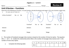
Unit 8 Review: Functions
Let's finish a functional review. Pupils work through 31 items to review the concepts learned in Unit 8. Scholars determine whether a mapping is a function and identify the domain and range. Using function notation, individuals then...
Curated OER
An Introduction to the Night Sky and Movement Astronomy
Basically, this is an interactive exploration of educational astronomy software and an app. Young astronomers discover how the apparent motion of the sky relates to Earth's movements and the position of the observer. It is out of this...
Alabama Department of Archives and History
From Alabama Farmer to Civil War Soldier
As part of a study of the Civil War, class members conduct a WebQuest to create a timeline of battles fought by the 10th Alabama Infantry Regimen. They then use Google Earth to pinpoint these battles of the Civil War on a map of Alabama.
Montana State University
Meet Mount Everest
Learning about one landform might seem boring to some, but using the resource provided practically guarantees scholar interest. The second in a sequential series of eight covering the topic of Mount Everest includes activities such as a...
Annenberg Foundation
America's History in the Making: Using Digital Technologies
How can digital technology of today link us to the events of the past? Scholars use technology to uncover the vast number of historical resources available in lesson 12 of a 22-part America's History in the Making series. Using databases...
New York Historical Society
The Vietnam War: 1945-1975
Do pupils know that the Vietnam War spanned a period of 30 years? A war that long is bound to leave devastating effects. Help young historians develop a comprehensive understanding of the war through multiple units on the subject that...
Curated OER
Geotagging in school
Students create a digital photo map of the world. In this digital photo map lesson plan, students pick topics such as the Olympics, natural disasters, or trip planning and create a photo map on the computer.
Other popular searches
- Scale Factor Google Maps
- Geography Google Maps
- Venn Diagram Google Maps
- Google Maps Science
- Google Maps 13 Colonies


