Curated OER
Introduction to the United States Map
Students identify a map of the United States. In this United States map instructional activity, students study a map of the United States and find various locations on the map. Students then locate and list the state that touches their...
Curated OER
Geography of the United States
Students examine the population growth of the United States. In this Geography lesson, students construct a map of the fifty states. Students create a graph of the population of the USA.
Curated OER
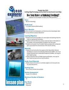
Do You Have a Sinking Feeling?
Students explore how marine archaeologists use data to draw inferences about shipwrecks. For this marine archeology lesson students plot the position of a vessel, draw inferences about a shipwreck and explain the possible...
Curated OER
Water Wars
In this water learning exercise, students match 5 water uses to their definitions, they unscramble 3 terms related to water supply to complete sentences and they answer 2 questions about water diversion.
Curated OER
Summertime Travel
Third graders write about a summer event they participated in. In this paragraph writing lesson, the teacher models how to write about a place they have visited. Students then write their own paragraphs. Students will point out on...
Curated OER
Biome Map
In this biomes learning exercise, students color the map of North America according to the biome clues. Students then answer questions about the North American biomes.
Curated OER
Reading Comprehension: Ohio
In this reading comprehension worksheet, students read a 2-page article regarding Ohio and respond to 10 true or false questions regarding the selection about the state.
Curated OER
Cities as Transportation Centers
Students work in small groups to identify some of the major transportation centers, recommending two as possible sites for a national political convention, based on population density and the travel networks available in 1835.
Michigan Sea Grant
Water Quality
Learners observe water samples and measure the samples' water quality. Students develop their own criteria for measuring water quality and test for temperature, acidity, oxygen levels, turbidity, conductance, sediment and hardness.
Curated OER
Indiana
For this Indiana worksheet, students read a two page text about the history of the state of Indiana. Students answer 10 true and false questions.
Curated OER
Map Keys
Third graders examine maps and map keys. In this locating map features instructional activity, 3rd graders use crayons, markers and colored pencils to label maps. Students work in partners to read map keys and locate given places and...
Curated OER
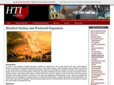
Manifest Destiny and Westward Expansion
Students discover how manifest destiny and westward expansion are related. Using the Internet, they research the beginnings of the movement of manifest destiny and how it influenced people moving westward. They discuss the expectations...
Curated OER
Native Lands: Indian in Georgia
Learners bring in vegetables that the Native Americans ate. In this vegetable lesson, students create a graph that shows how many learners brought in each vegetable. They measure their vegetable to find the length, circumference, and...
Curated OER
Fourth Grade Social Studies Quiz
In this social studies worksheet, 4th graders complete multiple choice questions about the colonies, The Boston Tea Party, Native Americans, and more. Students complete 15 questions.
Curated OER
Doing Our Share Lesson 1: Michigan History of Philanthropy
Students research the history of philanthropy in Michigan by looking at images and pictures while discussing the definition of philanthropy. They design a picture of the first time they saw a philanthropic act and write three sentences...
Curated OER
Traveling Through North America
Students identify places and landmarks in North America, specifically Canada and the United States, by using and constructing maps. Six lessons on one page; includes test.
Curated OER
Learning from Maps and Timelines Time Travel
Students create timelines depicting the important events in the lives of the groups that arrived at the Fort St. Louis. They include the fate of La Salle and the colonists.
Curated OER
Exploring National Marine Sanctuaries
Students conduct Internet research of the living organisms in national marine sanctuaries, and the resources protected in the sanctuaries. Students gather information about each of the sanctuaries and make an oral presentation and poster...
Curated OER
The Salt Water Connection
Students explore the hydrological cycle and oceans. They determine the factors that influence the Pacific Ocean. Students research an organism found in Monterey Bay. They describe the organism's biome and ecological factors that...
Curated OER
American States And Their Nicknames
In this social studies worksheet, students match the American states with their nicknames. There are no examples and no hints given on the page.
Curated OER
Crossword
In this crossword worksheet, learners, after studying about bugs, birds and ducks, complete a crossword puzzle involving twelve key clues.
Curated OER
Mystery State #51
In this mystery state worksheet, students answer five clues to identify the state in question. They then locate that state on a map.
Curated OER
Pennsylvania: Crossword Puzzle
In this United States history worksheet, students use the 15 clues in order to fill in the crossword puzzle with the appropriate answers pertaining to Pennsylvania.
Curated OER
Ohio: Crossword Puzzle
In this United States history learning exercise, learners use the 14 clues in order to fill in the crossword puzzle with the appropriate answers pertaining to Ohio
Other popular searches
- Great Lakes Worksheet
- Great Lakes Biodiversity
- Great Lakes Map
- Label the Great Lakes
- Maps of Great Lakes
- The Great Lakes
- Michigan's Great Lakes
- Five Great Lakes
- Great Lakes Region
- Great Lakes Lesson Plans
- Traveling the Great Lakes
- Activities the Great Lakes


