Curated OER
Iced In
Introduce junior oceanographers to ice conditions in The Great Lakes. The ice map links are no longer available, so you will not be able to have your class perform the mentioned data activity. You can, however, access the Canadian Ice...
Curated OER
Ancient Hunters of the Great Lakes
Students describe theories on how the first humans came to America and show the evidence that supports it. In this investigative lesson students study given material and prepare written or oral reports in their groups.
Curated OER
The Mighty Great Lakes and St. Lawrence Seaway System
Students participate in a variety of activities in a unit about the Great Lakes/St. Lawrence Seaway System. They create a diorama, read related stories, and correspond with other classes located in other port cities along the St Lawrence...
Curated OER
Commodore Oliver Hazard Perry
For this Commodore Oliver Hazard Perry worksheet, students read a 3 page article and then answer 10 statements as true or false.
Curated OER
Exploring Great Salt Lake Ecosystem
Fourth graders determine the Great Salt Lake is a unique, thriving, and diverse ecosystem. They engage in an actual or a virtual field trip. They record field trip, whether actual or virtual, in science lab book or journal and...
Oklahoma State Department of Education
Narrative Prompt
Reading about history is nothing like experiencing it firsthand. Encourage your eighth graders to do the next best thing with a historical narrative prompt, in which they describe the experience of a first-time traveler on the...
Curated OER
Students Slide to School on Air-Powered Sled
Students locate the Great Lakes on a US map, then read a news article about a sled being used as a wintertime school bus in Wisconsin. In this current events lesson, the teacher introduces the article with a map and vocabulary activity,...
Curated OER
Exploring The Great Salt Lake
Second graders experiment with sand samples taken from a lake. They use this as part of an inquiry that is based on observations. The properties of the sand are observed in the lab and recorded in writing. Prior to the lab students...
Curated OER
Travel by Train: South American DVD Assignment
In this geography skills learning exercise, students watch the National Geographic video "Travel by Train." Students then respond to 18 short answer questions about content in the video about South America.
Curated OER
The Great Water Hunt
Students examine a globe to locate the bodies of water present and create a representation of those bodies of water for further exploration of the concept. Extensions of their observations are made at school, home, and the community.
Syracuse University
Erie Canal
While canals are not the way to travel today, in the first half of the nineteenth century, they were sometimes the best way to move goods and people. Scholars examine primary sources, including maps and pictures, to investigate the role...
Curated OER
Lesson Plan on the Edmund Fitzgerald
Fourth graders describe the weather conditions and location of the Edmund Fitzgerald when it sank in Lake Superior.
California Historical Society
Understanding California
Here is a beautiful handout through which learners can explore the history of California, from the earliest Europeans to visit the Golden State up through its experiences during the Great Depression and position in the modern...
Curated OER
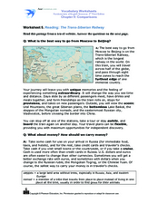
Reading: The Trans-Siberian Railway
In this reading for information worksheet, students read a passage about traveling from Moscow to Beijing on the Trans-Siberian Railway. Students answer 8 multiple choice questions.
Curated OER
Summertime Travel
Third graders write about a summer event they participated in. In this paragraph writing lesson, the teacher models how to write about a place they have visited. Students then write their own paragraphs. Students will point out on...
Curated OER
Traveling Through North America
Students identify places and landmarks in North America, specifically Canada and the United States, by using and constructing maps. Six lessons on one page; includes test.
Curated OER
Learning from Maps and Timelines Time Travel
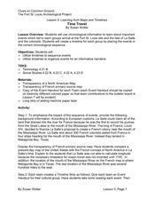
Students create timelines depicting the important events in the lives of the groups that arrived at the Fort St. Louis. They include the fate of La Salle and the colonists.
Scholastic
Perfect Postcards: Illinois
Connect the geography and history of Illinois using an art-centered lesson on the railroads. The railroad connected once-distant places, particularly in the Midwest. Using research, class members create postcards of fictional cross-state...
Curated OER
Waterdrops Water Cycle
In this earth science worksheet, students read an article about the water cycle. Then they continue the story about the travels of a water droplet through time and space. Students also complete sentences by writing in the correct word...
Calvin Crest Outdoor School
Survival
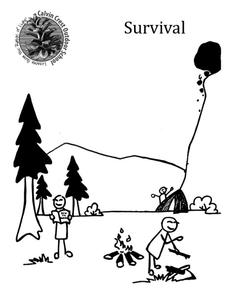
Equip young campers with important survival knowledge with a set of engaging lessons. Teammates work together to complete three outdoor activities, which include building a shelter, starting a campfire, and finding directions in the...
State University of New York
Going Back in Time Using “George Washington’s Socks”
After reading Elvira Woodruff's George Washington's Socks, young readers and writers embark upon writing their own historically based story, with a focus on developing ideas and details throughout the piece. In small groups, class...
Michigan Sea Grant
Exploring Watersheds
Collaboratively, students partake in a hands-on activity in which they build models of a watershed. Each group member draws an elevation map—a bird's eye view—of their model and predicts how water will flow from the high to low points....
Curated OER
Cities as Transportation Centers
Students work in small groups to identify some of the major transportation centers, recommending two as possible sites for a national political convention, based on population density and the travel networks available in 1835.
Curated OER
Richard Misrach
Students analyze the Great Salt Lake as a resource for artistic work and other studies. In this art analysis instructional activity, students view maps that show the location of the Great Salt Lake including a satellite image. Students...


