Curated OER
Geography: How do Louisiana Rice Farmers Help the Environment after they Harvest Rice?
Third graders study maps of the United States locating Louisiana, the East Coastal Plain, the Mississippi Alluvial Plain, the West Gulf Coastal Plain, and five of the main rivers. In this geography lesson, 3rd graders create a...
Curated OER
Landforms
In this landform review worksheet, students use 17 provided terms to complete a paragraph about different landforms. After filling in the blanks, they name 4 kinds of mountains and provide examples of each.
Curated OER
Aldridge Sawmill -- The Story in Numbers
Seventh graders view a recent transparency of the average rainfall zones of the state of Texas. Using another transparency, they identify the Piney Woods subregion of the Gulf Coastal Plain and locate national forests and sawmills. ...
Curated OER
Bromine: An Important Arkansas Industry
Arkansas ranks first in the entire world in the production of bromine! Here is a lesson which guides middle schoolers through a study about the formation and history of Arkansas' bromine reserves. They also looks at the many uses of...
Curated OER
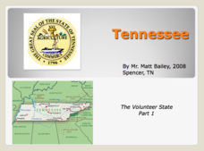
Tennessee: The Volunteer State Part 1
Explore the state of Tennessee, PowerPoint style! Regions, geographical features, and some amazing state facts are yours for the asking. Major cities are named and followed by related facts. This neat presentation on an interesting state...
Curated OER
Salt of the Earth: A Caddo Industry in Arkansas
Middle schoolers explore the history of the Caddo Salt Industry found in Arkansas. Along with learning about how salt deposits formed in Arkansas, learners study the process of salt production and how valuable salt is as a natural...
Curated OER
Landforms: Geomorphology of Arkansas
Second graders create large, salt dough maps of Arkansas and the natural regions in the state created by geographical and morphological features.
Curated OER
State of Alabama
In this reading passages about the state of Alabama learning exercise, students read about the state's geography, history, exploration, industry, and people and use the information to answer multiple choice and true and false questions....
Curated OER
Geographic Regions of Arkansas
Students examine maps that illustrate the various regions in Arkansas. They label the individual regions on a blank map that is divided into the regions and color each region a different color. Groups research a region and create a...
Curated OER
What's a Swamp Good For?
Students identify the function and value of wetlands. For this lesson on appreciating wetlands, students explain how different household items can represent different aspects of the wetlands.
Curated OER
Landforms and Resources of the United States and Canada
In this North American geography worksheet, students read about the physical features and resources of the United States and Canada. Students take notes and answer 3 short answer comprehension questions as they read the selection.
K12 Reader
Eastern Woodland Natives
Supplement your social studies instruction with a reading passage about the Eastern Woodlands. After reading the passage, learners respond to five related questions.
Curated OER
"Professional" Settlement of Arkansas
Eighth graders examine the physical geography of Arkansas played and instrumental role in the settlement of the state.
Curated OER
Arkansas Regions As They Relate To Slave Population
Fifth graders evaluate how the characteristics of Arkansas' regions affect the slave population.
Curated OER
Arkansas- Economic System
Students investigate how the six natural regions of Arkansas work together to form the economic system of the state. They read a paragraph and articles about the state and complete an activity that demonstrates interdependence. They...
Curated OER
America the Beautiful
Students analyze the physical geography of the United States and how we have adapted to or altered the land to create the country we know today. Students complete maps with physical features, states and cities of interest.
Curated OER
Geography of the United States
Students examine the population growth of the United States. In this Geography lesson, students construct a map of the fifty states. Students create a graph of the population of the USA.
Curated OER
Digging Deeper in Mission San Saba
Seventh graders explain Spanish motives for establishing Mission San Sab?? and the reasons for the mission's failure. This lesson should be used when students already have an understanding of the Spanish mission-presidio system in Texas.
Curated OER
Ecoregions of Texas
Seventh graders discuss why hunter-gatherers might have favored certain areas in which to live. In pairs, they research specific regions to examine in depth. Students present their eco-region vegetation findings (in this case Central...
Curated OER
Florida: U.S. Geography for Kids
In this Florida geography worksheet, students locate and label the important features of Florida and create icons for the economy and culture of Florida.
Curated OER
Aquaculture Science
Students research the different careers in aquaculture. In this aquaculture lesson students complete activities that include a PowerPoint presentation.
Curated OER
Fourth Grade Social Studies Quiz
In this social studies worksheet, 4th graders complete multiple choice questions about the colonies, The Boston Tea Party, Native Americans, and more. Students complete 15 questions.
Curated OER
Wetlands/Watershed Model
Students make a model that will demonstrate the flow of surface water across the land in Texas and how materials that originate many miles away can end up in the wetland along the coast.
Curated OER
Wetlands/Watershed Model
Students work together to create a watershed model. They discover the flow of surface water on different topography. They examine how materials originate from miles away and end up in a different wetland.


