Curated OER
Navajo Code Talkers
Pupils investigate the Navajo Code Talkers and their role in World War II. They complete a Webquest, explore various websites, encode a short message, analyze maps, answer discussion questions, and read newspaper articles about secure...
Curated OER
Council Grove: Site of the Hellgate Treaty
Students explore Native Americans and the migration of non native people to Montana. They investigate and interpret maps for information such as location of Indian reservations, transportation routes and important communities.
Curated OER
Family Heritage
Middle schoolers research their family heritage by interviewing family members. Using their responses, they record them in an organized fashion and develop a presentation. Using the Internet, they locate an artistic representation of...
Curated OER
American Civil War
Eighth graders read a collection of stories about the Civil War. Based upon their readings, they perform various activities to reinforce facts about the Civil War. Students create time lines, maps and reports about the war. They...
Curated OER
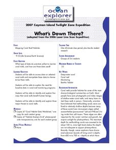
What's Down There?
Students analyze data on coral reefs and use this to help characterize reefs. In this mapping coral reefs lesson students identify and explain the major threats to coral reefs.
Curated OER
Ten Crucial Days-How to Win a War You Should Lose
Students research the victories of Washington at Trenton and Princeton. In this Revolutionary War lesson plan, students investigate and discuss the factors of Washington's victories and use maps to identify the strategy Washington used....
Curated OER
Discovering the Journal of Augustus Pelletier
Students explore journals. In this Discovering the Journal of Augustus Pelletier lesson, students read the historical fiction book and conduct research activities to validate events in the plot that reflect the Lewis and Clark...
Curated OER
The Trading Post with the Most: Colonial Dorchester's Settlement and Economy
Eighth graders explore the Dorchester settlement, In this American colonial history lesson, 8th graders examine primary resources and maps from the Dorchester trading post in order to learn about its contributions to the Revolutionary War.
Curated OER
NYC From A to Z
Second graders create an ABC book about New York City. In this ABC book lesson, 2nd graders find places of interest in New York City from A-Z. Students will research their place of interest. Students create maps and write an address...
Curated OER
Shipwreck Mystery
Students study web pages on a shipwreck then locate where this took place on a map. In this marine archaeologist lesson students examine what clues archaeologists use to find the location of a shipwreck and what they might find.
Curated OER
Civil War and Reconstruction
Fourth graders investigate the Civil War by researching the state of Virginia. In this US History lesson, 4th graders identify Abraham Lincoln, James Chestnut and Fort Sumter, and discuss their roles in the start of the Civil War. ...
Curated OER
Lesson 1 Walk Through and Notes
Fourth graders take notes on a class discussion. In this economy instructional activity students discuss Indiana's economy over a span of history. The students use a map and a timeline.
Curated OER
Through Time: Change in Sedona
Learners locate events on a timeline of Sedona, Arizona and describe human and physical characteristics of the city. In this Sedona lesson plan, students locate the city on a map and listen to stories about Sedona.
Curated OER
English Lesson for Grade 11
Eleventh graders role play a scenario where they have to make a decision. In this english lesson, 11th graders interpret graphs. They research about the life of different historical figures.
Eastconn
Learning to Analyze Political Cartoons with Lincoln as a Case Study
Discover the five main elements political cartoonists use—symbolism, captioning and labels, analogy, irony, and exaggeration—to convey their point of view.
Curated OER
Causes of the Civil War: Missouri Compromise, Compromise of 1850 and Kansas Nebraska Act
How did the Missouri Compromise, the Compromise of 1850, and the Kansas-Nebraska Act contribute to the growing tensions that led to the Civil war? To better understand the events that led to the Civil War, young historians engage in a...
Curated OER
Where in the World
Students explore the global grid system. In this globe lesson, students identify latitude and longitude lines and how these can tell the coordinates of any place. They use the Internet to find the exact coordinates for their town.
Stanford University
Korean War
Learners study the cause of the Korean War. In this World history lesson, Students read excerpts from two different textbooks, one from South Korea, and one from North Korea. They discuss how the cause of the war differs depending on the...
Curated OER
Climographs
Students identify trends and characteristics of climate zones and specific places within. Then, they graph annual climate trends (primarily Temperature and Precipitation) and create, interpret and extrapolate information based on...
Curated OER
Remember the Bridge: Poems of a People
Fifth graders explore poems of African Americans. They research a famous African American, write a report, create a timeline of events in African American history, create a map of the New World, and research Molly Walsh. After...
Beverly Hills High School
Congress of Vienna 1815
Europe was changing in the early nineteenth century, and the Congress of Vienna largely sought to slow and contain those sweeping changes. A slideshow presentation illustrates the details of the Congress of Vienna, including its three...
Curated OER
A Natural Connection to the Azores
Students use primary sources to examine whaling voyages, biology, and geography. In this geography lesson, students analyze ship logs and plot locations of animals and determine routes using latitude and longitude.
Curated OER
War in the News
Learners consider the portrayal of war in the news. In this lesson plan on Journalistic perspectives, students will work in groups to critically examine news articles written during war times throughout history.
Curated OER
Creating Your Own Rock Art
Eighth graders look at early art. In this visual arts lesson, 8th graders investigate the attributes of rock art, examine rock art, and create their own examples of rock art. Analysis and instructional worksheets are included.
Other popular searches
- Historical Maps Explorers
- Historical Maps Wwi
- Historical Maps Trade Routes
- Historical Maps Rome
- Historical Maps Mesopotamia
- Historical Maps Pirate
- Comparing Historical Maps
- Carthage Historical Maps
- Historical Maps Imperialism
- Historical Maps Inauguration
- Historical Maps Ussr
- Historical Maps" Ptolemy


