Curated OER
Connecting Cartography to Society
Older high schoolers use maps to study changes in society like migration, population loss, and economic shifts, and then connect events from historical events to present day mapping of their region (The resource focuses on Canada, but...
Curated OER
Local History: Mapping My Spot
Students explore maps to discover historical information about their local area. In this mapping and history lesson, students use panoramic maps of their own town/city to interpret historical information. Students also place themselves...
Curated OER
Mapping Perceptions
Students create and read maps. For this map skills lesson, students draw a map of their neighborhood, then use skills acquired during map-making to interpret a classmates map and a map of the Ming Dynasty.
Teach Engineering
What is GIS?
Is GIS the real manifestation of Harry Potter's Marauders Map? Introduce your class to the history of geographic information systems (GIS), the technology that allows for easy use of spatial information, with a resource that teaches...
Curated OER
Life in Old Babylonia: The Importance of Trade
Students read maps and artifacts for information indicating the existence of a trade network in Old Babylonia and beyond. They list goods imported to and exported from Babylonia. They indicate trading centers on a map of ancient...
Curated OER
Survey This!
Students examine biological information about George Washington focusing on his love of surveying. They explore cartography and field of surveying. They write a letter and make a map of Virginia.
Curated OER
Be A Cartographer
In this be a cartographer worksheet, students read about the history of cartography, make a map of a familiar place, share it with a friend and answer 2 questions about their friend's map.
Curated OER
Geography and World History
Students build off of their current knowledge of geography and world history, while being introduced to new concepts and ideas.
Curated OER
In Celebration of the Silk Road
Sixth graders explore the ancient trade routes of the Silk Road with a focus on a province in China to identify artifacts and research how these items arrived in the city of Turpan.
Aurora Trust
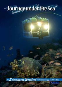
Journey Under the Sea
Discover the interesting world of maritime archaeology and explorations under the sea with this nice set of worksheets, which cover such topics as search tools and techniques of underwater archaeology, carbon dating, vessel types, and...
Curated OER
Tools of the Explorers
Fifth graders examine the history of the European exploration of the New World. They research and create replicas of many of the tools used by the explorers including a compass, quadrant, hourglass, log and map.
Curated OER
Create a Community Tree Tour
Students study tree identification. In this tree identification instructional activity, students design and assemble a tree tour booklet describing 5 trees found in their community. The booklet should feature common and Latin names of...
Curated OER
Mapping the Past
Students study historical maps to view how the world evolved from medieval times through the Renaissance. They work in groups to examine the maps and present a report on one of the listed maps.
Curated OER
"Trails, Rails, and Roads" Lesson 2: Road Tripping
Students practice map skills and take a virtual road trip through Maine examining the history of transportation. They create questions from the information they learned and play a game against other groups.
Curated OER
Fantasy / Art Maps
Ninth graders analyze a fantasy art map by Jeremy Anderson, paying careful attention to the way the topographic features of the land are represented. They create a similar map of Sacramento that includes topographical features as well as...
Curated OER
Columbian Contexts
Students explore geo-political and economic contexts for the European Renaissance journeys of exploration, including those of Columbus, create cartographic symbols, and add those symbols to a print-out of Ptolemy's map.
Curated OER
Map Reading in the 21st Century
Learners interact with MapPoint tools to view maps of the past and the present in multiple ways. They participate in mini-lessons aimed at locating certain points of interest or famous routes taken in history.
Curated OER
Silk Roads Big Map
Students create an oversized map from Europe to East Asia. They include information such as Silk Roads, geographical features, major cities and cultural information on their map.
Curated OER
the Bronze Bow By Elizabeth George Speare
Sixth graders learn about how Rome occupied ancient Palestine around 35 BC to 35 AD through cartography mathematics, creative writing and art.
Curated OER
What Can a Map Tell You?
Students investigate how maps can provide useful information about health issues. They study a map to draw conclusions about cholera death in London.
Annenberg Foundation
Reading Maps
Can you read a map? Scholars use an interactive technology tool to analyze maps of various kinds to gather evidence and data to better understand their meanings and usefulness. Using newly obtained knowledge, they form an interpretation...
Curated OER
Where Am I: How to Read a Map
Third graders develop an understanding of maps. They explore what a map is, who uses maps, and how to use maps. Students investigate the compas rose. They create a compose rose which illustrates the cardinal directions. Students practice...
Curated OER
Interview with Meriwether Lewis
Pupils ask questions and prepare responses to Meriwether Lewis and his expedition. In this journal instructional activity students present their questions to the class.


