International Technology Education Association
Reinventing Time
Take a trip through time. A lesson resource provides instruction on the origin of current measurements for time. The text explains the different tools humans used throughout history to measure time as well as provides examples such as...
Curated OER
Time Zones
Students solve time zone problems and chart travel around the world. In this time zone lesson, students learn about the history of time zones and view a time zone map. Students use the time zone map to solve time zone problems. ...
Curated OER
Time Zones
For this time zones worksheet, students are given a map of the Earth indicating the time zones, the prime meridian and the international date line. Students answer 5 questions about solar occurrences and determine when each would be seen...
Education World
Every Day Edit - Time Zones
Make half the number of copies you need, and cut this document in two! Here's a great daily activity to hone the editing skills of your learners. For this short assignment, they learn about time zones and how they were established.
Curated OER
Time Zones
Students are able to read and also use a variety of timetables and charts. They perform calculations with time, including 24-hour clock times and time zones. These are very important concepts that Students probably have to bear in mind...
Curated OER
Understanding Time Zones
Pupils investigate the times zones around the world. They discuss situations when it is important to know the time in different parts of the world and how to find it.
Curated OER
Time Zone Problems
For this time zones worksheet, students use a formula along with information found on Google Earth to calculate time zones around the world. Students complete 12 word problems.
Teacher's Corner
Hey Batter, Wake Up!
Does jet lag affect a baseball team's performance in games? Read about how a baseball team's chance of winning a game can be affected by traveling over one, two, and three time zones. Readers then respond to five short answer questions...
Curated OER
Understanding Latitude, Longitude, and Time Zones
Students take an imaginary world tour by locating cities with latitude and longitude. They plan an itinerary and calculate the time zones from which they would call home. Then they construct word problems involving travel across time zones.
Curated OER
How to Work With Time Zones
Learners solve time zone problems. In this time zone lesson, students view a time zone map and learn about the 24 time zones. Learners are given a worksheet where they compute the time in different areas.
Curated OER
Time Zones and Migration Patterns of the Leatherback Sea Turtle
Learners identify the different time zones by plotting the migration patterns of the leatherback sea turtles. They discover that traveling around the worlds includes passage through different time zones.
Curated OER
Time Zones in the United States
Eighth graders explore how to use the time zones in the United States and internationally. They use elapsed time to solve problems. Students calculate the time in various places in the United States. They discuss the 6 time zones in the...
Curated OER
Costco and Zoning
Students research zoning laws in the community. They interview city planners to find out necessary steps for approval. Students collect information about facilities being proposed. They write an article on their findings.
Curated OER
It's About Time!
Students examine the potentials, both positive and negative, of adapting an international 'Internet time' system. They create and solve word problems that require them to translate between the current time system and Internet time.
Curated OER
Viewpoints
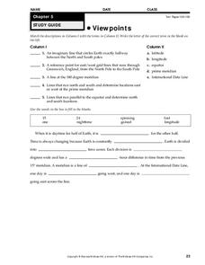
In this latitude and longitude worksheet, learners complete 10 matching questions identifying key features or locations on a map. Students also use lines of latitude and longitude to identify the time in 4 different places.
Curated OER
Math with Maps and Globes
Students round out their math skills with these ‘round the world' ideas. In this math and geography lesson, students try out time zone sticks, a polar race, and tic-tac-globe to engage them in learning more about globes and the...
Curated OER
Canada's Geographic Position
Ninth graders investigate the characteristics of the geographic position of Quebec and Canada in the World. They study Canada's land and water boundaries, surface area and time zones.
Curated OER
La Belle Époque [1871-1914]:
Progress through various aspects of the "The Beautiful Era" in this presentation. Political, technological, and scientific contexts surround the time of innovation and change in the world landscape. The short length of this slide show...
Curated OER
The Deadly Van Allen Belts?
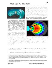
In this Van Allen Belts worksheet, students read about the deadly affects of the high energy particle clouds located around the Earth. Students answer 4 questions about the dosages of radiation astronauts receive in the zones of the Van...
Curated OER
Viewpoints
In this map worksheet, students review latitude, longitude, equator, and prime meridian. This worksheet has 5 matching and 8 fill in the blank questions.
Curated OER
"Lista Negra-The Black Lists"
Students review the history and political motivation behind the U.S. adoption of the Monroe Doctrine and how national security measures collide with the issues of due process and human rights during times of war. They learn about how the...
Curated OER
Do Suspected Enemies Have Rights?
Students investigate the history of Japanese immigration. They complete an online Webquest, explore various websites, answer discussion questions, and locate and read newspaper articles about enemy compatants.
Curated OER
Tools of the Trade: The Use of Geographic Tools
Students examine the tools of demographic analysis and apply them to real-world situations. They analyze maps, define terminology, and write an information paper for the appropriate government agency to recommend an action or policy change.
Curated OER
Geomnemonics: Facilitating the Teaching of Social Studies Content with Geography Skills
Students explore how to draw a world map by hand and how to locate countries.




![La Belle Époque [1871-1914]: PPT La Belle Époque [1871-1914]: PPT](http://content.lessonplanet.com/resources/thumbnails/292406/large/cgrmlwnvbnzlcnqymdeymtewoc0zmdqxni1ncdjpenquanbn.jpg?1414487063)
