Curated OER
Isthmus of Panama
In this coloring geography instructional activity, students identify the Isthmus of Panama and color the landmark. Students write a definition for the area.
Missouri University of science & Technology
General Overview History of the Panama Canal
Called the Eight Wonder of the World by some and the Big Ditch by others, the Panama Canal is indeed an engineering marvel. The long, complicated, and sometimes controversial history of the canal is captured in a presentation loaded with...
Curated OER
This Great Enterprise”: Theodore Roosevelt and the Panama Canal
Young scholars explore the implications of the "Great Enterprise." In this Panama Canal lesson, students listen to their instructor present a lecture regarding President Teddy Roosevelt and Panama Canal. Young scholars respond...
Curated OER
Christopher Columbus
Some very good graphics are included in this informative presentation on the life of Christopher Columbus and the voyages he took. Among other things, students discover that Columus missed the chance to be the first European to view the...
Curated OER
A Study of Panama
In this learning exercise on Panama, students read an introduction about Panama, then read about its history, The Panama Canal, the Kuna Indians and the Endangered Species of Panama. After each selection, students answer a set of related...
Curated OER
Gold Fever
In this reading worksheet, students answer 10 multiple-choice questions about the book. For example, "Why did John Sutter ask James Marshall to keep the gold a secret?"
Curated OER
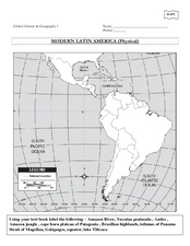
Global History & Geography: Latin America
The instructions say to use a text-book to label 11 different regions in modern Latin America. If a text-book is not available a map can be found on-line and printed for student reference.
Curated OER
Charles R. Savage Lesson Plan Ideas
Students explore works by English photographer Charles R. Savage. In this visual arts instructional activity, students investigate photography by Savage as they discuss the use of perspective, space, color, and texture.
Curated OER
You Want Me To Go Where?
In this social studies activity, students focus upon the five questions related to the subject of explorers and then do a research project as a possible extension activity.
Curated OER
Traveling to the Gold Rush
Fourth graders research the experiences the people who traveled to California during the Gold Rush by land and sea. They create a map showing the various routes that individuals took to get to California. Students explain the...
Country Studies US
Country Studies: Panama the 1903 Treaty and Qualified Independence
A canal between the Atlantic and Pacific Oceans had been the dream of several countires for years. Read about how the United States supported Panama's breakaway from Colombia in order to gain access to the isthmus of Panama, the final...
Other
Panama Canal Authority: El Canal De Panama: Canal History
This site presents a history of the construction of the Panama Canal. Content includes information on the Panama Canal Treaty, the canal's construction, involved government leaders, and the transition of the canal from U.S. hands to...
Digital History
Digital History: How the Us Obtained the Panama Canal [Pdf]
The story behind building a canal through the isthmus of Panama is one of incompetence and corruption on the part of the French, who first attempted the feat. Many of the actions of the United States in acquiring the land through which...
A&E Television
History.com: Why the Construction of the Panama Canal Was So Difficult and Deadly
A staggering 25,000 workers lost their lives. And artificial limb makers clamored for contracts with the canal builders. In a quest to fulfill a centuries-old dream to connect the Atlantic and Pacific Oceans, the builders of the Panama...
Curated OER
Etc: Maps Etc: United States Canal Zone Isthmus of Panama, 1912
A map from 1912 of the United States Canal Zone in Panama. The map shows the location of the canal, the deepened approaches to the canal, and the locks. The map also shows mountain ranges, railroads, projected railroads, post offices,...
CZBrats
Fulfilling Her Destiny, Panama City Becomes Municipal Giant
This page is a excerpt of an old (1969) newspaper article about the early history of Panama - when Spanish explorers first crossed the Isthmus and decided to call it by the name of a fishing village.
CZBrats
Vasco Nunez De Balboa
This page tells of the early history of Panama. "Vasco Nunez de Balboa first settled in Hispanola (present day Dominican Republic and Haiti). To escape his creditors there, Balboa stowed away on a voyage to Panama in 1510. There were, at...
Yale University
Yale University: Hay Bunau Varilla Treaty
Open this page to read the full text of the Hay-Bunau-Varilla Treaty, which gave the U.S. rights to build the Panama Canal.
CZBrats
Goldrush Days
This page is an article entitled "Gold Rush Days On The Isthmus", by Willie K. Friar, from "The Panama Canal Review" (Fall 1971). Read about this significant event in Panamanian history, which falls into the "Independence" years...
Curated OER
Etc: Maps Etc: Isthmus With Completed Panama Canal, 1914
A map from 1914 of the completed canal across the Isthmus of Panama. The map shows the Caribbean Sea entrance at Colon, the route of the canal through Gutan Lake and lock system, the Pacific entrance at the city of Panama, the Canal Zone...
Curated OER
Educational Technology Clearinghouse: Maps Etc: Panama, 1906
A map from 1906 of the Isthmus of Panama showing the railroad from Colon to the city of Panama, the projected route of the canal, the provinces of Panama at the time (Chiriqui, Veraguas, Azuero, and Panama), and the borders with Costa...
Curated OER
Etc: Maps Etc: Routes to the Panama Isthmus, 1913
A map from 1913 of the eastern United States, the Caribbean, and the Panama Isthmus showing the directness of the steamship routes from New York and New Orleans to Colon. Since the Panama Canal did not open to commercial traffic until...
Curated OER
Etc: Maps Etc: The Isthmus With Completed Canal, 1913
A map from 1913 detailing the Panama Canal Zone and completed canal, with an inset map of the entire country of Panama "The dotted lines show the boundary of the territory known as the Canal Zone, a strip ten miles wide, from deep water...
Curated OER
Educational Technology Clearinghouse: Maps Etc: The Isthmus of Tehuantepec, 1852
A map from 1852 of the Isthmus of Tehuantepec in Mexico, showing the proposed railroad route connecting the Gulf of Mexico and the Pacific. This was an alternative proposal to the construction of the Panama or Nicaragua canals, and was...


