Curated OER
Geographic Landforms
Each slide is a simple notebook page with one landform in blue and its definition in red. There are 26 vocabulary terms in all, some you may want to use, and others easily hidden. It is recommended that you add photos or other graphic...
Curated OER
Ozark Karst: A Fragile Landform
Young geologists become familiar with the Karst Topography in the Ozark Mountains. They study how human activity has affected the cave ecosystem. They conduct a simulation in which a large development is proposed in the area, and they...
Curated OER
Marine Energy
In small groups, energy engineers research and make a topographic map of a marine natural resource. They report to the rest of the class pros and cons of extracting their assigned resource. The two activities may take up to four class...
Houghton Mifflin Harcourt
One Land, Many Trails: Challenge Activities (Theme 5)
Bring history to life through literature. The first in a series of three challenge activities designed to accompany Theme 5: One Land, Many Trails does just that through unique projects connected to historical fiction and nonfiction...
Curated OER
Topographic Maps
Your choice of hands-on topographic mapping tasks is provided in this resource. From actual map-making to viewing and interpreting stereographic photos, the activities are sure to succeed. To make the most of this lesson, you will need...
Curated OER
Settlement Survival
Young scholars fill out worksheets about the landforms and developments needed to form settlements like when the colonists settled. In this settlement lesson plan, students learn about how different land formations played a key role in...
Curated OER
Physical Features
Students draw physical land features using ClarisWorks or Kid Pix, write their definitions, create slideshow, and create class geography book.
Curated OER
Landforms - Landform Examples in the Philippines (Matching)
In this landforms worksheet, learners match the landforms to their definitions. Students complete 10 matches on this worksheet and answer true and false and multiple choice questions about landforms in the Philippines.
Curated OER
Geography Terms
In this geography worksheet, students match vocabulary words to their definition. They identify words such as valley, peninsula and others dealing with land formations. Students solve 23 matching problems.
Curated OER
Plate Tectonics
Students examine plate tectonics and landforms. In this plate tectonics lesson plan students complete an activity. Students practice drawing maps that show different fault lines and the land formations that were caused.
K12 Reader
What Glaciers Leave Behind
Glaciers may seem distant and stationary, but they are huge deposits of moving ice that have made changes to the earth's surface. Your pupils can learn about the different types of impressions left by glaciers by reading the short...
Curated OER
Blank Jeopardy
Games are a great way to motivate learners to internalize information.. Using this PowerPoint which is in a Jeopardy format, students can review map skills and facts about the Civil War, famous places, and our government. This is a handy...
Curated OER
Plate Tectonics & Land Forms
Fourth graders discuss the different interactions of plates and the ways mountains are created. In this plate tectonics activity students complete an activity in groups.
NorthEast Ohio Geoscience Education Outreach
Hydrology and Landforms
Three days of erosion exploration await your elementary geologists. Learners begin by examining rivers via Google Earth, then they model water flow in sand, and finally, they identify resulting landforms. This lesson is written...
Curated OER
Who Are the Aliens in Our Inland Seas?
Students work in teams to research specific landforms in Great Lakes Watershed, compile information into data table, and write legend explaining landform for children's book. Students then research area surrounding landform, compile...
Curated OER
Google Earth Landforms
In this lesson, Google Earth Landforms, students research a landform that has been studied in class. Students explore Google Earth and record everything they find about their landform. Students have the opportunity to extend their...
Curated OER
Haiku Wrap Up
Students create a haiku about the land formations they've studied. In this haiku lesson, students identify the metaphor and meaning of a given haiku, brainstorm comparisons for a landform photo as a class and choose one to use in a...
Curated OER
Geological Features: How Weathering & Erosion Help Create Landforms
Young scholars explore how the Earth's surface changes resulting in geological features and landforms. They perform a read-a-loud on Thomas
Locker's Mountain Dance, complete a KWL chart, and create a
landform using plaster of paris.
Curated OER
Land Marked
Students explore proposed plans for land redistribution in Zimbabwe. They research the history of European colonization in Zimbabwe, focusing on the roles and views of various groups within the country. Based on these perspectives, s
Curated OER
Transportation
Engage in an 8-day study of different modes of transportation. Your students explore the concept of location and define the physical characteristics of places, such as, land forms, bodies of water, natural resources, and weather.
K20 Learn
Filling Our Land with Landfills: Solid Waste Disposal
Though it comprises only 5 percent of the world's population, the US generates 40 percent of the world's waste. Scholars learn about landfills, their safety, and other solid waste methods. They use experiments and research to learn more....
Curated OER
Introduction to Canada’s Landform Regions
In this geography skills instructional activity, learners examine a map of Canada and then respond to 4 short answer questions about Canadian landforms.
Curated OER
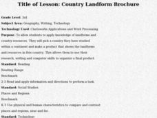
Country Landform Brochure
Third graders create brochures that include landforms, natural resources and pictures of a country that has been researched or studied in class.
EngageNY
Building Background Knowledge: Competing Views Regarding Mining on Inuit Lands
Scholars build background knowledge about mining on Inuit lands. Working in small groups, they sort information about the Inuit onto a point of view chart to determine if mining is beneficial to Inuit communities.


