Curated OER
What is a Watershed, Anyway?
Young scholars constrct a watershed and write about their observations. Students use maps to locate their area in relation to the watershed and inquire about what is applied to the ground above.
Curated OER
Your Neighborhood Geography
Tenth graders use maps and an atlas to observe different climates throughout the world. In groups, they brainstorm what they expect to see in their own neighborhoods and take pictures. They present their pictures to the class and write a...
Curated OER
Learning from Maps and Timelines Time Travel
Students create timelines depicting the important events in the lives of the groups that arrived at the Fort St. Louis. They include the fate of La Salle and the colonists.
Curated OER
Oregon Trail Maps
Fourth graders explore the Oregon Trail. In this Oregon Trail activity, 4th graders collaborate to conduct Internet research regarding states along the Oregon trail route. Students present their findings to their peers.
Curated OER
Mapping your watershed
Students investigate the importance of watersheds around the world. By visiting resource links, students can locate watersheds and their sources in the USA and Russia and analyze their effects on the surrounding topography. This lesson...
Curated OER
The Land of Milk and Honey: Reasons for Migration
Fourth graders analyze migration patterns. In this colonial North Carolina lesson, 4th graders listen to their instructor present a lecture regarding the details of immigrants from Switzerland who settled North Carolina....
Curated OER
Studying Seafloor Spreading on Land
In this seafloor spreading worksheet, students review the processes taking place along the mid-ocean ridges. This worksheet has 3 short answer questions.
Curated OER
Kansas Land
Fourth graders discover the geographic regions of Kansas. In this geography lesson, 4th graders explore the different regions of Kansas and determine how the different geography affects daily life in Kansas.
Curated OER
Mexico: One Land, Many Cultures
Students research and study the country of Mexico and complete a project about it. In this Mexico lesson plan, students research Mexico's geography, traditions, art, songs, stories, and legends that are native to Mexico.
Curated OER
Mapping a Refuge
Students record observations gathered while at a national wildlife refuge. In this lesson on wildlife refuges, students choose an observation spot and record seasonal changes throughout the year.
California Academy of Science
Exploring the Impacts of Feeding the World
Approximately 50 percent of people in the world who are chronically hungry work in agriculture. While it seems counter-intuitive, the farther you live from a farm, the more food options are available. Scholars explore concepts related to...
Curated OER
Shoes and the Backyard Landscape
Your shoes get a lot of mileage in familiar places. Represent the places you have traveled the most with an art project based on a print of Indian People Wear Shoes and Socks by Juane Quick-to-See Smith. Kids trace their shoes and...
Midnight Martian
Moon Globe
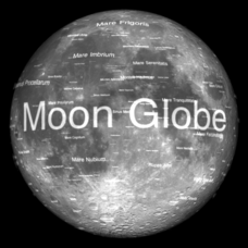
Not just a simple globe of the moon, this interactive version allows you to choose lighting according to the location of the sun, views from different positions on Earth, and more! Satellite images and topographic data have been combined...
Curated OER
Natural Features as a Resource
Students research how people use land and water features to meet their basic needs. For this natural features lesson, students review land and water features. Students discuss how the land is used to meet needs using a landscape picture...
Curated OER
Where are the Watersheds in San Francisco?
Students create a mental map of San Francisco. They compare it with actual topographical maps of the city. Then they label various locations on the San Francisco Hillshade map and locate watershed boundaries.
Curated OER
The Adventure of Echo the Bat
Students compare different habitats based on satellite imagery. They identify land features in the satellite imagery.
Curated OER
From Pirates to Pilots to Spies
Sixth graders enjoy this introduction to the world of map projections, globes, aerial photographs, and satellite images. This lesson instructs students on the advantages and disadvantages of each earthly representation.
Curated OER
Geography: Map Making
Students, working in groups, share notes and maps collected during a study of the Lewis and Clark Expedition. They draw large composite maps of the western United States on butcher paper including land formations, bodies of water, and...
Curated OER
Pacific Atolls and Island Groups
Pupils construct, interpret and translate maps and geographic data. Given a worksheet, students identify an island, an atoll, a scale, and a compass rose. Pupils grid systems, legends, and symbols. They use the map to find answers to...
Curated OER
Find the Way
Fourth graders, after discussing different places to visit and being given a map of Indiana, draw the route to his/her destination within Indiana. They tell the directions in their own words and formulate pertinent questions to ask along...
Curated OER
What Can Be Done to Improve Ha'iku Town Shopping Areas?
Second graders examine different areas to determine how they can be improved. They observe and collect data concerning different problems and use a map to record their information. After analyzing the data, they develop possible...
Curated OER
One Square Meter
Learners examine various ecosystems using scientific inquiry. Using the local area, they assess the characteristics and conditions in one square meter. They report their findings in the form of a survey map and data sheet. They...
Curated OER
Pilgrims/Voyage to America
Second graders are read the story "Tattered Sails". Using the text, they discover the reasons why the Pilgrims came to America. They identify the hardships they faced on the voyage and once they settled on land. Using a map, they locate...
Curated OER
Understanding Watersheds
Students should learn how their actions on land can affect the water quality of lakes and rivers.


