Curated OER
What's Dancing in the Water?
Students learn about watershed, as well as the different forms and uses of water. In this water forms lesson, students brainstorm water sources and uses. Students read the book Water Dance and discuss water examples. Students complete a...
Curated OER
Landforms - Landform Types (Matching)
For this landforms worksheet, learners match land forms with their definitions. Students complete 11 matches total on this worksheet.
Curated OER
Landforms - Landform Examples in the Philippines (Matching)
In this landforms worksheet, students match the landforms to their definitions. Students complete 10 matches on this worksheet and answer true and false and multiple choice questions about landforms in the Philippines.
K12 Reader
United States Geography
Encourage reading for information with a text about United States geography. Kids read a short passage about the landforms in the United States, including mountain ranges and natural resources, and answer five reading comprehension...
Curated OER
Exploring Landforms
Second graders discuss the different types of landforms throughout the world. They pick one and research and present it to the class.
Curated OER
Can You Catch the Water?
Students work together to construct a model of a water catchment basin. They survey water patterns and complete experiments to see where rain travels and collects. They discover how engineers design structures that help with drainage.
Curated OER
Tall as a Mountain, Flat as a Plain
Students examine a variety of landforms that are found on the Earth and compare and contrast the distinguishing qualities of these forms. A topographical model of the landforms is made.
Curated OER
Design an Island
Students explore islands. They create a two- or three-dimensional map of an island. They explain how the topography of an area influences the location of water sources, ecosystems, and human settlements. Lesson includes adaptations for...
Curated OER
Deep Blue: Exploring the Deep Ocean
Students examine landforms. In this social studies lesson, students bounce a beach ball around in order to discover that seventy percent of the Earth is covered in water. Students
Curated OER
Earth System Science
Students explore the Earth and its ability to support life. They discuss the geosphere and the water cycle and complete the Water Wonders activity. After completing the activity, they respond in their journals and reflect upon the...
Curated OER
Landforms By Hand: Geography, Map Skills
Students experiment with landform vocabulary by using their own hands and a bar of soap as media.
Curated OER
I Love the Mountains
First graders discuss and define different landforms. They read the book "Our Land", sing a landform song and perform it with motions and then complete a worksheet.
K12 Reader
Natural Resources
What natural resources are available in your area? Your learners can consider this question after reading a brief passage about natural and renewable resources. After reading, class members respond to five questions related to the reading.
Curated OER
Topography of Africa
Students study Africa's diverse landscape and investigate how these features impact the available water supply, food sources, and population distribution of the continent. They compare topographical features and
their affect on each...
Curated OER
War of 1812
Eighth graders locate the major land forms and bodies of water on a map of Louisiana. In groups, they discuss the role of the Mississippi River in the Battle of New Orleans and how land and water affect the outcome of battles. To end...
Curated OER
Chapter 3 Test: The Southeast States
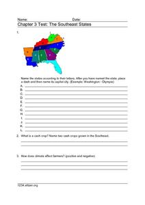
In this geography worksheet, students complete a test about the southeastern United States. They name the states, tell about the climate and crops, complete a matching activity about the landforms. and another about the industry.
Curated OER
U.S. Geography for Children: The Northeast
In this map skills of the northeastern United States worksheet, students observe an outline map, locate and label the states, and designated landforms and bodies of water; and create symbols and a map key for sources of economy and other...
Curated OER
Tall as a Mountain, Flat as a Plain
Students examine pictures of various landforms before placing them on a chart under the appropriate label.They sing songs about landforms to the tune of "She'll Be Comin' 'Round the Mountain." Next, they use non-edible baker's dough to...
Curated OER
Environment: Just Around the Bend
Students decipher landforms on a map and corresponding satellite imagery. They consider the impact of pollution on agriculture and water. They draw diagrams demonstrating how pollution works its way into the food source.
Curated OER
Living in a Watershed
Fourth graders examine watersheds. In this ecosystem lesson, 4th graders discover what a watershed is and identify the local watershed they live in. Students investigate the attributes of a watershed as well.
Curated OER
Science: Draining the Land - the Mississippi River
Students use topographic maps to identify parts of rivers. In addition, they discover gradient and predict changes in the channels caused by variations in water flow. Other activities include sketching a river model with a new channel...
Curated OER
Geographic Context for War
Students explore the geography of Korea. In this Korean War lesson, students examine maps of the country and label landforms, bodies of water, climate, population centers, and neighboring countries to determine the significance of...
Curated OER
"Tri-County" Project--Ground Water
Students explore data on some of the landforms in Nebraska to distinguish between porous and nonpremeable soils. The state's groundwater is investigated.
Curated OER
Wright Brothers Centennial: North Carolina, Creation and Development of the State
Eighth graders examine technological advances and how they influenced the quality of life in North Carolina. Using maps, they locate the city of Kitty Hawk and discuss why it was chosen for the first flight. They read primary source...


