Curated OER
Chart Interpretation
Students study the use of a nautical chart and how to obtain information from it. They describe and differentiate the basic topographic characteristics of a chart and demonstrate the use of nautical tools used to plot fixed points on a...
Curated OER
Geographics in Arkansas
Third graders discuss where Arkansas is located on the United States map. They use geographic tools to participate in activities.
Curated OER
Climate & Atmosphere: A Global & Local Perspective
Students complete a series of activities in which they study atoms, molecules, and the presence of atmosphere. They study the water cycle and the Greenhouse Effect by investigating and completing handouts.
Curated OER
Search for Ice and Snow
Young scholars use satellite images to locate areas of ice and snow on the globe. They create a table showing the information they gathered. They present their information to the class.
Curated OER
Adventures With Maps And Globes
First graders examine the differences between a map and a globe. They discuss and identify the symbols on maps and globes, then in small groups complete a worksheet. Students then complete a Venn Diagram comparing maps and globes.
Curated OER
Vocabulary Review: Completing Sentences
In this vocabulary worksheet, students check the word that will correctly complete a sentence, 7 sentences. Students choose from 4 words.
Curated OER
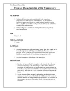
Physical Characteristics of the Troposphere
Students lexplore environmental trends in the troposphere- temperature, dew point, pressure and wind speed- by checking their hypotheses against data collected by weather balloons.
Curated OER
Physical Characteristics of the Troposphere
Students examine troposphere graphs and mcompare their hypotheses with data collected by weather balloons launched from the NOAA ship, Ronald H. Brown. they write summaries about the physical properties of the troposphere.
Curated OER
Mapping Seamounts in the Gulf of Alaska
Students describe major topographic features on the Patton Seamount, and interpret two-dimensional topographic data. They create three-dimensional models of landforms from two-dimensional topographic data.
Curated OER
Naval Warfare in the American Revolution
Students determine speed and bearing, calculate a position by dead reckoning, and modify this position using vectors for wind and current drift.
Curated OER
Correlating Atmospheric Data Lesson Plan
High schoolers make and test hypotheses about atmospheric data collected aboard the NOAA ship Ronald H. Brown research cruise.
Curated OER
Roller Coaster Mania
Fifth graders extend their knowledge of developing maps. They work in cooperative groups to develop an amusement park display and a brochure.
Curated OER
Learning About the Shape of the Earth
Seventh graders investigate ways of telling the shape of the Earth and its position in the Universe both historically and today.
Curated OER
Relative Humidity of Your School
Students predict the location where the relative humidity the highest and lowest in and around their school. They use a sling psychrometer to measure the relative humidity of the various locations.
Curated OER
In The Shadow of Angkor
Students are introduced to basic historic and geographic facts about Cambodia. They understand the spiritual component of Cambodia's art. They identify Cambodia on a map of the world. They construct a graphic representation of a film...
Curated OER
State Your Position
Learners practice using a global positioning system. They discuss the use of celestial objects as navigation points and its problems. They list the advantages and disadvantages of GPS as well.
Curated OER
Identifying Continents and Oceans
Students locate and identify the four major oceans and the seven continents on a world map. They use an unlabeled world map and compass rose to describe relative locations of the continents and oceans.
Curated OER
Chuuk Introduction (Middle School)
Learners pretend they are visiting a relative in the Chuuk nation of Micronesia. Using their knowledge of the 4th of July, they compare and contrast the holiday to the Chuuk's independence day. They create travelogues that outline...
Curated OER
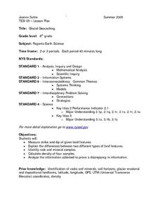
Glacial Geocaching
Eighth graders measure strike and dip of given land features and explain the difference between them. They also look at rock and mineral samples for indentification, along with calculating the density. Finally, information is analyzed...
Curated OER
On the Road Again": Moving People, Products, and Ideas
In this lesson students learn how to identify modes of transportation and communication for moving people, products, and ideas from place to place. Students also study the advantages and disadvantages of different modes of...
Curated OER
Measuring Angles
Third graders describe an amount of turn from a particular position to another using the 'circular' benchmarks of 0, ++, ++, ++, and full turn. Estimation language such as 'just about', 'between', 'not quite', 'just over', and similar...
Curated OER
Tracking the Movement of Sunspots
Students examine how the development of new technology has increased our knowledge of how the sun works. Students study sunspots through the use of solar imaging from satellite instruments.
Curated OER
The Legend of the Indian Paintbrush: Native American Life
Young scholars read," The Legend of the Indian Paintbrush" by Tomie dePaola and discuss the way legends are passed down orally. They then create their own legend and illustrate it on a simulated "Buffalo Skin" made from brown paper.
Curated OER
Journey North
Third graders study butterflies and their migration habits. They track butterfly migration and communicate via e-mail with students in Mexico where the butterflies migrate. They write letters to the students in Mexico, as well.
Other popular searches
- Longitude and Latitude
- Longitude Latitude
- Latitude and Longitude Games
- Latitude and Longitude Maps
- Longitude & Latitude
- Longitude and Latitude Game
- Longitude and Latitude Math
- Geography Latitude Longitude
- Whaling Latitude Longitude
- Longitude Latitude Minutes
- Longitude and Latitude Lines
- Volcano Latitude Longitude


