NSTATE
The Geography of North Dakota
Here you will find a variety of facts about the geography of the state of North Dakota. Find out the geographic center, total area, elevations and much more.
NSTATE
Net State: The Geography of Rhode Island
Here at NetState you will find a variety of facts about the geography of the state of Rhode Island. Find out the geographic center, total area, elevations and much more.
NSTATE
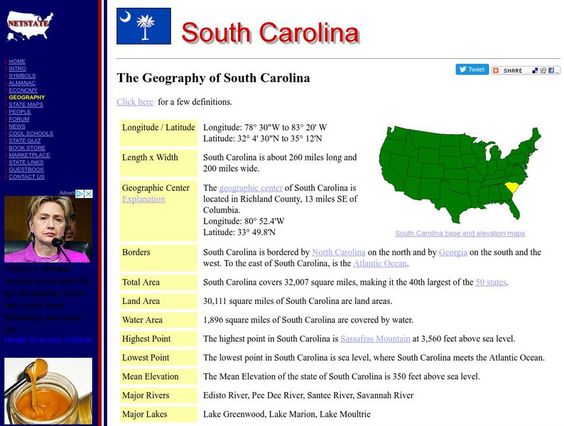
The Geography of South Carolina
Here you will find a variety of cool facts about the geography of the state of South Carolina. Find out the geographic center, total area, elevations and much more.
NSTATE
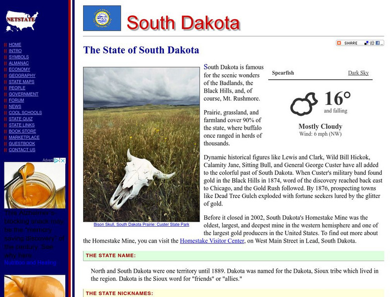
The Geography of South Dakota
Here you will find a variety of facts about the geography of the state of South Dakota. Find out the geographic center, total area, elevations and much more.
NSTATE
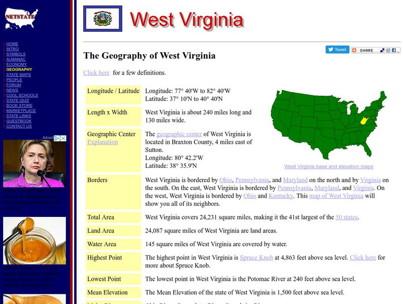
The Geography of West Virginia
Here you will find a variety of cool facts about the geography of the state of West Virginia. Find out the geographic center, total area, elevations and much more.
E-learning for Kids
E Learning for Kids: Math: Dance Performance: Position on a Map
This interactive website allows students to practice their map skills including scale factors on a map.
Houghton Mifflin Harcourt
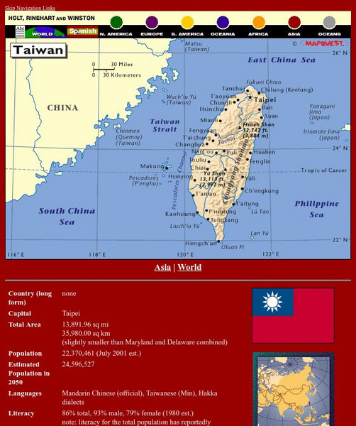
Holt, Rinehart and Winston: World Atlas: Taiwan
Grab quick facts about Taiwan (capital, total area, population, languages, literacy, religions, government, currency, industry, and more) while looking at a map, complete with cities, elevations, bodies of water, longitude, and latitude....
Rice University
Rice University: Cynthia Lanius: Mathematics of Cartography: Coordinate System
A coordinate system such as latitude/longitude is an example of absolute location. Links to Greenwich/Prime Meridian.
Ducksters
Ducksters: Earth Science for Kids: Topography
Kids learn about the Earth science subject of topography including features such as landforms, elevation, latitude, longitude, and topographical maps.
Fourmilab Switzerland
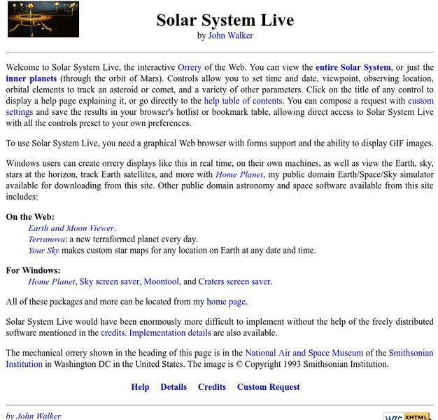
John Walker: Solar System Live
This planetarium program allows you to create an accurate model of the solar system with icons or pictures of each planet. You can specify a date in the past or the future, change the viewpoint to any latitude/longitude, and even view in...
History Teacher
Historyteacher.net: Global Studies: General Geography Concepts Quiz
Quiz yourself on basic geography concepts.
Fourmilab Switzerland
John Walker: View From Satellite
View images of the Earth taken by various satellites that are orbiting the Earth.
ClassFlow
Class Flow: Geographical Skills
[Free Registration/Login Required] In this lesson students understand how physical processes (weathering, erosion, climates, soils, and landforms) shape earth's surface patterns and systems.
National Council of Teachers of Mathematics
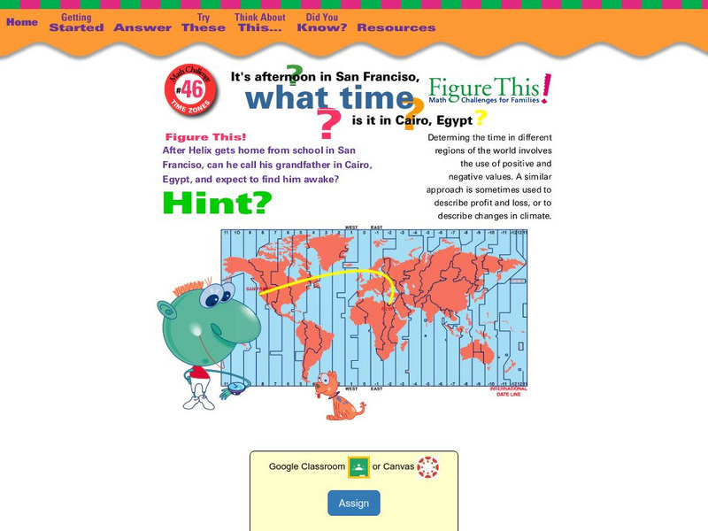
Nctm: Figure This: What Time Is It In?
Can you figure this? If it is afternoon in San Francisco, California, what time is it in Cairo, Egypt? Explore positive and negative number values in this one page activity using time zones from different parts of the world.
Curated OER
Etc: Maps Etc: West Indies and Central America, 1872
A map from 1872 of the West Indies and Central America. The map shows political boundaries at the time, capitals, major cities, and ports, railroads, main steamship routes, rivers, terrain and coastal features, and banks. The map shows...
Curated OER
Educational Technology Clearinghouse: Maps Etc: Nevada, 1903
A map from 1903 of Nevada showing counties and county seats, principal cities and towns, mountain ranges, and rivers. "Nevada, one of the most western of the States of the American Union, was formed from a portion of the territory...
Curated OER
Educational Technology Clearinghouse: Maps Etc: Pre Colonial Africa, 1872
A map of Africa showing the continent prior to the Berlin Conference of 1885, when the most powerful countries in Europe at the time convened to make their territorial claims on Africa and establish their colonial borders at the start of...
Curated OER
Etc: Maps Etc: Physical, Political, and Economic Asia, 1872
A map of Asia from 1872, showing physical features including mountain systems, deserts, lakes, rivers with direction of flow, coastal features, and ocean currents, political boundaries and foreign possessions at the time, and commercial...
Curated OER
Etc: Maps Etc: Europe on a Conic Projection, 1915
A map of Europe on a simple conic projection showing straight meridians or lines of longitude, and concentric circular parallels or lines of latitude.
Curated OER
Educational Technology Clearinghouse: Maps Etc: Mexico, 1872
A map from 1872 of Mexico, showing states and state capitals, major cities, towns, and ports, railroads, lakes and rivers, mountain systems, terrain, and coastal features. Steamship routes to major ports are shown, with distances marked...
Curated OER
Etc: Maps Etc: United States Canal Zone Isthmus of Panama, 1912
A map from 1912 of the United States Canal Zone in Panama. The map shows the location of the canal, the deepened approaches to the canal, and the locks. The map also shows mountain ranges, railroads, projected railroads, post offices,...
Curated OER
Educational Technology Clearinghouse: Maps Etc: British Isles, 1902
A map of the British Isles in 1902, showing Ireland, Scotland, England, and Wales. The map shows cities, towns, and ports, primary and secondary railways, canals, heads of navigation on major rivers, isotherms of averaged annual...
Curated OER
Degree Confluence Project
This project makes it interesting to learn about degree confluence, latitude, longitude, and the geography of the world in general. Volunteers can visit the nearest confluence; or you might want to take a mysterious trip to find one that...
Curated OER
Degree Confluence Project
This project makes it interesting to learn about degree confluence, latitude, longitude, and the geography of the world in general. Volunteers can visit the nearest confluence; or you might want to take a mysterious trip to find one that...
Other popular searches
- Longitude and Latitude
- Longitude Latitude
- Latitude and Longitude Games
- Latitude and Longitude Maps
- Longitude & Latitude
- Longitude and Latitude Game
- Longitude and Latitude Math
- Geography Latitude Longitude
- Whaling Latitude Longitude
- Longitude Latitude Minutes
- Longitude and Latitude Lines
- Volcano Latitude Longitude


