Curated OER
Longitude
In this globe worksheet, students learn how longitude is measured on a globe. Students read the information before answering 5 questions. A globe will be required.
Curated OER
Globe Lesson 6 - Longitude - Grade 6+
In this longitude activity, students read a 3-paragraph review of longitude and respond to 13 short answer questions.
Curated OER
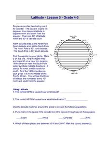
Globe Lesson 5 - Latitude - Grade 6+
In this latitude worksheet, students read a 3-paragraph review of latitude and respond to 12 short answer questions.
Curated OER
Maps: Latitude and Longitude
Pupils visit interactive sites focusing on latitude and longitude. They participate in activities about the prime meridian, time zones, and equator. They view the coordinates of states and cities.
Curated OER
Latitude and Longitude- Online Interactive
In this maps learning exercise, students learn about longitude and latitude by reading a two paragraph text and studying two maps. Students answer 9 fill in the blank questions. This is an online interactive learning exercise.
Curated OER
Terrabagga Activity Using a Magnetometer
Clever! Earth science learners construct a model of a planet containing a magnetic core. The planet, Terrabagga, is made out of a paper grocery bag, magnets, a dead D battery, and rubber bands. Pictures of each step of the construction...
Curated OER
Latitude
Your young geologists generate a graph given a table of values from the context of latitude and percent of the earth's surface north of that latitude. The questions in the activity then focus the learners to a deeper understanding of the...
NOAA
Ocean Exploration
Where am I? The second installment of a 23-part NOAA Enrichment in Marine sciences and Oceanography (NEMO) program starts with pupils guessing the years in which major ocean exploration events took place. The instructional activity then...
Curated OER
Plotting Earthquakes
Students plot earthquakes on a map. In this lesson on earthquakes, students will explore recent earthquake activity in California and Nevada. Students will plot fault lines and earthquake occurrences on a map.
Curated OER
Where Am I?
High schoolers apply map reading skills by locating places through the use of latitude and longitude.
Curated OER
Plotting A Hurricane Using latitude and Longitude
High schoolers explore map and plotting skills by tracing the movement s of hurricanes through the Earth's systems. a hurricane map is developed from daily media reports.
Curated OER
Latitude on World Maps
Sixth graders examine the purposes of maps. In this Geography lesson, 6th graders practice using latitude and longitude on a map.
Curated OER
Globe Skills Lesson 3 Voyage to the New World
Pupils explore the globe. In this globe skills lesson plan, students use their knowledge of latitude and longitude to respond to questions regarding Christopher Columbus's maiden voyage to the Americas.
Curated OER
Follow That Ship!
Students in this exercise are introduced to the distinct ways of measuring distance (nautical miles) and speed (knots) at sea, as well as the concepts of latitude and longitude for establishing location.
Curated OER
Post Roads
Students locate the major cities in the colonies during the Revolutionary War. In this map skills lesson plan, students use a globe to locate cities such as Charleston and Boston using latitude and longitude coordinates.
Curated OER
Civil War Naval Strategy
Learners apply critical thinking skills to war strategy. In this Civil War map activity, students use their knowledge of latitude and longitude as well as scale to respond to questions regarding Civil War battle strategies.
Curated OER
Creating Station Models
Young scholars work in groups to interpret weather maps. They use latitude and longitude readings to complete a worksheet together and turn in the worksheet along with the maps and a rubric.
Curated OER
CLIMATE AND WEATHER UNIT
Students locate on-line weather source, gathers and interprets weather data, work collaboratively on-line with other schools to collect weather data, and write about the cause of temperature inconsistencies in various locations.
Institute for Geophysics
Understanding Maps of Earth
Here is your go-to student resource on primary geography concepts, including facts about the surface of the earth and its hemispheres, latitude and longitude, globes, types of maps, and identifying continents and oceans.
Curated OER
Seasons and Day Time
Learners label a diagram of the Earth rotating about the sun and indicate the direction of the rotation and the seasons at each location. They indicate the seasons, the poles, the hours of daylight at each pole, the direction of rotation...
Radford University
Earthquake Problem
Shake up things in the classroom. The unit uses earthquakes to bring a real-life connection to finding arc lengths, logarithms, and equations of circles. Small groups determine whether particular towns would have felt an earthquake after...
Curated OER
Latitude
In this latitude learning exercise, students answer questions about latitude that include absolute locations of countries and coordinates. Students complete 12 questions.
Curated OER
Map Skills
Do you need to practice map skills? Children with a range of abilities will complete a KWL chart about maps, practice important map vocabulary and then read a few pages from their textbook. They will use their vocabulary words and...
Curated OER
Parallels and Meridians
In this parallels and meridians worksheet, students read about parallels and meridians and answer questions about lines of latitude and longitude. Students complete 8 problems.


