Curated OER
Lesson on GPS
Students investigate global positioning systems. In this technology and mapping lesson, students view a PowerPoint presentation in which they identify the features of a GPS, state its uses, and follow steps to find a waypoint.
Curated OER
Student Exploration: Summer and Winter
In this recognizing the seasons online/interactive worksheet, learners explore the Earth's positions and determine the summer and winter season. Students answer 21 short answer questions
K12 Reader
Eratosthenes: Geographer and Mathematician
Mathematicians can be famous, too! Introduce your class to Eratosthenes with a reading passage. After they complete the passage, learners respond to five questions, some of which require opinions and others reading comprehension skills.
Curated OER
The Seven Continents Scavenger Hunt
Who doesn't enjoy an engaging scavenger hunt? Here, scholars listen to, and discuss, the informative text, Where is my Continent? by Robin Nelson. They then explore the seven continents and four major oceans using...
Curated OER
Degree Confluence Project: At the Intersection of Geography and Technology
Students participate in a Longitude-meets-latitude project comes together on the Web!
Curated OER
Map of Arctic Region
In this Arctic region geography worksheet, students examine a map of the Arctic and color it. The latitude and longitude lines are shown as well as the labeled countries and oceans. The map shows an overhead view looking down on the...
Curated OER
Where Are We?
Students use Cartesian coordinates or degrees of latitude and longitude to locate important locations within their specific countries. They Use a grid to apply the concept of latitude and longitude, or positive and negative Cartesian...
Curated OER
Activity on United States Moon Landing: Apollo 11
Young scholars use the World Wide Web to access additional information needed to complete a set of questions. They demonstrate an understanding of latitude and longitude by interpreting a lunar map.
Curated OER
Plate Patterns
Students read about a volcano and use the latitude and longitude information to plot and describe the volcano on the map. They discuss patterns seen on the map. In addition, they color code a map according to zones, plates, etc.
Curated OER
Understanding Topographic Maps
Underclassmen create a cone-shaped landform and then draw a contour map for it. Then they examine a quadrangle (which was easily located with an online search), and relate it to what they experienced. The accompanying worksheet is...
Bowland
Sundials!
Time to learn about sundials. Scholars see how to build sundials after learning about Earth's rotation and its relation to time. The unit describes several different types of possible sundials, so choose the one that fits your needs — or...
Curated OER
The Global Grid System-World Map Activity
Students demonstrate how to use the global grid system. In this map skills lesson, students use a world map to locate various locations. Students identify locations based on the global grid system. Students complete a worksheet as an...
Curated OER
Map Your School
Learners participate in a project to map their school. They measure and graph various areas around the school. Students find the longitude and latitude of the school and research the school's history, and highlight special important areas.
Curated OER
What do Maps Show?
Eighth graders practice the skill of reading maps. In this geography instructional activity, 8th graders participate in a classroom lecture on how to read a map.
Curated OER
The Underground Railroad
Young scholars explore the Underground Railroad routes. For this map skills and Civil War lesson, students use map and globe reading vocabulary and skills to track the routes the slaves followed from the Bahamas to the United States and...
Curated OER
Students Become Mapmakers
Learners practice making a map of a continent and correctly plotting five cities on that map. They place latitude and longitude lines on a map, determine the need for various map projections and explain why map scales are necessary.
Curated OER
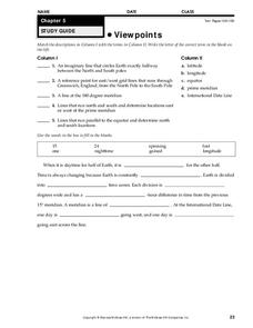
Viewpoints
In this map worksheet, students review latitude, longitude, equator, and prime meridian. This worksheet has 5 matching and 8 fill in the blank questions.
Curated OER
Earthquake Depth
Students research and locate earthquake epicenters on a map using latitude and longitude. They determine if the depth of an earthquake has any relationship to the distance from a plate boundary.
Curated OER
Plotting Earthquakes
In this earthquakes worksheet, students access a website to gather information about the magnitude and location of earthquakes for 5 days. Then students complete 7 short answer questions.
Curated OER
Individual Horizontal Sundial 2: Cloud/Rain Activity
Learners create a sundial to measure local apparent time as it relates to the position of the sun in the sky. In this sundial lesson, students cut and glue gnomon to a sheet of thin cardboard. Learners then set the sundial in an...
Curated OER
Maps Reinforcement
In this map activity, students complete 6 multiple choice questions and 5 short answer questions about 3 different map figures.
Curated OER
Common Themes
Tenth graders test usefulness of a model Earth by comparing its predictions to observations in the real world. In this landforms lesson students construct an island from a contour map using model clay then analyze the landscape...
Curated OER
Is Portland, Oregon Experiencing Global Warming?
Students use data to determine if the climate in Portland has changed over the years. In this weather lesson students complete line graphs and study long wave radiation.


