Curated OER
At Your Fingertips
First graders observe a variety of different foods including kiwi, banbnas, coffee, chocolate and discuss where they come from. They discuss the terms import and export then identify the locations where the items came from and their...
Curated OER
Graphing on a Coordinate Plane
Eighth graders explore the coordinate system. They identify the x and y-axis, parts of the coordinate plane, and discuss the process of plotting points. To emphasize the process of plotting points, 8th graders play an ordered pair...
Curated OER
Globe Lesson 4 - Intermediate Directions
Students explore the concept of intermediate directions. In this geography skills lesson, students use map skills in order to identify intermediate directions as they complete a map activity.
Curated OER
Where In The World Is Bermuda?
Students locate the Island of Bermuda, and identify its absolute and relative location.
Curated OER
Gray Whales on the Move
Young scholars study whale migration and their natural history. In this migration instructional activity students plot whale migration on a map and describe their ecosystems.
Curated OER
Geology Word List
In this science worksheet, students review the vocabulary words for the separate categories related to the concept of geology.
Curated OER
Traveling the Silk Road
Students take a virtual trip down the Silk Road. Using a map, they trace the location of the trade route and others that were developed later. They use different spices and goods to trace how they came to the Americas. They answer...
Curated OER
Getting to the Core of World and State Geography
Students create topography relief maps. In this geography skills lesson, students review geography core knowledge skills, design and make a state relief map, and compile a student atlas.
Curated OER
Science Test B-Grade 4
For this grade 4 science test worksheet, 4th graders complete a 30 question multiple choice quiz covering a variety of grade 4 concepts.
Curated OER
Adventures With Maps And Globes
First graders examine the differences between a map and a globe. They discuss and identify the symbols on maps and globes, then in small groups complete a worksheet. Students then complete a Venn Diagram comparing maps and globes.
Curated OER
May We Present Planet Earth?
Students draw a map to scale. They illustrate knowledge of how to use DOGS TAILS on a map. Students identify the main parts of a map. They identify and illustrate the major features necessary for sustaining a quality of life for a society.
Curated OER
Mapping Seamounts in the Gulf of Alaska
Students describe major topographic features on the Patton Seamount, and interpret two-dimensional topographic data. They create three-dimensional models of landforms from two-dimensional topographic data.
Curated OER
Identifying Continents and Oceans
Students locate and identify the four major oceans and the seven continents on a world map. They use an unlabeled world map and compass rose to describe relative locations of the continents and oceans.
Curated OER
Measuring Angles
Third graders describe an amount of turn from a particular position to another using the 'circular' benchmarks of 0, ++, ++, ++, and full turn. Estimation language such as 'just about', 'between', 'not quite', 'just over', and similar...
Curated OER
Journey North
Third graders study butterflies and their migration habits. They track butterfly migration and communicate via e-mail with students in Mexico where the butterflies migrate. They write letters to the students in Mexico, as well.
Curated OER
The Life of Dona Felisa Rincon De Gautier
Students identify Puerto Rico and discuss its relationship and proximity to the United States. Next, students identify significant events that occurred during Dona Felisa's term in office and how if may have affected her popularity. ...
City University of New York
Brooklyn College, Cuny: Latitude and Longitude
Students can read about how lines of latitude and longitude form a grid that makes it easy to pinpoint one's location on Earth. Then they can take an online quiz to check their understanding.
PBS
Pbs Nova Online: Lost at Sea the Search for Longitude
"The quest for a reliable method to find your way at sea was one of the thorniest problems of the 1700s." Find out about the search for longitude at this NOVA site. Includes interactive Shockwave game, learning activities and more.
Science Education Resource Center at Carleton College
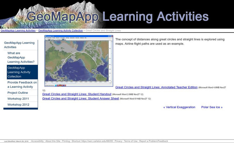
Serc: Great Circles and Straight Lines
Using maps, students explore the concept of distances along great circles and straight lines. Airline flight paths are used as an example.
University of Hawai'i
The Hawai`i Space Grant Consortium: Lunar Images
Part of the Exploring Planets in the Classroom series, this site provides images of the Moon, with Latitude and Longitude reference lines.
City University of New York
Earth and Environmental Sciences: Treasure Hunt
Looking for enrichment? Here's an online treasure hunt requiring skill with directions, distance, contour maps, latitude, and longitude. Also supplementing the activity are interactive quizzes on latitude, longitude, and other related...
Texas Instruments
Texas Instruments: Math Today Dangerous Births
In this activity, using the USA TODAY Snapshot "Dangerous births" students will explore the geometric relationships of triangles using perpendicular bisectors of the sides, bisectors of the angles and medians of the triangle. They will...
Texas Instruments
Texas Instruments: Numb3 Rs: Traveling on Good Circles
Based off of the hit television show NUMB3RS, this high-level math lesson has students delve into the topic of Great Circles on a sphere (specifically, the Earth), in order to find the shortest distances between locations. Students will...
ClassFlow
Class Flow: Major Topographical Features of the u.s.
[Free Registration/Login Required] In this flipchart students will locate major topographical features of the United States of America. Website links covering Identify rivers, mountain ranges, the equator, prime meridian, and lines of...


