Curated OER
Latitude Longitude
In this latitude and longitude worksheet, students plot 34 latitude/longitude locations onto a graph, connecting the dots as they go along.
Curated OER
Musical Plates-Earthquakes
In this plotting earthquake data worksheet, students use a large world map and given web sites showing the latitude and longitude for the epicenter of recent earthquakes around the world. Students plot 2 weeks of earthquake data...
Curated OER
Where in the World
Students explore the global grid system. In this globe instructional activity, students identify latitude and longitude lines and how these can tell the coordinates of any place. They use the Internet to find the exact coordinates for...
Curated OER
Degrees and Minutes
In this latitude and longitude worksheet, students place 9 cities on a map using the latitude and longitude of each. Once cities are placed in the correct location, students complete 2 short answer follow-up questions.
Curated OER
Where in the World Is ...?
Students move themselves around a "world" map on the classroom floor, using lines of latitude and longitude to locate specific spots. They determine the locations of 11 countries where Peace Corps Volunteers are serving and identify in...
Curated OER
Variables Affecting Earth's Albedo
Young scholars study the variables that affect the Earth's albedo. In this environmental data analysis lesson plan students interpret and graph information and calculate changes.
Curated OER
Snow Cover By Latitude
Students create graphs comparing the amount of snow cover along selected latitudes using data sets from a NASA website. They create a spreadsheet and a bar graph on the computer, and analyze the data.
Curated OER
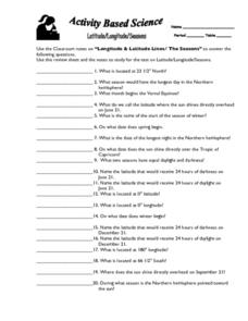
Latitude, Longitude, Seasons
In this latitude and longitude worksheet, students use their classroom notes on both longitude and latitude lines as well as seasons to complete 20 fill in the blank questions.
Curated OER
Latitude Longitude Skills
In this latitude and longitude worksheet, students determine the number of degrees between the equator and specific latitude points. Students to the same for the longitude points from the Prime Meridian. This worksheet has 3 problems to...
Curated OER
Give Me Some Latitude
In this latitude worksheet, students use an atlas or other reference to respond to 4 multiple choice questions about the equator and the poles.
Teach Engineering
Projections and Coordinates: Turning a 3D Earth into Flatlands
Introduce your class to map projections and coordinates, the basics for the work done in a GIS, with an activity that uses Google Earth to challenge learners to think about the earth's shape.
Curated OER
Viewpoints
In this latitude and longitude worksheet, students complete 10 matching questions identifying key features or locations on a map. Students also use lines of latitude and longitude to identify the time in 4 different places.
Curated OER
Stellar Navigation
Middle schoolers are introduced to the concept of stellar navigation. Inside a portable digital planetarium they identify various stars that were used as a navigational tool. They go through several activities in which they attempt to...
Curated OER
Hide and Seek with Geocaching
Students locate objects using a Global Positioning System. For this global geography lesson, students explore latitude and longitude using a GPS in order to locate objects.
Curated OER
Mapping the News
Students explore cartography. In this map skills and map making lesson, Students work in groups to create wall size world maps including legends, compass roses, latitude and longitude, and physical features. Students collect...
Curated OER
Latitude and Longitude- Online Interactive
In this maps worksheet, learners learn about longitude and latitude by reading a two paragraph text and studying two maps. Students answer 9 fill in the blank questions. This is an online interactive worksheet.
Curated OER
Explore Surface Types on a Journey Around Earth
Students explore satellite data. In this technology cross-curriculum math and world geography lesson plan, students locate specific map areas using a microset of satellite data. Students use technology and math skills to determine...
Curated OER
Some Things You Need to Know to Read a Map
Pupils study things the you need to know to read a map and explain location.
Curated OER
Shadows and Skyscrapers
Eighth graders explain the relationship between the position of the sun, a city's latitude and shadow length. Ratio's, geometry, and algebra are used to determine the shadow lengths and building heights. A sun angle (altitude) charts to...
Curated OER
WORLD GEOGRAPHY
Students identify and analyze map symbols and map grids by completing various worksheets and creating their own map using these skills. Students identify and analyze what latitude and longitude are on a map to play a game of Bingo....
Curated OER
Plotting Earthquakes and Volcanoes
In this earthquakes and volcanoes worksheet, students are given the latitude and longitude of earthquakes and volcanoes and they plot them on a world map. They answer questions based on their results.
Curated OER
You Can Find It!
Students, in groups, use longitude and latitude to locate various places on a map.
Curated OER
Plotting A Hurricane Using latitude and Longitude
Students explore map and plotting skills by tracing the movement s of hurricanes through the Earth's systems. a hurricane map is developed from daily media reports.
Curated OER
Seasons Worksheet #2
A tilted Earth is shown in relation to the rays of light from the sun. Earth science superstars determine latitude, month, and time of day. They compare number of daylight hours for different points on Earth. The five multiple choice...
Other popular searches
- Maps Latitude and Longitude
- Maps, Longitude and Latitude
- Longitude & Latitude Maps
- Longitude Latitude Maps
- Maps, Longitude Latitude
- Maps, Latitude/longitude


