Curated OER
Understanding Latitude, Longitude, and Time Zones
Students take an imaginary world tour by locating cities with latitude and longitude. They plan an itinerary and calculate the time zones from which they would call home. Then they construct word problems involving travel across time zones.
Curated OER
Where Am I?
Students identify the latitude and longitude of various locations and calculate the distance between two given coordinate points. They read an eBook, explore the City Zen program, and complete a worksheet.
Curated OER
Topographic Map Unit Plan
High schoolers examine topographic maps and discover how to decipher contour intervals, use contour lines and apply information to complete a topographic map lab. Working in groups, they identify the scale of the map, latitude and...
Curated OER
Terrabagga Activity Using a Magnetometer
Clever! Earth science learners construct a model of a planet containing a magnetic core. The planet, Terrabagga, is made out of a paper grocery bag, magnets, a dead D battery, and rubber bands. Pictures of each step of the construction...
NOAA
Tracking a Drifter
Be shore to use this drifter resource. The third installment of a five-part series has learners using the NOAA's Adopt-a-Drifter website to track to movement of a drifter (buoy) in the ocean. Graphing the collected data on a map allows...
Curated OER
Map Coordinate Bingo
Students play a bingo-type game to locate cities by coordinates. They explain the use of orientation on a map and identify cities in the western hemisphere. They compare road maps, shutttle images, and a CIR image and obtain an...
Curated OER
Mapping School Grounds
Students map and analyze the natural and cultural environment of the school grounds. In small groups, they sketch the natural and cultural features of each side of the school building, create a map, participate in a class discussion,...
Curated OER
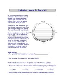
Latitude
For this latitude worksheet, students answer questions about latitude that include absolute locations of countries and coordinates. Students complete 12 questions.
Curated OER
Google Earth
In this Google Earth learning exercise, learners access the Google Earth website and find the latitude, longitude, and elevation for their house and school. Then they do the same for a variety of world locations. This learning exercise...
Curated OER
U.S. History: What Happened Here?
Learners apply the global positioning system to create maps of local historical sites. By collaborating with local historical groups, they research events and relate them to broader, national history. In addition to writing essays...
Curated OER
Topographic Maps Worksheet
In this geography skills learning exercise, students respond to 37 multi-part questions that require them to read and interpret topographic maps.
Curated OER
Congressional Travel
Students determine the distances traveled by the members of the legislative branch of the US Government. In this travel distance lesson, students locate Washington, DC on a globe using the longitude and latitude of the city. They...
Curated OER
Walking on Maps
Learners are introduced to the various types of maps and their functions. As a class, they play a game similar to twister to review map concepts. They answer questions about the map and use the internet to view larger maps of the world.
Curated OER
Constellation Mapping
Students plot constellations on a grid map. They discuss the various ways early explorers planned their travels. Students identify and recognize major constellations. They color their maps and take them home to try to find various...
NOAA
Understanding El Niño Using Data in the Classroom
Are weather troubles caused by El Nino? An installment of a larger series presents a five-part lesson on El Nino. First, scholars learn to read sea surface temperature maps. Then, they compare them to data on graphs before determining if...
Curated OER
Earth Matters
Students identify Earth's equator, prime meridian, lines of latitude, lines of longitude, parallels, and meridians.
Curated OER
The World (With an emphasis on the United States)
Fourth graders recognize the different continents. They are introduced to longitude and latitude and how to find locations using these measurements. This series ends with an emphasis on the fifty states of the United States and their...
Curated OER
What in the World?
Eighth graders plot points of longitude and latitude on a world map. In groups, they create a model of the earth's interior and label the parts,
Curated OER
MAP GRIDS, CLIMATES AND HEMISPHERES
Students compare/contrast the grid and latitude/longitude system used on a globe. They describe the areas which are considered to be a tropical, temperate, and polar, based on knowledge of climates.
Curated OER
Viewing Earth and Sky
For this earth and sky worksheet, students review terms associated with map reading. Students also review topographic maps and how contour lines represent elevation. This worksheet has 5 matching, 5 true or false, 5 fill in the blank,...
Curated OER
Earth Viewer
Students explore the Earth. In this space lesson, students view the " Earth and Moon Viewer" web site and complete a related worksheet.
Curated OER
Let the North Star Tell You Where You Are
Students participate in activities in which they find the Big Dipper and locate the North Star in the night sky, examine the relationship between the angle to Polaris and latitude, and determine latitude by using an astrolabe.
Curated OER
Taming the Mighty Dragon
Students incorporate the five themes of geography to study the Yangtze river region. They analyze the possible effects of the three rivers gorge damn project on this area and role play a float the entire length of this dangerous river...
Curated OER
Globe Lesson 9 - Around the World - Grade 6+
In this geography skills worksheet, learners read 5-travel scenarios and use their problem solving skills to respond to 9 short answer questions.
Other popular searches
- Maps Latitude and Longitude
- Maps, Longitude and Latitude
- Longitude & Latitude Maps
- Longitude Latitude Maps
- Maps, Longitude Latitude
- Maps, Latitude/longitude


