Curated OER
Tell Time With Your Feet
Students discover what the latitude and longitude of their location is. They start walking and measure their shadow. They fill in a chart to discover the approximate time.
Curated OER
Cities and Countries Around the World
Briefly introduce your young Spanish speakers to different cities around the world. Identify the country they are located in, what the people are called from those countries, and the country's location on a class map. Make sure to use...
Curated OER
The Global Grid System-World Map Activity
Students demonstrate how to use the global grid system. In this map skills lesson, students use a world map to locate various locations. Students identify locations based on the global grid system. Students complete a worksheet as an...
Curated OER
Maps: Latitude and Longitude
Pupils visit interactive sites focusing on latitude and longitude. They participate in activities about the prime meridian, time zones, and equator. They view the coordinates of states and cities.
Curated OER
Your Expedition of Discovery
Learners study GPS and see how it is used to determine points on the Earths surface. In this expedition lesson students use GPS to find given coordinates.
Curated OER
U.S. History: What Happened Here?
Students apply the global positioning system to create maps of local historical sites. By collaborating with local historical groups, they research events and relate them to broader, national history. In addition to writing essays...
Curated OER
What do Maps Show?
Eighth graders practice the skill of reading maps. In this geography instructional activity, 8th graders participate in a classroom lecture on how to read a map.
Curated OER
"Where in the World is my School?"
Students learn new vocabulary and discuss what GPS is and does. They locate their school using the equipment.
Curated OER
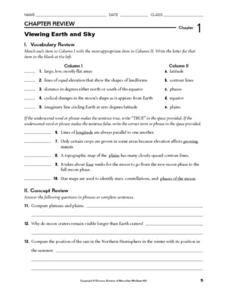
Viewing Earth and Sky
In this earth and sky worksheet, students review terms associated with map reading. Students also review topographic maps and how contour lines represent elevation. This worksheet has 5 matching, 5 true or false, 5 fill in the blank, and...
Curated OER
The Underground Railroad
Young scholars explore the Underground Railroad routes. For this map skills and Civil War lesson, students use map and globe reading vocabulary and skills to track the routes the slaves followed from the Bahamas to the United States and...
Curated OER
How far have we traveled?
Students practice longitude and latitude to determine given position on Earth's surface, convert and calculate angular measurements, and use Pythagorean Theorem to determine change in position or distance traveled between any two locations.
Curated OER
Mapping and Topgraphy- 8th Grade
Eighth graders practice interpreting a contour map as well as reading latitude and longitude in a team activity. Following a discussion on mapping terms, teams are given maps and estimate the distance between two points. Students...
Curated OER
Mush! Tracking Travelers on the Trail
Students get to know Alaska and the Iditarod route that is run by dogs as they track the mushers' progress on a map that they create specifically for the race. They learn about latitude, longitude, plotting on a map, checkpoints, and...
Curated OER
GPS Treasure Hunt for Knowledge
Students examine themselves as being part of a global community. In this global community lesson, students investigate GPS systems. Students gain knowledge on how the device works. Students discover that satellites provide information...
Curated OER
Earth's Features
In this geography worksheet, students label a map of the world with the Arctic Circle, Tropic of Capricorn, Tropic of Cancer, Equator, North Pole, South Pole, and the Antarctic Circle.
Curated OER
Introduction to Maps
Students investigate different types of maps and their purposes. In this mapping lesson students complete a worksheet, participate in a class discussion and do a hands on activity.
Curated OER
Plotting A Hurricane Using latitude and Longitude
High schoolers explore map and plotting skills by tracing the movement s of hurricanes through the Earth's systems. a hurricane map is developed from daily media reports.
Curated OER
A Star to Steer Her By
Young scholars determine their latitude using a protracdtor and/or cross-staff to find the altitude of Polaris.
Curated OER
Map Your School
Learners participate in a project to map their school. They measure and graph various areas around the school. Students find the longitude and latitude of the school and research the school's history, and highlight special important areas.
Curated OER
Lost at Sea: The Search for Longitude
Students research and chart the shortest course to circumnavigate the globe.
Curated OER
Earth Viewer Welcomes You- Web View of the Earth
For this science and Internet technology worksheet, students access the given web site to look at a current view of the Earth's surface. They enter longitude and latitude co-ordinates before answering 8 questions. They change the...
Curated OER
NIGHT AND DAY: DAILY CYCLES IN SOLAR RADIATION
Students examine how Earth's rotation causes daily cycles in solar energy using a microset of satellite data to investigate the Earth's daily radiation budget and locating map locations using latitude and longitude coordinates.
NOAA
Ocean Exploration
Where am I? The second installment of a 23-part NOAA Enrichment in Marine sciences and Oceanography (NEMO) program starts with pupils guessing the years in which major ocean exploration events took place. The instructional activity then...
Other popular searches
- Longitude and Latitude
- Longitude Latitude
- Latitude and Longitude Games
- Latitude and Longitude Maps
- Longitude & Latitude
- Longitude and Latitude Game
- Longitude and Latitude Math
- Geography Latitude Longitude
- Whaling Latitude Longitude
- Longitude Latitude Minutes
- Longitude and Latitude Lines
- Volcano Latitude Longitude


