Curated OER
What's Your Temperature?
Learners take a look at the local newspaper and focus on the weather section. They get into small groups, and each one looks at the same map, but of a different part of the country. They must prepare a presentation that shows how...
Curated OER
The Global Grid System-World Map Activity
Students demonstrate how to use the global grid system. In this map skills lesson, students use a world map to locate various locations. Students identify locations based on the global grid system. Students complete a worksheet as an...
Curated OER
Earth Viewer
Students explore the Earth. In this space lesson plan, students view the " Earth and Moon Viewer" web site and complete a related worksheet.
Curated OER
Your Expedition of Discovery
Learners study GPS and see how it is used to determine points on the Earths surface. In this expedition lesson students use GPS to find given coordinates.
Curated OER
Globe Lesson 7 - Parallels and Meridians - Grade 6+
In this parallels and meridians learning exercise, students read a 2-paragraph review of parallels and meridians and respond to 7 short answer questions.
Curated OER
"Where in the World is my School?"
Students learn new vocabulary and discuss what GPS is and does. They locate their school using the equipment.
Curated OER
Maps, Charts, and Graphs
Students define key geographic terms and track a hurricane on a map. They examine various types of maps and find locations on them,including rivers, cities and mountains.
Curated OER
Taming the Mighty Dragon
Students incorporate the five themes of geography to study the Yangtze river region. They analyze the possible effects of the three rivers gorge damn project on this area and role play a float the entire length of this dangerous river...
Curated OER
Viewing Earth and Sky
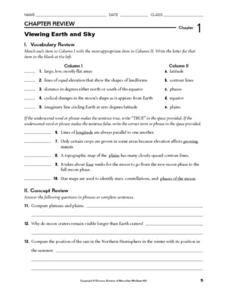
In this earth and sky worksheet, students review terms associated with map reading. Students also review topographic maps and how contour lines represent elevation. This worksheet has 5 matching, 5 true or false, 5 fill in the blank, and...
Curated OER
Plotting Earthquakes
In this earthquakes worksheet, students access a website to gather information about the magnitude and location of earthquakes for 5 days. Then students complete 7 short answer questions.
Curated OER
Globe Lesson 9 - Around the World - Grade 6+
In this geography skills worksheet, students read 5-travel scenarios and use their problem solving skills to respond to 9 short answer questions.
Curated OER
An Early American Culture
Students identify the locations of the Hopewell culture. In this map skills instructional activity, students use a globe to mark several locations of the Hopewell culture.
Curated OER
The Underground Railroad
Young scholars explore the Underground Railroad routes. For this map skills and Civil War lesson, students use map and globe reading vocabulary and skills to track the routes the slaves followed from the Bahamas to the United States and...
Curated OER
Globe Lesson 17 - Alaska and Hawaii - Grade 4-5
Students develop their globe skills. In this geography skills lesson, students explore the area added to the United States when the Alaskan territory was purchased from Russia.
Curated OER
Globe Skills Lesson 10 Apollo 11
Middle schoolers develop their globe skills. For this geography skills lesson, students use a globe and a softball to replicate distance between the earth and its moon.
Curated OER
Globe Skills Lesson 7 The Transcontinental Railroad
Students explore the Transcontinental Railroad. In this geography skills activity, students use map skills in order to locate legs of the Transcontinental Railroad on globes.
Curated OER
Globe Skills Lesson 5
For this map skills worksheet, students read a text selection about locations during the American Revolution and then respond to 8 fill in the blank questions.
Curated OER
Globe Skills Lesson 1 Some Early American Cultures
Learners apply their knowledge of geography. In this geography skills lesson, students read brief selections regarding early Americans. Learners respond to the questions included in the self-guided map skills lesson.
Curated OER
Individual Horizontal Sundial 2: Cloud/Rain Activity
Learners create a sundial to measure local apparent time as it relates to the position of the sun in the sky. In this sundial lesson, students cut and glue gnomon to a sheet of thin cardboard. Learners then set the sundial in an...
Curated OER
Walking that Line
Young scholars attempt to describe and use longitude and latitude. They will identify different countries, their neighbors, and borders around the world. Included in the instructional activity the students identify natural features that...
Curated OER
From Home to School, GPS Style
Students are introduced and increase proficiency in the use of the hand held GPS system. They explore the meaning of longitude and latitude lines, then identify the parts of the map.
Curated OER
Location of Cities 201
Students work in pairs to locate the ancient cities on a world atlas using the longitude and latitude measurements. They examine the physical and human futures that explain their locations.
Curated OER
Did You Feel That? Earthquake Data Chart
Students plot earthquakes on the world map using coordinates of longitude and latitude. They designate the earthquakes magnitude with a symbol which they include in the map key.
Other popular searches
- Latitude and Longitude
- Latitude Longitude
- Latitude and Longitude Games
- Latitude & Longitude
- Latitude and Longitude Maps
- Longitude and Latitude Game
- Longitude and Latitude Math
- Geography Latitude Longitude
- Whaling Latitude Longitude
- Longitude Latitude Minutes
- Longitude and Latitude Lines
- Volcano Latitude Longitude


