Magic of Physics
Rotating Sky
Ever found it difficult to observe the night sky with pupils because school takes place during the day? Host a stellar lesson using a detailed night sky interactive! Scholars view the apparent rotation of the sky from the comfort of the...
PBS
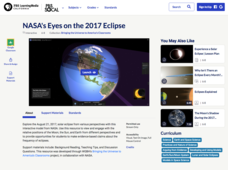
NASA's Eyes on the 2017 Eclipse
How did the 2017 eclipse look in Los Angeles—or Chicago? Experience both views, plus many more, using a lesson from PBS's Space series for middle schoolers. Scholars follow the movements of the sun, moon, and Earth during the most recent...
NOAA
Understanding El Niño Using Data in the Classroom
Are weather troubles caused by El Nino? An installment of a larger series presents a five-part lesson on El Nino. First, scholars learn to read sea surface temperature maps. Then, they compare them to data on graphs before determining if...
Radford University
Earthquake Problem
Shake up things in the classroom. The unit uses earthquakes to bring a real-life connection to finding arc lengths, logarithms, and equations of circles. Small groups determine whether particular towns would have felt an earthquake after...
Radford University
Georgia Peaches and California Dreamin’
Plant the fruits of trigonometry. Pairs work through the process of finding the best place to plant fruit trees on a piece of property. The scholars must take into consideration the location of the property and the solar zenith angle. To...
Radford University
Trouble in the Orchard
It's no fun catching a fungus. Scholars first investigate how the seasons affect the angle of the sun and the lengths of shadows. They then apply right triangle trigonometry to determine the height of trees based on their shadows to...
Bonneville
Solar Pathfinder Tutorial
Find the right path to learn about solar energy. Scholars set up and use Solar Pathfinders to take measurements related to solar insolation at a particular site. Based on the data, they estimate the solar potential in kWh/m^2/day of a...
Curated OER
The Geophysics And Cultural Aspects of the Greater Antilles
Students determine location by using longitude and latitude. They measure to the minute longitude and latitude of a place and select a body of land and determine its location. They approximate time zones by using every 15 degrees of...
Curated OER
Map Coordinate Bingo
Students play a bingo-type game to locate cities by coordinates. They explain the use of orientation on a map and identify cities in the western hemisphere. They compare road maps, shutttle images, and a CIR image and obtain an...
Curated OER
What A Tombstone Can Tell Us
In this coordinates worksheet, students determine the coordinates to visit a cemetery. Students determine 18 coordinates on this worksheet.
Curated OER
Coral Bleaching in the Caribbean
Students use authentic satellite data on the NASA website to determine when the sea surface temperature meets the criteria to induce coral bleaching.
Curated OER
Social Studies: African Folklore and Geography
Students discover the connection between geography and folklore in several African nations. In groups, they record information from maps of their assigned countries. Students observe the pictures in books and match the geographic...
Curated OER
Globe Lesson 4 - The Compass
Students study compass' and their use in navigation. In this compass instructional activity, students use a compass and a globe to answer the questions about navigation.
Curated OER
The Pilgrims
Students use distance measuring tools to follow directions and chart the path the pilgrims made from Plymouth, England to Boston, Massachusetts. In this Pilgrim voyage lesson, students use a map to chart the distance traveled by the...
Curated OER
The Sounds of Samba
Young scholars research the origins of Samba in Brazil using the internet. After defining new vocabulary, they locate the cities in Brazil using latitude and longitude which practice the Samba. In groups, they compare and contrast the...
Curated OER
Mush! Tracking Travelers on the Trail
Students get to know Alaska and the Iditarod route that is run by dogs as they track the mushers' progress on a map that they create specifically for the race. They learn about latitude, longitude, plotting on a map, checkpoints, and...
Curated OER
Mapping the News
Students explore cartography. In this map skills and map making activity, Students work in groups to create wall size world maps including legends, compass roses, latitude and longitude, and physical features. Students...
Curated OER
GPS Treasure Hunt for Knowledge
Students examine themselves as being part of a global community. In this global community lesson, students investigate GPS systems. Students gain knowledge on how the device works. Students discover that satellites provide information...
Midnight Martian
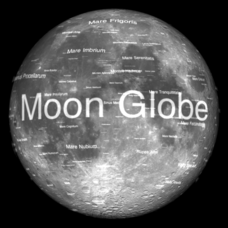
Moon Globe
Not just a simple globe of the moon, this interactive version allows you to choose lighting according to the location of the sun, views from different positions on Earth, and more! Satellite images and topographic data have been combined...
Curated OER
How Does Temperature Change With Respect To Latitude and Longitude?
Students research the concept of predicting the weather. The research focuses on how some weather facts intuitively make sense. Students answer key questions based upon the mathematical concept of covariance.
Curated OER
Science: Hurricanes As Heat Engines
Pupils conduct Internet research to track the path of Hurricane Rita. They record the sea surface temperature of the Gulf of Mexico during and after the hurricane and draw conclusions about how hurricanes extract heat energy from the...
Curated OER
Research Cruise Scavenger Hunt
Students track the research cruise of the Ronald H. Brown from San Diego to the Galapagos Islands. They match research groups with the key words, using the ship's daily logs to find the answers.
Curated OER
How to be a Great Navigator!
Students, through teacher lecture and class discussion, explore historical methods of navigation: dead reckoning and celestial navigation.
Curated OER
Celebrating 100 Years of Negro Leagues Baseball
Ninth graders locate original locations of Negro Leagues Baseball teams using latitude and longitude, calculate distances between locations using maps and/or Internet resources, and use critical thinking skills to compare and contrast...
Other popular searches
- Latitude and Longitude
- Latitude Longitude
- Latitude and Longitude Games
- Latitude & Longitude
- Latitude and Longitude Maps
- Longitude and Latitude Game
- Longitude and Latitude Math
- Geography Latitude Longitude
- Whaling Latitude Longitude
- Longitude Latitude Minutes
- Longitude and Latitude Lines
- Volcano Latitude Longitude


