Curated OER
River Research
Students use the internet to research the streams and rivers found in Illinois. Using the information, they identify and describe the rivers and streams along with the physical characteristics of a river ecosystem. They share what they...
Curated OER
Rollin' on the River: The McClellan-Kerr Arkansas River Navigation System
Middle schoolers take a close look at the McClellan-Kerr Arkansas River Navigation system. They study how the Army Corps of Engineers built and monitor the system. Learners discover how a lock and a dam work, and study three benefits of...
Curated OER
Lesson 7 - Our Rivers and Streams
Students examine the major rivers in Northeast Florida and how they are useful. They study the St. John's River, its tributaries, and unique characteristics.
Curated OER
Controlling the Flow of the Colorado River: A Study of Dams
Students research and map the Colorado River and its dams and predict the effects of a dam on an area. They suggest reasons a dam would be built and compare the Colorado River system with other major river systems within the US and...
K12 Reader
Water Carves the Land
What affect do bodies of water have on the world around us? Kids can find out by reading this passage. After reading, they answer five questions related to the text.
Curated OER
States and Capitals, Mountains and Rivers
Students identify geographical locations in the midwestern United States. In this geography lesson, students identify 12 states and capitals and geographical features in the region by using U.S. maps. Students use blank maps to fill in...
Curated OER
Environment: Rivers of Destiny
Students investigate the results of human intervention with the Mekong. Mississippi, and Amazon rivers. After watching a video about the status of the three rivers, they complete experiments demonstrating the effects of erosion and...
Curated OER
Sedimentary Rocks
Sedimentary rocks are the building blocks of this geology lesson. In it, learners discover what sedimentary rocks are and how they form. They understand the differences between the major sedimentary rock varieties and learn what types of...
Curated OER
Sacred Places
Students examine places considered sacred in both India and the U.S. They read and discuss a website on the Ganges River, discuss places considered sacred in the U.S., and write an essay comparing/contrasting personal sacred places and...
Owl Teacher
Teach Ancient Civilizations: Africa
Amazing! Teach learners about the wonders of ancient Africa and Asia with a comprehensive set of teaching tools. You'll click to find a well-constructed presentation, a worksheet that has kids compare and contrast ancient alphabets, a...
Curated OER
Land Use Change Introduction
Pupils discuss the major changes that have taken place in the Hudson Valley over the past 400 years. They use aerial photos to describe major trends in Dutchess County. Students view a PowerPoint presentation. They work in small groups...
National Endowment for the Humanities
Victory and the New Order in Europe
A New Order in Europe calls for a new lesson plan! This third plan in a series of four sequential lessons encourages high schoolers to read primary sources about the development of the New Order and follow up their knowledge with a...
Curated OER
River Basin to Reservoirs: A Profile of the Kansas Republican River Basin and Reservoirs
Students examine the role the river played in the settlement of towns in the basin. Student groups prepare an oral presentation on Milford Lake, Tuttle Creek Lake or Perry Lake.
Curated OER
State Poster Fair: US Geography, Social Science, Art
Students research a US state, design and construct a state 'poster' to display important facts about that particular state. They present their work to the class.
Curated OER
Chesapeake Bay
The Chesapeake Bay is the largest estuary in the United States. Explore its origins, organisms, and contributing rivers with this PowerPoint. It opens with several slides of general information on the formation of estuaries, then it...
Curated OER
Majority Muslim Countries Quiz
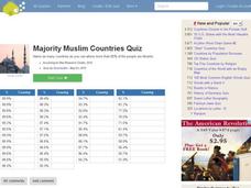
In this online interactive geography quiz worksheet, learners respond to 47 identification questions about Muslim cities. Students have 4 minutes to complete the quiz.
Curated OER
War of 1812
Eighth graders locate the major land forms and bodies of water on a map of Louisiana. In groups, they discuss the role of the Mississippi River in the Battle of New Orleans and how land and water affect the outcome of battles. To end...
Curated OER
Charles Lawrence's Expulsion Orders or Acadians in 1755
An interesting, but sparse, PowerPoint on early North American history awaits your class. The presentation is only two slides. It is a copy of a letter written by Charles Lawrence to Major Hanfield commanding him to clearing the country...
Curated OER
Nutrients In Chesapeake Bay
Students perform pH and turbidity test to determine water quality. In this environmental science lesson, students analyze NASA database on chlorophyll-a in the bay. They explain how a small river area affects Chesapeake Bay.
Curated OER
Maps that Teach
Students study maps to locate the states and capital on the US map. Students locate continents, major world physical features and historical monuments. Students locate the provinces and territories of Canada.
Curated OER
Carve That Mountain
Students investigate major landforms (e.g., mountains, rivers, plains, hills, oceans and plateaus). They build a three-dimensional model of a landscape depicting several of these landforms. Once they have built their model, they act as...
Curated OER
Floodplain Modeling
Learners simulate the impact of fluctuating river volumes on structures and landforms. They experiment with table top-sized riverbed models and water. Students consider how human design can help mitigate the effects of a flood.
Curated OER
Three Mapping Activities
Pupils label three maps of China after being introduced to background information about the country. For this geography lesson, students color two maps and label various points of interest in China. Finally, pupils draw their...
Curated OER
The 50 States
Fifth graders use maps and music to learn the 50 states. In this US Geography lesson, 5th graders map out a region of the United States and practice singing the song, The 50 States that Rhyme.


