Curated OER
Mapping La Salle's Travels
Middle schoolers use the internet to create a map showing the path of La Salle through North America and the Caribbean. They identify the main geographic features of the two areas and the main French forts. They also complete a timeline.
Curated OER
Water Management in Florida
Students discuss water management. They examine the water management districts in their area. They complete an experiment in which they role-play a water management manager.
Curated OER
North Dakota Reading Comprehension
In this North Dakota reading comprehension worksheet, students read a 2-page selection regarding the state and then respond to 10 true or false questions.
Curated OER
Erosion: Slip Sliding Away
Fourth graders investigate the causes of erosion. Through several demonstrations including one using sugar cubes and warm water, they observe the effects of erosion. In groups, 4th graders conduct similar experiments and record their...
Curated OER
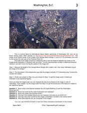
Washington D.C. from Space
In this Washington D.C. from space learning exercise, students use a picture generated by the International Space Station and they find the scale of the image. They determine the actual size of features in the image, they find the...
Curated OER
The Time Has Come: Poetry and Drama Use in the Geography Class
Students use drama and poetry in their Geography class. In groups, they role play an interviewer or the interviewee in various plays that were presented to them. In their role, they must locate and label where the countries mentioned...
Curated OER
Does Cloud Type Affect Rainfall?
Student uses MY NASA DATA to obtain precipitation and cloud type data. They create graphs of data within MY NASA DATA. They compare different cloud types as well as precipitation types. They describe graphs of the precipitation and cloud...
Curated OER
Blast from the Past
Young scholars analyze historic artifacts to help gain an understanding of how the past has impacted their lives. They explain ways "design" can be both a noun and a verb. Students use internet resources to view and learn about artifacts...
Curated OER
IDP Introduction
Fourth graders examine the three regions of North Carolina through class discussion of favorite places in the state and a review game based on the game of twister. The different colors on the twister sheet represent the different...
Curated OER
The Industrial Revolution
Eighth graders examine the time period of the Industrial revolution in American history. In this American History lesson, 8th graders read the chapter on this time period. Students create a presentation on this time period to...
Curated OER
Day 1: IDP Introduction
Fourth graders locate the three regions of North Carolina (Coastal
Plains, Piedmont, and Mountain Region) and differentiate between the regions on a physical and cultural level. They identify a region based on characteristics through a...
Curated OER
Fish In a Bottle
Students work together to build their own fish ecosystems. As a class, they share their prior knowledge about catfish and use a diagram to label its body parts. They record their observations of the ecosystem and determine what they...
Curated OER
The Lewis and Clark Expedition
Pupils examine the Lewis and Clark expedition. They develop skills for historical analysis. They locate a variety of geographic features encountered by the expedition, and create a timeline that documents Lewis and Clark on their journey.
Curated OER
Wetland Adaptation
Students participate in a simulation to investigate the impact of the wetland environment on the migration of birds. They discuss the patterns of migration they took and why they avoided certain wetlands.
Curated OER
What is Drought?
Students explore and conduct an experiment on the effects of drought on the environment. They define what drought is and the impact that a shortage of rainfall can have on agriculture, municipal water supplies, tourism, recreation, etc.
Curated OER
Famous Hoosiers
Fourth graders make a timeline about a famous person from Indiana. In this famous Hoosiers activity, 4th graders watch a PowerPoint presentation about David Letterman's life. They make a timeline using information from the presentation...
Curated OER
Viriginan American Indians
Learners complete a KWL chart about the American Indians using graphic organizers from websites. They read a teacher-selected book about the early Virginia American Indians and then read Becoming a Homeplace from the Virginia Historical...
Curated OER
Heritage: What A Sight!
Fifth graders examine the landmarks along the Pioneer Trail. They discover these landmarks were used as guides. They research the Pioneer Trail and present to the class.
Country Studies US
Country Studies: Cambodia: Rivers
Read this discussion of the rivers in Cambodia from this Country Studies report. Find out sources and mouths of the major rivers.
National Geographic
National Geographic: Mapping u.s. Watersheds
Students will identify and explore major rivers and watersheds in the United States.
Ducksters
Ducksters: United States Geography: Rivers
Kids learn about the major rivers of the United States including the Mississippi, Missouri, Rio Grande, Colorado, and the Hudson. Geography of the US.
War Times Journal
War Times Journal: Ia Drang River Valley Battle Maps
Three animated battle maps on the famous three-day battle fought between the US Army and the North Vietnamese Army in November 1965. This battle represented the first major encounter between the two combatants.
Khan Academy
Khan Academy: Eakins, the Champion Single Sculls (Max Schmitt in a Single Scull)
Thomas Eakins' "Champion Single Sculls" was his first major success by demonstrating his remarkable technical skill. View pictures of this tranquil scene and read the backstory of this painting.
Curated OER
Educational Technology Clearinghouse: Maps Etc: Red River Expedition, 1864
A map of Louisiana and Mississippi showing the area of the Red River Campaign of 1864 during the American Civil War (March 10 to May 22). The map shows major cities and towns, forts, railroads, rivers, and coastline, and includes the...


