Curated OER
Blank Jeopardy
Games are a great way to motivate learners to internalize information.. Using this PowerPoint which is in a Jeopardy format, students can review map skills and facts about the Civil War, famous places, and our government. This is a handy...
Curated OER
Lesson Plan on Latitude and Longitude
Sixth graders identify at least ten places on the world map using given longitude and latitude points. They identify the longitude and latitude of ten places on the world map.
Curated OER
Latitude and Longitude- Online Interactive
In this maps worksheet, learners learn about longitude and latitude by reading a two paragraph text and studying two maps. Students answer 9 fill in the blank questions. This is an online interactive worksheet.
Curated OER
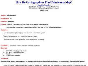
How Do Cartographers Find Points on a Map?
Ninth graders describe latitude and longitude and how they may be useful to find things on a map. In this cartography lesson students divide into groups and devise a coordinate system that can be used to communicate a position.
Owl Teacher
Latitude & Longitude
Here is a worksheet activity where learners mark the latitude and longitude coordinates of cities all over the world. There are 15 cities to identify, from Baghdad, Iraq to Warsaw, Poland and Anchorage, Alaska.
Space Awareness
How To Travel On Earth Without Getting Lost
Have you ever wanted to travel the world? Take a virtual trip with a geography lesson that uses longitude and latitude, the position of the sun, an astronomy app, and a classroom globe.
Curated OER
Latitude/Longitude Activity
Youngsters work in groups to solve clues involving latitude and longitude coordinates in order to decipher mystery animals in this fun learning experience!
Curated OER
Geography Terms
Introduce the terms and concepts related to basic map and geography skills. Terms include full definitions and cover latitude, longitude, the Equator, Tropic of Cancer, Tropic of Capricorn, Prime Meridian, and the International Date Line.
Curated OER
Latitude and Longitude
Students explore longitude and latitude lines to discover locations. In this finding locations lesson plan students construct a model showing the latitude and longitude lines on Earth.
Curated OER
Finding Longitude and Latitude on Pennsylvania Maps
Students draw the lines of longitude and latitude on a map. Students look at a topographical maps to see how topography relates to land use.
Curated OER
Where are We?
Fifth graders explore places visited by Lewis and Clark. In this geographical concepts lesson, 5th graders plot places on a map and put events in chronological order. Students find locations on a map using longitude and latitude....
Curated OER
Learning About Location: Charting the Path of the George W. Elder
Students acquire a working knowledge of the geographical concepts: absolute location, relative location, longitude and latitude. They analyze primary sources that shows the physical and human characteristics of the places along the 1899...
Curated OER
Understanding Weather and Climate Patterns
Young scholars research the climate patterns of various locations and make predictions based on their findings. They determine the importance of latitude and longitude in weather and climate. Students create graphs displaying their...
Curated OER
Storm Clouds-- Fly over a Late Winter Storm onboard a NASA Earth Observing Satellite
Students study cloud data and weather maps to explore cloud activity. In this cloud data lesson plan students locate latitude and longitude coordinates and determine cloud cover percentages.
Curated OER
Journey to Gettysburg
Students use latitude and longitude to map the path of the Battle of Gettysburg.
Curated OER
Separate Vacations
Students plot the migration paths of birds using latitude and longitude data from a table.
Curated OER
Geography and Culture of China
Take out a map, a paper, a ruler, and those coveted colored pencils for a activity on Chinese culture and geography. This is a multifaceted approach to basic geography skills that incorporate story telling, class discussion, primary...
Curated OER
Lesson 1 Activity 1: Tools of the Ancients
Students examine how Christopher Columbus determined his latitude.
Curated OER
Coral Bleaching in the Caribbean
Students practice analyzing images, maps and graphs from Internet-based educational resources. They explore the correlation between sea surface temperature and coral bleaching. Students comprehend that coral reefs are collections of tiny...
Curated OER
Baseball Challenge: Social Studies TCAP
Using a baseball theme, this presentation provides a review of social studies topics covered in sixth grade. Students play a game in which they score based on the answers to various questions involving Ancient Rome, Ancient Greece, map...
Curated OER
Plotting Earthquakes
Students plot earthquakes on a map. In this lesson on earthquakes, students will explore recent earthquake activity in California and Nevada. Students will plot fault lines and earthquake occurrences on a map.
Curated OER
Degrees and Minutes
In this latitude and longitude worksheet, students place 9 cities on a map using the latitude and longitude of each. Once cities are placed in the correct location, students complete 2 short answer follow-up questions.
Curated OER
The Coldest Place at the Bottom of the World
Students examine Ernest Shackleton's journey through the Antarctic and trace Shackleton's Actual Route on a map using longitude and latitude coordinates. Students compare his intended route with his actual and determine how far off...
Curated OER
Latitude
Your young geologists generate a graph given a table of values from the context of latitude and percent of the earth's surface north of that latitude. The questions in the activity then focus the learners to a deeper understanding of the...
Other popular searches
- Latitude and Longitude Maps
- Longitude & Latitude Maps
- Longitude Latitude Maps
- Maps, Latitude/longitude


