Curated OER
Sunspots 3: Tracking the Movement of Sunspots
Learners analyze sunspots through the use of solar imaging from satellite instruments. They collect two types of images, and track the movement of sunspots using a latitude/longitude grid.
Curated OER
Of Compasses, Sextants and Chronometers
Students identify longitude and latitude and how they were, and are, determined, and discuss the rudiments of navigation in the eighteenth century.
Curated OER
The Grand Excursion GPS Map
Eighth graders investigate the uses of a global positioning system. They create waypoints and have to find them using the system. Students must review the geographical concepts of latitude and longitude. The media requirements of the...
Curated OER
Investigating Earthquakes: GIS Mapping and Analysis
Students describes the technique of preparing "GIS-ready" data and shows how to map that data and conduct basic analyses using a geographic information system (GIS).They use latitude and longitude fields to plot the data in a GIS and...
Curated OER
Earth's Features
In this geography worksheet, students label a map of the world with the Arctic Circle, Tropic of Capricorn, Tropic of Cancer, Equator, North Pole, South Pole, and the Antarctic Circle.
Curated OER
MAP UNIT
First graders investigate how maps are used to identify different locations. They will also appreciate how there are different types of maps for their purposes. Finally students study how maps contain symbols that represent real places.
Curated OER
Making a Map of the Classroom
Students create a map of the classroom using the computer programs AppleWorks and iChat in this math-based technology lesson. Lesson extension ideas include a scavenger hunt and maps of other school buildings.
Teach Engineering
Searching for Bigfoot and Others Like Him
Individuals create a GIS data layer in Google Earth that displays information about where one might find seven different cryptids. The class members research to find data on cryptid sightings they can include in their data...
Curated OER
Creating Station Models
Students review weather conditions at various cities and create station models on a weather map.
Curated OER
The Pilgrims
Students use distance measuring tools to follow directions and chart the path the pilgrims made from Plymouth, England to Boston, Massachusetts. In this Pilgrim voyage lesson, students use a map to chart the distance traveled by the...
Curated OER
Design an Island
Students explore islands. They create a two- or three-dimensional map of an island. They explain how the topography of an area influences the location of water sources, ecosystems, and human settlements. Lesson includes adaptations for...
Curated OER
Mush! Tracking Travelers on the Trail
Young scholars get to know Alaska and the Iditarod route that is run by dogs as they track the mushers' progress on a map that they create specifically for the race. They learn about latitude, longitude, plotting on a map, checkpoints,...
Curated OER
Our 50 States
Students identify the location of the 50 states using an interactive map. They practice geography skills by playing a fun game. Pupils become familiar with the state abbreviations for the US states. Students become familiar with the...
Curated OER
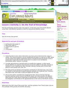
Lesson 3 Activity 1: On the Trail of Knowledge
Students plot the earthquake epicenter data on the base map of the North Atlantic ocean floor using different symbols or colors to characterize different values.
Curated OER
Comparison of Snow Cover on Different Continents
Students use the Live Access Server (LAS) to form maps and a numerical text file of snow cover for each continent on a particular date and analyze the data for each map, corresponding text file to determine an estimate of snow cover for...
Curated OER
Lost at Sea: The Search for Longitude
Students research and chart the shortest course to circumnavigate the globe.
Mr. E. Science
Introduction to Earth Science
From the layers of Earth's spheres to latitude and longitude to looking at topographic maps, learners discover the elements of Earth's systems.
Curated OER
Earthquake Depth
Students research and locate earthquake epicenters on a map using latitude and longitude. They determine if the depth of an earthquake has any relationship to the distance from a plate boundary.
PBS
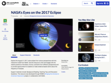
NASA's Eyes on the 2017 Eclipse
How did the 2017 eclipse look in Los Angeles—or Chicago? Experience both views, plus many more, using a lesson from PBS's Space series for middle schoolers. Scholars follow the movements of the sun, moon, and Earth during the most recent...
Curated OER
Spherical Geometry: A Global Perspective
Students investigate spherical geometry using a globe and an apple. In this spherical geometry lesson plan, students translate Euclidean geometry terms to spherical geometry terms using a globe. They answer 3 questions about spherical...
Curated OER
GPS Sports Field Activity
Students practice using GPS receivers and explore how knowing the coordinates of two locations allows them to determine the distance between those two points. They use the theory that they already had knowledge of and apply it to a...
Curated OER
Student Exploration: Summer and Winter
In this recognizing the seasons online/interactive worksheet, learners explore the Earth's positions and determine the summer and winter season. Students answer 21 short answer questions
Curated OER
CLIMATE AND WEATHER UNIT
Students locate on-line weather source, gathers and interprets weather data, work collaboratively on-line with other schools to collect weather data, and write about the cause of temperature inconsistencies in various locations.
Curated OER
World Climate Growing Zones
Young scholars create a map showing where crops would be grown around the world. In this crops lesson plan, students show how the world climate would produce different parts of the world at different times. Young scholars fill out...
Other popular searches
- Latitude and Longitude Maps
- Longitude & Latitude Maps
- Longitude Latitude Maps
- Maps, Latitude/longitude


