Curated OER
Let's Build
Students observe and discuss a picture of Curious George building a bridge and discuss what it means to build, plan and design a project. As a class, they list things they need to do in oder to build something and explore how a compass...
Curated OER
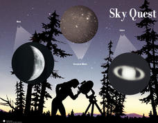
Sky Quest
Students identify constellations in the evening sky. In this Sky Quest lesson, students create their own star patterns using a star map worksheet. Students explain how different celestial bodies in space are viewed through a telescope.
Curated OER
The Old Folks Will Bless You and the Girls Kiss You
Fourth graders reflect on the Revolutionary War. In this Colonial America history lesson, 4th graders discuss various battles of the war, specifically the Battle of Cowpens. Students begin by watching a video chronicling that...
Curated OER
African Folktales Lesson
Students explore what a folktale consists of as it relates to oral tradition. In this folktale lesson, students are told the African folktale, Why the Sun is Lives in the Sky and make personal inferences about what the folktale is...
Curated OER
Design a Wildlife Habitat-Habitat Detective
Students discuss ways people have changed landscapes and how this effects wildlife. They map the area around their school and keep a journal of wildlife they see. They predict how to preserve the wildlife they see for future generations.
Curated OER
Nautical Navigation
Middle schoolers work together to discover the importance of charts while navigating. They complete a worksheet and practice reading maps. They create their own nautical chart to complete the activity.
Curated OER
The ABCs of Citizenship
In this lesson, students read the book that focuses on the ascpects of citizenship/ Students imagine a scene in which each statement is actually happening. Students descirbe rights, repsonisbilities. Assess students by asking what is...
Curated OER
Go For the Gold!: Ancient Olympics For Grades 4-8
Learners create an ancient Greek newspaper with articles about the Olympics. They perform online research on the pentathalon. Students discuss present-day atheletes. They create a map of cities where the olympics were held.
Curated OER
California Indians
Fourth graders discuss the major nations of California Indians, their geographic distribution, economic activities, legends and religious beliefs. They describe the function of Spanish missions and the influence of Catholicism. In...
Curated OER
Water, Rivers & Topography
Students explore the topography of Idaho and the importance of surface water and drainage. using digital maps, they inspect the courses of major rivers, Yellowstone Hot Spots, and the natural landscaping of Pocatello. Students explore...
Curated OER
Cinderella Stories: An African Tale
Students read and analyze an African version of the Cinderella story. They listen to John Steptoe's story, "Mufaro's Beautiful Daughters," locate Africa on a map, compare and contrast the story with Cinderella, and identify fairytale and...
Curated OER
Creating Stories Using Pictographs
Students participate in diverse cultural activities that lead them to a better understanding of Native American people. They use pictographs to write a story, imagining themselves as tribal members. Students transfer their story to a...
Curated OER
Slim Down to the Good Stuff by Summarizing
Students summarize a piece of literature using the technique "mapping" in this lesson. The technique involves 6 main steps: delete unimportant information, delete repeated information, substitute easy terms, add a series of event with...
Curated OER
Prepare for a Field Trip
Students write a journal exercise that relates to preparing for a trip. They make a visual map to generate ideas about things to see, do and learn during the field trip. They assign roles for different tasks that need to be performed...
Curated OER
Triangular Trade Route
Eighth graders explore The Middle Passage and the Triangular Trade Route. They read their text to explore the treatment of African slaves and their route to America. After observing maps and pictures of slave ships, 8th graders share...
Curated OER
Transportation at the Fair
Students practice map reading, study modes of transportation, and use a map to interpret the past. They imagine a day at the fair to demonstrate knowledge of the role transportation systems play in a community.
Curated OER
Making Rocks
Students use their imaginations in order to journey to the center of the earth to find different types of minerals. They create minerals using playdough and create scientific drawings of them. Finally, students create a map to locate the...
Curated OER
Where in The World Am I?
Students explore the concept of absolution location. In this geography skills instructional activity, students discuss how to identify and locate latitude and longitude. Students play a game to reinforce the skills.
Curated OER
An American Spy with Money To Spend
Sixth graders use their imagination, math, reading, computer, geography, and social studies skills in this unique, innovative, and fun lesson where students pretend to be international spies!
Curated OER
Where Can I See The Sea?
Learners see how the pieces of the fossil puzzle fit together to allow the paleontologist to imagine the earth as it was millions of years ago. They draw a map showing what environments were present in a certain area more than 70 million...
Curated OER
Scientist Simulation
Students imagine themselves working as research scientists completing the end-steps of a molecular research project and interpreting the data. They compare the gene sequences of normal and abnormal mice and evaluate the protein product...
Curated OER
Mississippi Under British Rule
Learners construct appropriate maps to depict the following information: changes in European territorial claims as a result of the French and Indian War; boundaries of British East and West Florida; significant rivers and settlements of...
Curated OER
A Nation in (Some) Context
Eleventh graders view selected websites to gain information about Puerto Rico and think about its relevance to Rafael Ferrer's "12 Variations on An 18th-century Map of Puerto Rico".
Curated OER
Colonial Geography: To and From Canada
Students identify the major geographic features of colonial New England. They explain the essential parts to a map and interpret journals to plot a journey. They discover the connection between geography and life.


