Curated OER
A Place Called Nepal
Learners investigate maps of Nepal and then create their own to disover how human activity is influenced by terrain and climate. Students participate in a trek across Nepal simulation to imagine the challenges people have to face...
Curated OER
Social Studies: Cultural New Orleans
Students observe the PBS film, "New Orleans," to explore such topics as race relations, cultural history, and urbanization. After examining n interactive map displaying the city at various dates in its history, students role-play as...
Curated OER
Evacuating a Volcano: A Simulation
Students imagine themselves staying for the weekend in a summer cabin near Mount St. Helens (or other volcanic site,) and having to quickly evacuate the area.
Curated OER
Destination Outer Space
Fourth graders use effective writing skills, their imagination, and their knowledge of the nine planets as they create travel pamphlets of the solar system.
Curated OER
Amazon Rainforest: You Won't Find George in This Jungle
Learners identify locations of rainforests, compare/contrast layers of the rainforest, construct and interpret maps and graphs, recognize relationships between man and the environment, and write about an imaginary walk in the rainforest.
Curated OER
Journey on the Underground Railroad
Young scholars use Indiana and Michigan state road maps to trace a route to Canada from Madison, IN. with the many possible stops along the way. They make a picture book that depicts a runaway slave's journey on UCR.
Curated OER
Scientist Simulation
Students envision the work of a research scientist, and the relationship between molecular biology and medicine. This activity allows students to imagine themselves working as research scientists by asking them to complete the end-steps...
Curated OER
Where In the World Are We?
Fifth graders read postcards and find their locations on maps. They use the pictures and text on the postcards to write about imaginary vacations. They compute the mileage and compare it to TripMaker data.
Curated OER
Born, Bread and Buttered in London
Students map points of interest and listen to an interview to become familiar with London. In this London lesson, students pair share what they pictured from the interview. Students discuss specific vocabulary and points of interest in...
Curated OER
Flat Stanley
Pupils read Flat Stanley, and make a poster board Flat Stanley which they sent out to family members in different states. They create an adventure for their Flat Stanley based on his "travels" and map out his trip.
Curated OER
Sunken Slave Ship
Students imagine they are archaeologists who are looking for treasure under the sand or sea. They work in teams to create the story and site of a shipwreck in a tub or aquarium filled with sand and water.
Curated OER
What is a River?
Young scholars study the various types of bodies of water: rivers, oceans, lakes and ponds. They observe models of each and then use clues to discuss how they are alike and different. They imagine they have found a new planet and draw...
Curated OER
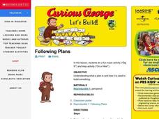
Let's Build
Students observe and discuss a picture of Curious George building a bridge and discuss what it means to build, plan and design a project. As a class, they list things they need to do in oder to build something and explore how a compass...
Curated OER
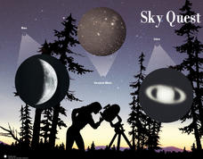
Sky Quest
Students identify constellations in the evening sky. In this Sky Quest lesson, students create their own star patterns using a star map worksheet. Students explain how different celestial bodies in space are viewed through a telescope.
Curated OER
The Old Folks Will Bless You and the Girls Kiss You
Fourth graders reflect on the Revolutionary War. In this Colonial America history lesson, 4th graders discuss various battles of the war, specifically the Battle of Cowpens. Students begin by watching a video chronicling that...
Curated OER
African Folktales Lesson
Students explore what a folktale consists of as it relates to oral tradition. In this folktale lesson, students are told the African folktale, Why the Sun is Lives in the Sky and make personal inferences about what the folktale is...
Curated OER
Design a Wildlife Habitat-Habitat Detective
Students discuss ways people have changed landscapes and how this effects wildlife. They map the area around their school and keep a journal of wildlife they see. They predict how to preserve the wildlife they see for future generations.
Curated OER
Nautical Navigation
Middle schoolers work together to discover the importance of charts while navigating. They complete a worksheet and practice reading maps. They create their own nautical chart to complete the lesson.
Curated OER
The ABCs of Citizenship
In this lesson, students read the book that focuses on the ascpects of citizenship/ Students imagine a scene in which each statement is actually happening. Students descirbe rights, repsonisbilities. Assess students by asking what is...
Curated OER
Go For the Gold!: Ancient Olympics For Grades 4-8
Learners create an ancient Greek newspaper with articles about the Olympics. They perform online research on the pentathalon. Students discuss present-day atheletes. They create a map of cities where the olympics were held.
Curated OER
California Indians
Fourth graders discuss the major nations of California Indians, their geographic distribution, economic activities, legends and religious beliefs. They describe the function of Spanish missions and the influence of Catholicism. In...
Curated OER
Water, Rivers & Topography
Students explore the topography of Idaho and the importance of surface water and drainage. using digital maps, they inspect the courses of major rivers, Yellowstone Hot Spots, and the natural landscaping of Pocatello. Students explore...
Curated OER
Max's Math Adventures
For this math worksheet, students read a rhyming poem about Max's adventure, then answer a word problem, complete 5 questions using a map of the bicycle route Max used.
Curated OER
Primary History: Viking Settlements
In this Viking culture worksheet, students complete 4 extension activities to learn about Viking settlements. Students write a newspaper story, a TV newscast between Alfred the Great and the Danes, use a map to locate modern towns that...


