Curated OER
The Power of Maps & Native American Cultures
Sixth graders discover where and how five Native American cultures lived in North America in what is currently the United States. They examine their way of life and the regions they inhabited. Additionally, 6th graders will understand...
Curated OER
Do You Know Your 50 States?
Learners use the names and abbreviations of the 50 states to label a blank map of the United States.
Curated OER
Along the El Camino Real
While studying each of the 21 missions in California, your class will learn about the founders and founding dates of each mission. Note: Some resource links may not be working, but can be supplemented with additional activities found on...
Curated OER
Hidalgo's Fight for the Independence of Mexico
Tenth graders study and examine the life of Miguel Hidalgo while working to identify major themes. Small groups create sequence of event chains, analyze and label maps of Hidalgo's travels, and work together to create giant chalk maps...
Curated OER
Using Maps to Make Public Health Descisions Case Study: Harmful Algal Blooms in the Gulf of Mexico
Students are introduced to GIS and its uses. Students participate as public health scientists to deliberate a course of action to explore possible research questions. Pupils interpret spatial data, and make predictions based on GIS data,...
Curated OER
We've got the whole world in our hands
Students explore spatial sense in regards to maps about the globe. In this maps lesson plan, students label oceans, locate the continents and poles, follow directions, and explain the symbols on a map.
Curated OER
Bank Loans Money to Start Businesses
After locating Latin American countries on a world map, children read about how microbanks are loaning money to help start small businesses. Involving both current events and economics, the teacher introduces the article with a map...
Curated OER
Elena by Diane Stanley
This story is bound to motivate your class. Learners read a story called Elena by Diane Stanley. The story is about a young woman who marries for love but is soon widowed during the Mexican Revolution. She takes her children to...
Curated OER
Investigating Latitude and Longitude
Students examine the lines of latitude and longitude on a map, and explain why these lines might be useful. In this lesson students also explore websites that provide information to improve their understanding of how and why latitude and...
Read Write Think
Book Report Alternative: Rewind the Plot!
Have you ever looked for a new way to teach an old concept? Scholars thinking about the rising action of a story in a whole new perspective. However, Book Report Alternative: Rewind the Plot! challenges readers and allows for much...
Curated OER
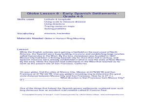
Globe Lesson- Early Spanish Settlements
Students use a globe. In this geography and early settlements lesson, students learn about the settlement of missions and haciendas in New Mexico. Students locate Mexico City and San Francisco on the globe and determine the distance...
Curated OER
Choral Music II
In this music worksheet, students look at a map of the world and find the places where the Santa Fe, New Mexico Desert Chorale has traveled. There is little information about music on this page.
Curated OER
About Life: The Photographs of Dorothea Lange Going to the Promised Land
To better understand the migrant experience during the Great Depression, pupils analyze two primary resources: photographs by Dorothea Lange and a U.S. Map that shows the Dust Bowl. They compare and contrast Lange's images to Steinbeck's...
Curated OER
A Dollar Goes A Long Way
Investigate life along the Old Spanish Trail! They visit websites and identify the history and environment. They create journals, dramatic enactments, and maps to discover the role individuals played in society. They also explore the...
Curated OER
Hopi Running
Students identify why the Hopi tribe practiced running as it relates to health, delivering messages, defeating other tribes, and for ceremonial events. In this social studies lesson, students use maps to identify latitude and longitude...
American Battlefield Trust
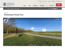
Gettysburg Virtual Tour
Step into one of the most iconic battlefields of the American Civil War with an educational interactive resource. Young historians learn about key moments, locations, soldiers, and turning points in the battle with a clickable map and...
ReadWriteThink
Biography Project: Research and Class Presentation
I Have A Dream ... that after the lesson, all individuals master the reading, writing, researching, listening, and speaking skills the biography project helps them develop. Martin Luther King, Jr. serves as a topic example for a model...
Curated OER
Prejudice and the Navaho Indian Long Walk
Students read Scott O'Dell's book, Sing Down the Moon, and answer questions about the forced migration of the Navahos from Arizona to Fort Sumter, New Mexico. They conduct research and describe a tenebrae service and its importance.
Curated OER
Marine Archaeology
Students examine marine archaeology. In this archaeological data lesson, students see how archaeologists use data to make inferences about shipwrecks. Students read data and make their own inferences, write about marine life and...
Curated OER
Aztec History
Students explore facets of Aztec history. In this ancient civilizations lesson, students map landmarks in Mexico, read excerpts from The Sad Night: The Story of an Aztec Victory and a Spanish Loss, by Sally Mathews and design concept...
Curated OER
Where in the world is...
Learners identify locations around the world. In this mapping lesson, students place tag board pieces with names of locations on a wall map of the world. Initially, learners identify states, then cities, then continents, eventually...
Curated OER
Where in the World Is…
Students identify countries, oceans, states, and more on a globe and on a flat map. In this geography lesson plan, students also locate places around their school.
Curated OER
The Age of Early European Explorations & Conquests
Your students' world will literally take shape in this presentation, which chronicles the growing edges of the (flat) earth during European Exploration of New Worlds. Dias, da Gama, Magellean, and Columbus are key players in this game of...
Missouri University of science & Technology
General Overview History of the Panama Canal
Called the Eight Wonder of the World by some and the Big Ditch by others, the Panama Canal is indeed an engineering marvel. The long, complicated, and sometimes controversial history of the canal is captured in a presentation loaded with...


