Curated OER
Geography: Puerto Rico
Take a trip to Puerto Rico! Learners engage in a web quest, identify Puerto Rico on the map, and gather information related to physical features and cultural factors. Their efforts culminate when they design a brochure comparing the...
Curated OER
What's Your Temperature?
Learners take a look at the local newspaper and focus on the weather section. They get into small groups, and each one looks at the same map, but of a different part of the country. They must prepare a presentation that shows how...
Curated OER
Geography of South America
Student's identify geographic features of a South American map. They use the scale of the map to calculate distances between points. They identify examples of the five geographic themes on the map of South America.
Curated OER
The Case of the "Lost Gorge:
Pupils examine the case of a map making expedition. In groups, they read a case study on "The Lost Gorge" in the Finger Lakes region of New York state. They examine maps and determine where the error in the map-making occured to end the...
Curated OER
Plotting a Hurricane Using Latitude and Longitude
Learners define and use "absolute location," latitude, and longitude. They locate on a map or globe the Earth's poles, circles, tropics, and beginning points of measurements for latitude and longitude.
Curated OER
Orienteering - Lesson 4 - Distance and Height
Pretend that you've been dropped onto a mountain, in the middle of nowhere, and all you have to find your way is a topographical map and a compass. Could you find your way to the nearest town? Orienteering teaches the skills of map...
Curated OER
Exploring Hawaiian Mountain Zones
Fourth graders watch a video that describes the climate and vegetation zones of Hawaii. They describe the different physical conditions that create vegetation zones from the sea to the mountains. In groups, they create an illustrated...
Curated OER
Virtual Field Trip
This hands-on resource has future trip planners analyze graphs of mileage, gasoline costs, and travel time on different routes. While this was originally designed for a problem-solving exercise using a Michigan map, it could be used as a...
Curated OER
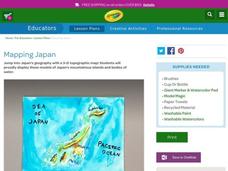
Mapping Japan
Students research the islands of Japan to investigate their location in the world and the islands' characteristics. They comprehend map making and topography. Studnets construct a scale-model map of the Japanese islands and surrounding...
Curated OER
You Are Here
Students map local places and learn to use scale and distance. In this mapping lesson plan, students map their school and a favorite place. Students recreate their maps showing distance and scale sizes. Students locate their...
Curated OER
The Hatfield and McCoy Feud
Fourth graders investigate the Hatfield and McCoy feud. For this Hatfield and McCoy feud lesson, 4th graders examine factors that caused the feud. Students also locate on a map where the feud took place, make a timeline of the main...
National Park Service
Remembering Pearl Harbor: The USS Arizona Memorial
Young historians use primary source materials to investigate the 1941 attack on Pearl Harbor and the sinking of the USS Arizona. After reading background articles and studying maps and images of the attack, class members consider whether...
Science Matters
Ring of Fire
Over a period of 35 years, earthquakes and volcanoes combined only accounted for 1.5 percent of the deaths from natural disasters in the United States. The 15th lesson plan in a 20-part series connects the locations of earthquakes...
Teach Engineering
Stormy Skies
Young meteorologists examine the four main types of weather fronts and how they appear on a weather map. Participants learn about the difference between the types of weather fronts along with their distinguishing features. A...
EngageNY
Grade 9 ELA Module 4, Unit 1, Lesson 3
What is the connection between the spread of ideas and the expansion of the sugar trade? Class members continue their reading of Sugar Changed the World and use an analysis tool to identify how critical ideas in the chapters are...
EngageNY
Synthesizing Information: Living Things in the Rainforest
How is a map a type of informational text? Class members view a world map of major rainforests, discussing its text features with a partner. Next, they take notes on key details from multiple texts about rainforests and write an...
Global Oneness Project
Architectural Wonders
Angkor Wat, a UNESCO World Heritage Site located in Cambodia, is the focus of a instructional activity that asks class members to consider factors that could result in the destruction of these archeological treasures....
Museum of Disability
Taking Visual Impairment to School
What is the world like when you can't see, or when your vision is impaired? Learn about how Lisa communicates with the world around her with Taking Visual Impairment to School by Rita Whitman Steingold. Learners answer...
Curated OER
Math: Navigating the World Around Me
Young mathematicians research and discuss real world math word problems and ways in which they apply math concepts in their everyday lives. They create a storyboard of a math word problem from which they create a slide for a multi-media...
Curated OER
Say Hello! Around the World
Hello! Bonjour! Paivaa! Ni hao! Teach learners of all ages how to say hello in several different languages. There are project ideas for younger learners and older learners. Kids love learning a different language, even if it's just this...
Curated OER
Time Around the World
Seventh graders investigate the characteristics of a time zone map. They read and interpret time zone maps. Students compare the time in various time zones. Students solve time zone problems.
Curated OER
Around the World At 30o North Latitude
Reinforce the use of an atlas and reference materials with writers. They discover how geographic location can make living easier or harder. They draw an assigned journey on a map, categorize survival needs, and prioritize options during...
Curated OER
Create a World
Students combine imaginative powers with known map-making techniques to create a whole new world.
Other popular searches
- World War Ii Map
- World War I Map
- World War 2 Map
- World War I Outline Map
- World Climate Map
- World Biomes Map
- World Outline Map
- Blank Map of the World
- World Political Map
- Ancient World Greece Map
- World Time Zone Map
- Deciduous Forests Map World


