Curated OER
Life in Old Babylonia: The Importance of Trade
Students read maps and artifacts for information indicating the existence of a trade network in Old Babylonia and beyond. They list goods imported to and exported from Babylonia. They indicate trading centers on a map of ancient...
Curated OER
Journey to Gettysburg
Students use latitude and longitude to map the path of the Battle of Gettysburg.
Howard Hughes Medical Institute
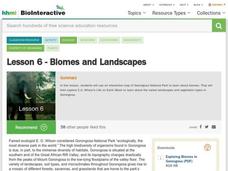
Lesson 6: Biomes and Landscapes
Aside from the amazing animals in Gorongosa National Park, what else is there to discover? The sixth installment in an eight-part themed series contains an interactive map where scholars can learn more about the geographic features of...
Geophysical Institute
Latitude and Longitude with Google Earth
Travel the world from the comfort of your classroom with a lesson plan that features Google Earth. High schoolers follow a series of steps to locate places all over the earth with sets of coordinates. Additionally, they measure the...
Core Knowledge Foundation
Thanksgiving with the Pilgrims
Teach kindergartners about the First Thanksgiving with a series of lessons about the Pilgrims' journey to the New World. As they practice handwriting, CVC words, reading comprehension, and fun Thanksgiving songs, they learn about what...
British Council
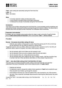
Letters Home
When you're writing historical fiction, the past really can become the present — especially if you're writing in the present continuous tense! Cover World War I, verb tenses, censorship, and letter writing with one informative lesson and...
BrainPOP
World History Lesson Plan: Uncovering Essential Questions
Have you ever noticed a news story revolves around an essential question? Scholars research methods of reporting historical events. Working in groups, they use an interactive module to gather information on a historical topic, uncovering...
Teach Engineering
What's Wrong with the Coordinates at the North Pole?
Here is an activity that merges technology with life skills as individuals use Google Earth to explore the differences between coordinate systems and map projections. The self-guided worksheet is the fourth segment in a nine-part unit....
Core Knowledge Foundation
The United Kingdom
Scotland, Northern Ireland, Wales, and England are four countries united by more than a monarchy. Academics explore the geography of the nations that make up the United Kingdom. The resource is broken into six lessons focusing on the...
Curated OER
Buddhism
Pair this presentation about the tenets and philosophies of Buddhism with a lecture on world history or world religions.Viewers will appreciate the clarity of the information as well as the colorful maps and images that adorn each slide.
Shaker Junior High School Library Media Center
WWII Project Outline
Work together as a class and get to know the ins and outs of World War II with this engaging collaborative project. Class members are broken into groups to research particular war topics, from life on the home front to the Holocaust and...
American Battle Monuments Commission
Honoring Service, Achievements, and Sacrifice: A WWI Virtual Field Trip
The largest offensive in United States military history comes alive in a online interactive resource. Young historians explore the Meuse Argonne battlefield and scour the landscape for evidence from the battle. They then use primary...
Curated OER
The Columbia Exchange
The Columbia Exchange was one of the first major instances of mass international trade. Learners cut out 24 images of trade commodities and glue them on a map of the world. It'll be fun for kids to see where so many products they use...
Curated OER
Volcanoes: Sixth Grade Lesson Plans and Activities
Bring a set of pre-lab, lab, and post-lab lesson plans on volcanoes to your earth science unit. Sixth graders explore the three types of volcanoes found on Earth, plot the specific locations of these volcanoes on a map, and investigate...
Curated OER
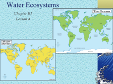
Water Ecosystems
Freshwater and Saltwater ecosystems are the focus of this Earth Science PowerPoint. Presentation is full of interesting facts, photographs, and maps. A slide with review questions appears at the end of the presentation. Very nice!
Curated OER
Around the World in 5 Days
Students explore continents, draw map, discuss cultures, use research to learn geography, and investigate cultures.
Curated OER
The Race to Dominate the Known World
High schoolers describe cause/effect relationship of a European country's need for resources, exploration, colonization, and settlement of different regions of the world beginning in the 14th Century, and role play representatives of...
Curated OER
Where In the World Am I?
Learners identify their location in the world after studying latitude, longitude, relative location, and absolute location. They use assigned web site to find information to make a flipbook that answers questions about their location in...
Curated OER
Four Corners Mystery: Where In The World Are We?
Students research and describe various locations around the world using five fundamental themes of geography.
Curated OER
Where in the World is Mr. Fultz?
Learners use maps and other geographic resources to learn about their world while problem solving. They read clues each day and use classroom resources to narrow down where the prize is located.
Curated OER
How To Make an Apple Pie And See the World
Students define and discuss global interdependence. They read How to Make an Apple Pie and See the World and keep a list of the countries visited during the story and identify all of the productive resources and natural resource...
Curated OER
Mapping the Human Movement
Students research data on African-American emigration, place the data in a chart and create a human movement map. They also create another map using research on current immigration information.
Curated OER
Map Your State: Regions of Arizona
Fourth graders define vocabulary and locate physical features on maps. In this mapping lesson plan, 4th graders explore regions of Arizona through landforms found on topographic maps. Students research the history and culture of the...
Curated OER
Where in the World?
Learners locate famous landmarks around the world. They identify the location of natural and manmade landmarks using a worksheet that provides ten clues.
Other popular searches
- World War Ii Map
- World War I Map
- World War 2 Map
- World War I Outline Map
- World Climate Map
- World Biomes Map
- World Outline Map
- Blank Map of the World
- World Political Map
- Ancient World Greece Map
- World Time Zone Map
- Deciduous Forests Map World


