Space Awareness
Let's Map the Earth
Before maps went mobile, people actually had to learn how to read maps. Pupils look at map elements in order to understand how to read them and locate specific locations. Finally, young cartographers discover how to make aerial maps.
Curated OER
A World of Information
Students analyze data and statistics about countries around the world. They read graphs and charts, color a world map to illustrate the top ten statistics about the world, and write a paragraph to summarize their information.
American Battle Monuments Commission
World War II: A Visual History
Explore the enormity of World War II, including its causes, prominent battles, and historical figures, with an interactive map and timeline. Divided into each year from 1939 to 1945, as well as sections pre- and post-war, the resource...
American Museum of Natural History
Map Your Own World
Young archaeologists practice their mapping skills by creating a detailed site map of their room or another room in their home. After indicating walls, windows, doors, and closets, they add furniture and objects, labeling each item.
Curated OER
Mapping My World
First graders make two maps. In this developing and reading maps instructional activity, 1st graders read Mapping Penny's World, discuss the parts of a map, create a map of their classroom, and create a list of directions of how to get...
Curated OER
Earth from Space Maps
Students use photo images from space to create a large map of the United States or the world, find where they live and label other places they know. They are exposed to a Web resource that allows them to view photo images of Earth taken...
Curated OER
Scaling it Down: Caves Have Maps, Too
Measurement and map skills are the focus of this lesson, where learners crawl through a "cave" made out of boxes, desks and chairs, observing the dimensions. Your young geographers measure various aspects of the cave and practice math...
Curated OER
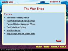
World War I - The War Ends
Your class is in for a treat with this outstanding PowerPoint on World War I. The presentation is loaded with facts, maps, important personalities, and discussion questions on the war. Additionally, there is a wonderful video called,...
Curated OER
Mapmaker, Make Me a Map!
Here is a well-designed, very thorough lesson plan on mapping for very young children. Within the six-page plan, you will find everything you need to implement the lesson. They will identify various landforms found in Colorado on a map,...
AGSSS
World Regions
Help your learners to visualize where historical events have taken place around the globe with a map that details the major regions of the seven continents.
Owl Teacher
Introduction to World of Geography Test
Assess your learners on the five themes of geography and the most important key terms and concepts from an introductory geography unit. Here you'll find an assessment with 15 fill-in-the-blank and 14 multiple-choice questions, sections...
Curated OER
Tiles, Blocks, Sapphires & Gold: Designing a Treasure Map
Young cartographers in groups hide treasure at school and then create a map to find it using pattern blocks and tiles. They make paintings with clues to create a visual representation of the location of their treasure. Groups present...
Wikipedia
Map of World War II Japanese American Internment Camps
Your learners may be surprised to view the extensive number of Japanese American Internment Camps that existed in the United States during World War II. This map details the area along the Pacific Coast from which people of Japanese...
Alpha Omega
History and Geography—Two World Wars
Here's a combination textbook/workbook that examines the conditions in Europe that lead to World War I. Ideal for homeschoolers as well as classroom use.
Curated OER
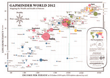
Gapminder World 2012
Here is a very interesting infographic that compares the average life expectancies, per capita incomes, and population sizes of every country in the world in 2012.
Curated OER
World Governments and Mapping Activity
Here you will find maps, great informational text, and vital information on political systems and government. The slide show provides material on democratic and nondemocratic systems of government as well as a map activity intended to...
Curated OER
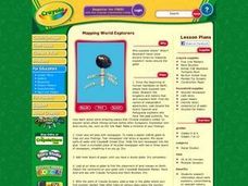
Mapping World Explorers
Students research early explorers from selected nations, routes, or time periods. After finding maps of exploration routes over water and land, they create a time line. Presentations are created in the form of three-dimensional models...
Luminations Media Group
Geography: Map Reading Basic Skills
Enhance scholars' map skills using this worksheet displaying the land of Kahitsa’an from the series, The Realm, by K.L. Glanville. The activity helps readers visualize the make believe-land, examine its attributes, and answer 10 short...
A&E Television
The World Wars
Contemporaneously known as The Great War, World War I had never seen its match on the global stage—until World War II. An engaging set of resources designed to extend a viewing of the History Channel's The World Wars features discussion...
Reporters Without Borders
2017 World Press Freedom Index
Freedom of the press was seen as a right so important that the Founding Fathers listed it as part of the first amendment to the United States Constitution. Americans pride themselves on this freedom, but just how free are American...
Curated OER
Exploring Biomes Lesson 1: Mapping Biomes
Environmental science learners examine satellite imagery of temperature, vegetation, precipitation, and productivity. They use these maps to understand how scientists divide the planet into major biomes. As part of a larger unit on...
Curated OER
Countries Involved in World War II
Students create their own floor map of Europe, Northern Africa, and the Pacific. They locate, identify, and speak for one of the countries involved. In addition, they classify the country they represent as an Axis Power or as an Allied...
Curated OER
A world of oil
Students practice in analyzing spatial data in maps and graphic presentations while studying the distribution of fossil fuel resources. They study, analyze, and map the distribution of fossil fuels on blank maps. Students discuss gas...
Curated OER
Finding Your Way Around the World
Students plan a trip around the world and create a PowerPoint presentation of the journey. In this map, atlas, and technology activity, students plan a trip around the world in which they avoid using an airplane. Students will consider...
Other popular searches
- World War Ii Map
- World War I Map
- World War 2 Map
- World War I Outline Map
- World Climate Map
- World Biomes Map
- World Outline Map
- Blank Map of the World
- World Political Map
- Ancient World Greece Map
- World Time Zone Map
- Deciduous Forests Map World


