Curated OER
Mapping West Virginia
Fourth graders explore West Virginia. In this Unites States geography lesson, 4th graders discuss the type of land and the cities in West Virginia. Students create two overlays, with transparencies, that show the natural land and the...
Curated OER
We Are One World
Students access prior knowledge to choose a country and research the living conditions in that country. In this living conditions lesson, students recognize the differences and similarities of conditions of another country to ours....
Curated OER
Christmas Around the World
Learners produce a factual book about customs in other countries. They produce a poem about a country/custom. They locate countries on a map. They compile and compare data about each country.
Curated OER
Mapping the Human Journey
High schoolers explore a migration of people with their surname. As a class, they define key vocabulary and identify the different types of movementbs of people in history. They examine the reasons for the migration and use the internet...
University of California
Decolonization
The ripple effect from one small event can impact many others. Young historians research the ripple effect World War II had on decolonization in the second installment of an eight-part series. Through primary and secondary documents as...
Cornell University
Too Much of a Good Thing?
Continuing their study of beneficial insects, young entomologists discover where in the world some of these bugs are. By labeling, coloring, and using the scale on a map, pupils explore the territories and arrival of the Asian lady...
Virginia Department of Education
World History and Geography: 1500 A.D. (C.E.) to the Present
Intended to help Virginia teachers align their curriculum to the state's history and social science standards, this packet provides a wealth of materials for any social studies or science instructor. Loaded with plans, suggestions for...
Advocates for Human Rights
A Global Perspective on Immigration
To gain a global perspective on immigration, groups investigate and create a map of the migration patterns in Africa, Asia, Europe, Latin America, and the Middle East. Class members then examine the background, immigration history, and...
Messenger Education
Look But Don’t Touch—Exploration with Remote Sensing
Mars is home to the tallest mountain in our solar system, Olympus Mons. In this set of two activities, learners review geologic land formations through the analysis of aerial maps. They then apply this knowledge to aerial maps of objects...
Curated OER
Chalkboard Challenge: Social Studies Online
If used as an independent review, this presentation could be a quick way for students to study U.S. History facts. Since it only presents a few simple facts, it would not be adequate for a comprehensive review, but a teacher could...
Curated OER
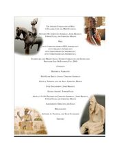
The Ancient Civilization of Mali
Young scholars explore the ancient civilization of Mali and examine various historical and cultural aspects of the civilization. In this ancient civilization of Mali lesson, students examine trade with respect to geographic locations,...
California Academy of Science
California's Climate
The United States is a large country with many different climates. Graph and analyze temperature and rainfall data for Sacramento and Washington DC as you teach your class about the characteristics of Mediterranean climates. Discuss the...
Core Knowledge Foundation
Year 2: Northern Europe
How is life in Northern Europe different from other areas of the world? Historians journey through the various regions of Northern Europe discovering what type of climate, animals, and lifestyles exist in that section of the world. They...
Curated OER
Dos mapas de Florida, el Caribe y parte de Sur America
What can maps tell us about the past? Find out with a Spanish lesson that incorporates geography. After examining maps individually, comparing two old maps of Spanish Florida and writing notes in the provided Venn diagram, pupils pair up...
Science Matters
Slip Sliding Along
The San Andreas Fault is the largest earthquake-producing fault in California. In the seventh lesson in the 20 part series, pupils create maps of California, focusing on the San Andreas Fault system. The comparison of where California is...
Syracuse University
Erie Canal
While canals are not the way to travel today, in the first half of the nineteenth century, they were sometimes the best way to move goods and people. Scholars examine primary sources, including maps and pictures, to investigate the role...
Curated OER
Earth's Water
If the majority of our planet is covered with water, why do we need to bother conserving it? With a thorough and varied investigation into the location and types of water on the earth, learners will gain an understanding of why this...
US Holocaust Museum
Defying Genocide
Defying death. Defying those who want to do harm. Defying genocide. Pupils research the events in Rwanda to gain an understanding of what it takes to survive a horrific event like a holocaust. They use video, time lines, and Holocaust...
US Holocaust Museum
Ripples of Genocide: Journey through Eastern Congo
Could you locate the Democratic Republic of Congo on a map? Scholars investigate the genocide taking place in Eastern Congo. Groups explore web-based evidence as well as the Ripples in Genocide source to take a closer look at the issue....
Radford University
Real Life Parallels
There's no parallel to a great resource. Scholars take part in three lessons in which they investigate parallel lines in real-world situations. They search for and take pictures of parallel lines in and around the school, develop artwork...
Curated OER
E-mailing the Chamber of Commerce
Encourage effective internet research and e-mail correspondence as scholars investigate a US capital city they've never visited to find pertinent and relevant information. They begin by picking a city, then visit that city's chamber of...
NY Learns
Geography of the Fertile Crescent by ECSDM
Using Google Earth, a vocabulary assignment, and map handout, your class members will outline the Fertile Crescent in Mesopotamia and identify the source of the Tigris and Euphrates rivers. They will then complete graphic organizers...
Curated OER
Earthquakes: Second Grade Lesson Plans and Activities
What causes earthquakes? Second graders learn about stresses from plate movement with a set of hands-on activities. After tracing fault lines on a map with yarn, class members create a paper plate model of Earth to show its layers and...
Curated OER
Domain and Range
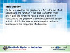
Relations, and functions, and line tests, oh my! An instructional slideshow demonstrates the definitions of a relation, a function, and the domain and range of a relation. Viewers then learn how to use mappings and vertical line tests to...
Other popular searches
- World War Ii Map
- World War I Map
- World War 2 Map
- World War I Outline Map
- World Climate Map
- World Biomes Map
- World Outline Map
- Blank Map of the World
- World Political Map
- Ancient World Greece Map
- World Time Zone Map
- Deciduous Forests Map World


